Regional landslide risk evaluation method based on slope units and machine learning
A technology of machine learning and evaluation methods, applied in neural learning methods, instruments, biological neural network models, etc., can solve the problem of high human factors in the weight determination process, and achieve the effect of saving time
- Summary
- Abstract
- Description
- Claims
- Application Information
AI Technical Summary
Problems solved by technology
Method used
Image
Examples
Embodiment Construction
[0041] The present invention will be further described below in conjunction with the accompanying drawings and embodiments.
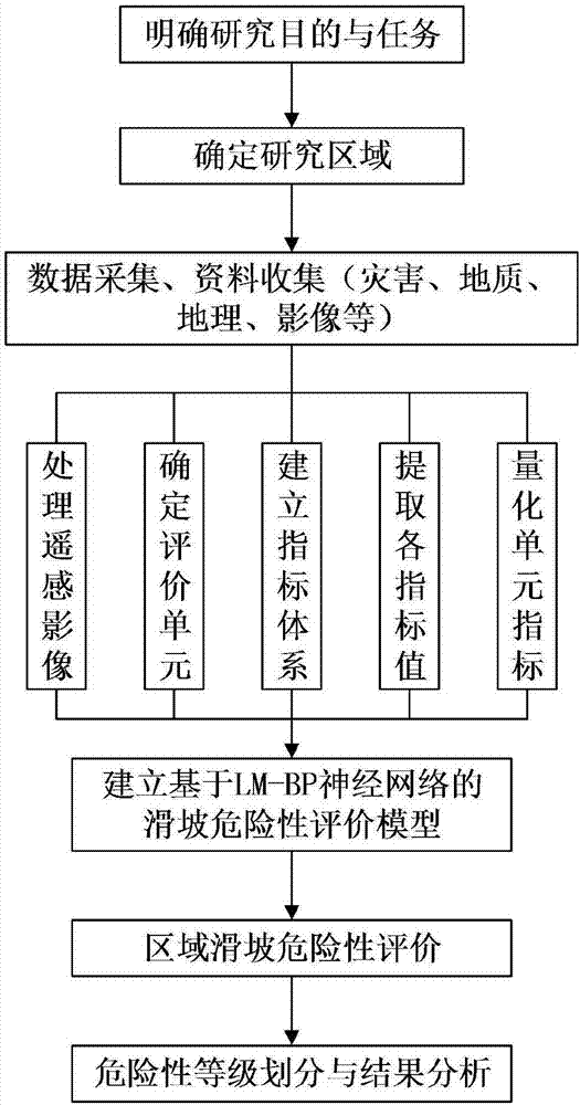
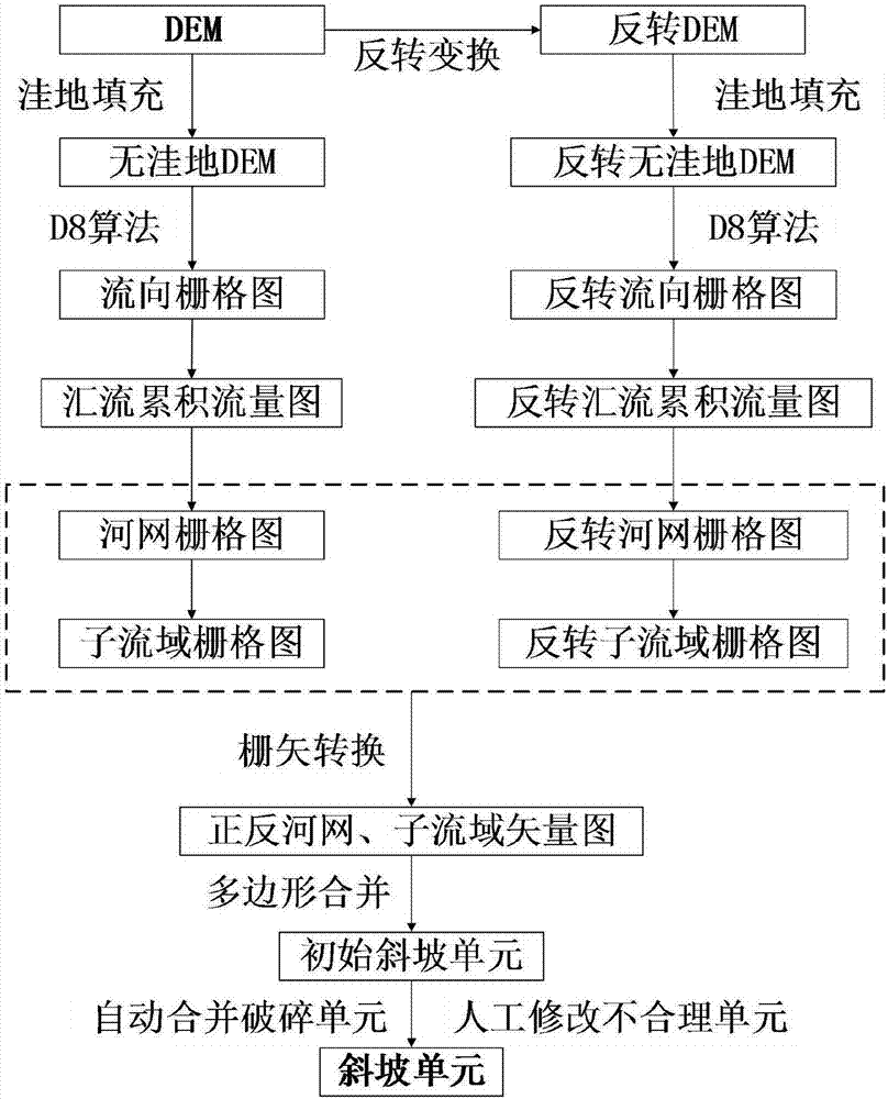
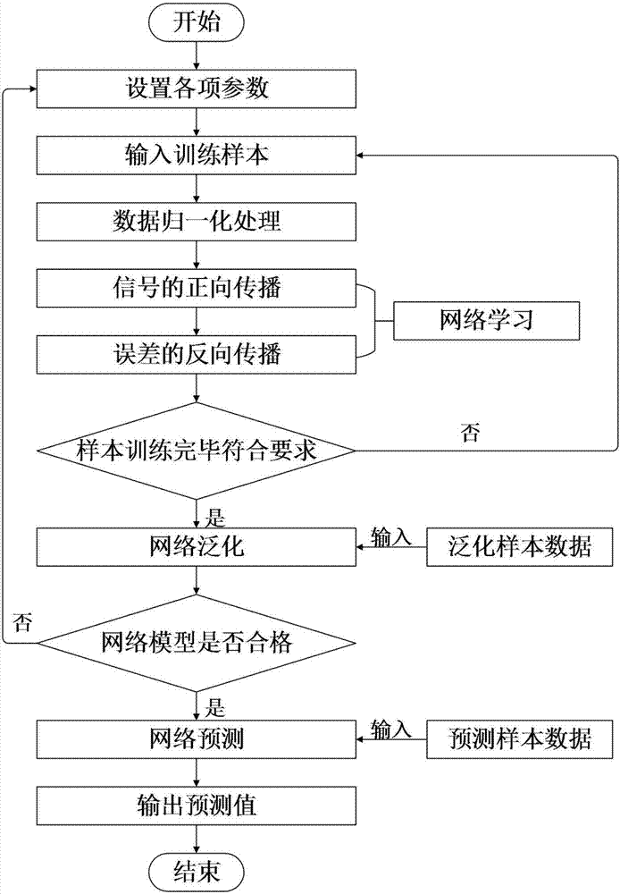
[0042] Attached below Figures 1 to 4 , to further describe the preferred embodiments of the present invention.
[0043] Taking the range of the slope that may affect the K558-K642 mileage section (Guangyuan section) of the Lanchengyu refined oil pipeline as the research area, the method of the present invention is used to evaluate the risk of landslides in the research area.
[0044] The research area is located in Guangyuan City, Sichuan Province, with east longitude 105°15′-106°4′, north latitude 32°3′-32°45′, across Chaotian District, Lizhou District, Zhaohua District, Qingchuan County and Jiange from north to south The county has 19 townships in three districts and two counties. There are more than 100 landslide geological disasters in the study area, and some landslides are less than 100m away from the pipeline. These landslides pose a great thr...
PUM
 Abstract
Description
Claims
Application Information
 - Generate Ideas
- Intellectual Property
- Life Sciences
- Materials
- Tech Scout
- Unparalleled Data Quality
- Higher Quality Content
- 60% Fewer Hallucinations
Browse by: Latest US Patents, China's latest patents, Technical Efficacy Thesaurus, Application Domain, Technology Topic, Popular Technical Reports.
© 2025 PatSnap. All rights reserved.Legal|Privacy policy|Modern Slavery Act Transparency Statement|Sitemap|About US| Contact US: help@patsnap.com


