Method of Monitoring and Tracking Forest Fire Echoes Using Cinrad/sa Weather Radar
A weather radar and echo technology, applied in the field of forest fire echo tracking, can solve the problems of underreporting weak forest fires, inability to echo tracking, and inability to identify multiple forest fires at the same time
- Summary
- Abstract
- Description
- Claims
- Application Information
AI Technical Summary
Problems solved by technology
Method used
Image
Examples
Embodiment Construction
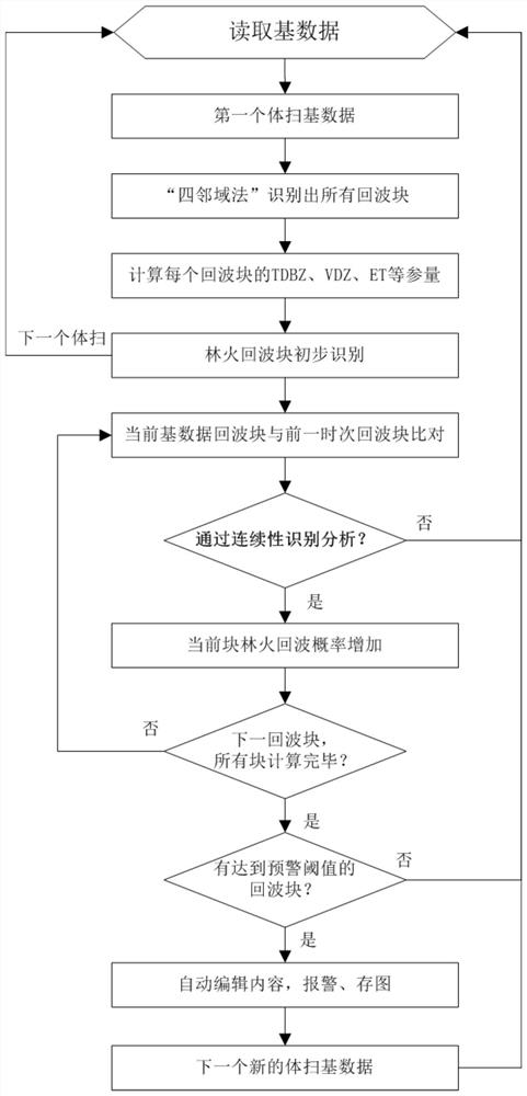
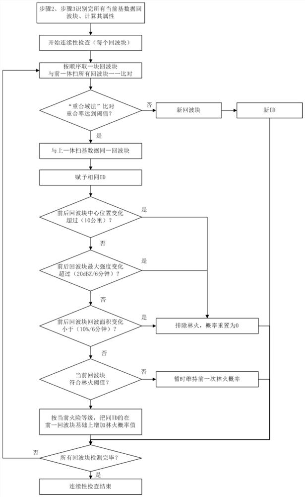
[0067] Such as figure 1 Shown, a kind of method of the present invention utilizes CINRAD / SA weather radar to monitor and track forest fire echo, comprises the steps:
[0068] Step 1. Set the basic data format for CINRAD / SA weather radar monitoring
[0069] The current business model of CINRAD / SA weather radar is to complete a 0-360° scan every 6 minutes. There are 9 elevation angles for the scan. Each scan generates a volume scan base data of about 10M in size. The height and data of each elevation scan are set in order from 0 to 360°;
[0070] Since the width of the radar detection beam is 1°, the minimum data element of 1 km×1° is used as the distance base data, and the distance base data is stored in polar coordinates;
[0071] Step 2. Using the four-neighborhood method to identify echo blocks
[0072] Read the base data of all distances at the specified elevation angle (because the forest fire echo is short, so it is generally the lowest elevation angle) in the first vo...
PUM
 Abstract
Description
Claims
Application Information
 - Generate Ideas
- Intellectual Property
- Life Sciences
- Materials
- Tech Scout
- Unparalleled Data Quality
- Higher Quality Content
- 60% Fewer Hallucinations
Browse by: Latest US Patents, China's latest patents, Technical Efficacy Thesaurus, Application Domain, Technology Topic, Popular Technical Reports.
© 2025 PatSnap. All rights reserved.Legal|Privacy policy|Modern Slavery Act Transparency Statement|Sitemap|About US| Contact US: help@patsnap.com


