Eureka AIR delivers breakthrough ideas for toughest innovation challenges, trusted by R&D personnel around the world.

Vehicle position and gesture estimation method based on traffic sign

A technology for traffic signage and pose estimation, which is applied in computing, computer components, image analysis, etc., and can solve problems such as limited ground texture clarity, difficulty in maintaining databases, and complex databases

Active Publication Date: 2017-05-10
SHANDONG UNIV
View PDF7 Cites 33 Cited by
  • Summary
  • Abstract
  • Description
  • Claims
  • Application Information

AI Technical Summary

Problems solved by technology

The first and third types of positioning methods are limited by the clarity of the ground texture, especially at urban traffic intersections with heavy traffic and frequent congestion. Road lane lines and guide signs are blocked by dense traffic and cannot be detected. The self-positioning of the vehicle is completed very well; at the same time, when the road texture is covered in rainy or snowy weather, this type of method cannot achieve vehicle positioning
The second type of database needs to be built is extremely complex and huge, and the construction and update speed of urban buildings is relatively fast, and the later maintenance of the database is also more difficult
[0005] At present, the research on vehicle positioning technology based on computer vision is relatively small in China, and it is still in the initial stage of research. If a low-cost, high-precision, simple and easy method can be provided, it can effectively solve the problem of vehicle positioning at complex urban traffic intersections and congested roads. In the short term, it can be connected with the vehicle navigation system to accurately judge the vehicle’s driving lane and vehicle heading. In the long run, it can make my country’s unmanned driving technology achieve certain development and catch up in some fields. ultra-developed countries

Method used


Image

  • Vehicle position and gesture estimation method based on traffic sign
  • Vehicle position and gesture estimation method based on traffic sign
  • Vehicle position and gesture estimation method based on traffic sign

Examples


Embodiment

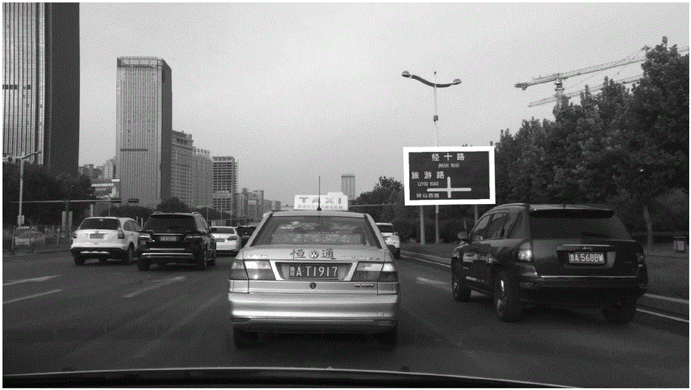
[0084] A vehicle pose estimation method based on traffic signs, such as figure 1 As shown, the traffic sign refers to a flat rectangular target located at a prominent position on both sides of the road, and its background color is mainly blue, green or yellow; the steps involved are as follows:

[0085] A. Build a database

[0086] The database includes the following information of each traffic sign: geographical coordinates, the size of the traffic sign, the angle between the traffic sign and the road, the lane information at the traffic sign, and the background color. The geographic coordinates refer to the longitude and latitude where the traffic sign is located The geographic coordinates of the traffic sign are measured by the handheld RTK-GPS instrument; the size of the traffic sign includes the length and width of the traffic sign; the lane information at the traffic sign includes the number of lanes on the road and the width of the lane and lane guidance; geographic co...


PUM


Abstract

The invention relates to a vehicle position and gesture estimation method based on a traffic sign. The method comprises the following steps that: firstly, through conventional GPS (Global Positioning System) equipment, obtaining the sketchy position of a vehicle, and obtaining an image in front of the vehicle through a monocular camera installed in front of the vehicle; then, detecting the traffic sign in one frame of image, and processing a next frame of image if no traffic signs are detected; after the traffic sign is obtained by detection, extracting four control point coordinates of the traffic sign, obtaining four pre-stored orthogonal control point coordinates of the traffic sign pre-stored in a database through GPS sketchy information, calculating a plane perspective transformation matrix from a traffic sign position to a database orthogonal position in an input image, and carrying out resolving by the matrix to obtain the accurate position and gesture of the vehicle under a traffic sign coordinate system, wherein the four control points correspond one by one. When the vehicle is driven on a road provided with the traffic sign, the position and the gesture of the vehicle under the traffic sign coordinate system can be quickly positioned, and the method has the advantages of being high in instantaneity, low in cost and easy in large-scale promotion.

Description

technical field [0001] The invention relates to a method for estimating the pose of a vehicle based on a traffic sign, and belongs to the fields of digital image processing technology and computer vision technology. Background technique [0002] At present, many countries in the world and companies including Google and Baidu are conducting research on unmanned vehicles, and some unmanned test vehicles have entered the stage of actual road testing. The Nevada State Department of Motor Vehicles has officially issued the first unmanned vehicle license to Google, which indicates that unmanned vehicles will enter the lives of the public in the near future and change the way people travel. [0003] Vehicle autonomous positioning, as the basis of intelligent driving of automobiles, has become a key technology in this field. The positioning technology based on multi-sensor cascading is relatively mature and can meet the requirements of high precision and real-time performance. Howe...

Claims


Application Information

Patent Timeline
Patent Type & Authority Applications(China)
IPC IPC(8): G06T7/73G06T7/80G06T7/90G06K9/62
CPCG06T2207/20061G06F18/2411
Inventor 陈辉袁金钊
Owner SHANDONG UNIV
Why Eureka
Eureka Blog
Learn More