
Method for constructing geomorphologic unit hydrograph distinguishing confluence speed differences of slope surface and channel

A construction method and unit line technology, applied in special data processing applications, instruments, climate change adaptation, etc., can solve problems such as inability to perform accurate flood analysis and calculation

Active Publication Date: 2017-04-26
CHINA INST OF WATER RESOURCES & HYDROPOWER RES
View PDF3 Cites 15 Cited by
  • Summary
  • Abstract
  • Description
  • Claims
  • Application Information

AI Technical Summary

Problems solved by technology

[0003] The technical problem to be solved by the present invention is to provide a calculation method of the unit line of geomorphology time period that only relies on topography and geomorphology data, and considers the difference in confluence velocity between slope and channel, which can overcome the situation of no hydrological data or lack of hydrological data in small watersheds in mountainous areas. The problem of being unable to perform accurate flood analysis and calculation can be used in the business of flood forecasting and early warning for small watersheds in mountainous areas

Method used


Image

  • Method for constructing geomorphologic unit hydrograph distinguishing confluence speed differences of slope surface and channel
  • Method for constructing geomorphologic unit hydrograph distinguishing confluence speed differences of slope surface and channel
  • Method for constructing geomorphologic unit hydrograph distinguishing confluence speed differences of slope surface and channel

Examples


Embodiment 1

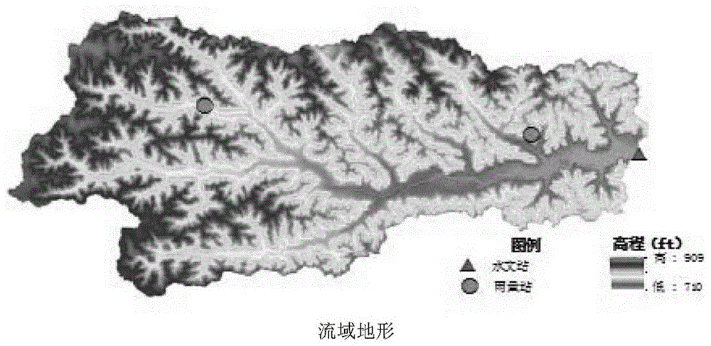
[0036] like figure 1 As shown, a geomorphic unit line construction method for distinguishing the difference of confluence velocity between slope and gully, the method is based on the hydrological "particle theory" assumption, it is assumed that there is a raindrop particle on each grid, and the particle will have a fixed line path flow to a watershed outlet, the method comprising the steps of:

[0037] 1) Collect digital elevation model data of small watersheds;

[0038] 2) Use the D8 algorithm to calculate the flow direction data of the small watershed, extract the water system of the small watershed, and divide the grid into slope grid and channel grid;

[0039] 3) Determine the calculation period Δt of the period unit line;

[0040] 4) Calculate the time for each raindrop particle to reach the watershed outlet along the fixed flow path;

[0041] 5) Count the number of raindrop particles arriving at the outlet of the watershed in each time period and its relative percenta...

Embodiment 2

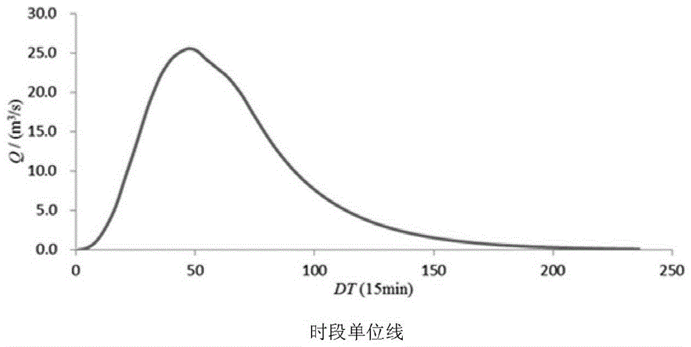
[0074] figure 2 For adopting the period unit line of the Clear Creek watershed in the central and eastern region of Iowa, U.S. calculated by the method of the present invention and the flood process obtained by using the period unit line to carry out flood analysis and calculation, it can be found by comparison that the calculated flood process is the same as the actual measured flood The process fits well.


PUM


Abstract

The invention provides a method for constructing a geomorphologic unit hydrograph distinguishing confluence speed differences of a slope surface and a channel. The method comprises the steps of calculating flow directions of grids by adopting a D8 algorithm firstly based on digital elevation model (DEM) grid data, extracting a watershed system, and distinguishing the grids into slope surface grids and channel grids; calculating confluence speeds of raindrops during motion on the slope surface and in the channel; calculating the time for reaching a watershed outlet by the raindrops according to specific confluence paths of the raindrops, performing statistics on the number of the raindrops reaching the watershed outlet in each time segment delta t, and calculating percentages of the number of the raindrops in all time segments in a total grid number, namely, coordinate values of an S curve at the moments delta t, 2 delta t, 3 delta t, ......, and n delta t; and calculating a non-dimensional t-hour unit hydrograph and a unit hydrograph of the watershed according to the obtained S curve conveniently. According to the method, the t-hour unit hydrograph of any time segment of the small watershed in the mountainous and hilly area can be conveniently obtained, and flood analysis calculation can be performed in areas without or lack of hydrological data.

Description

technical field [0001] The invention relates to the technical field of water conservancy engineering, in particular to a method for calculating a unit line in a hydrological period, and in particular to a method for constructing a unit line in a geomorphic period. Background technique [0002] With the improvement of flood control projects for major rivers in my country, flood control standards have been generally improved, and the risk of floods caused by accidents or overflows of major river projects has been greatly reduced. At present, mountain torrent disasters have become the main disasters that cause casualties in flood disasters in my country. In the prevention and control of mountain torrents, many scientific problems need to be solved urgently, such as the division of mountain torrent danger areas, the determination of the threshold of mountain torrent warning indicators, and the technology of making mountain torrent risk maps. These problems cannot be solved witho...

Claims


Application Information

Patent Timeline
IPC IPC(8): G06F17/50
CPCG06F30/18Y02A10/40
Inventor 张大伟权锦马建明鞠琴吕烨张洪斌喻海军穆杰吴滨滨
Owner CHINA INST OF WATER RESOURCES & HYDROPOWER RES
Learn More