High-resolution-image-based regional adaptive cultivated land extraction method
An extraction method and high-resolution technology, applied in the field of remote sensing applications, can solve the problems of small application area, low degree of automation, lack of universality and promotion, etc.
- Summary
- Abstract
- Description
- Claims
- Application Information
AI Technical Summary
Problems solved by technology
Method used
Image
Examples
Embodiment 1
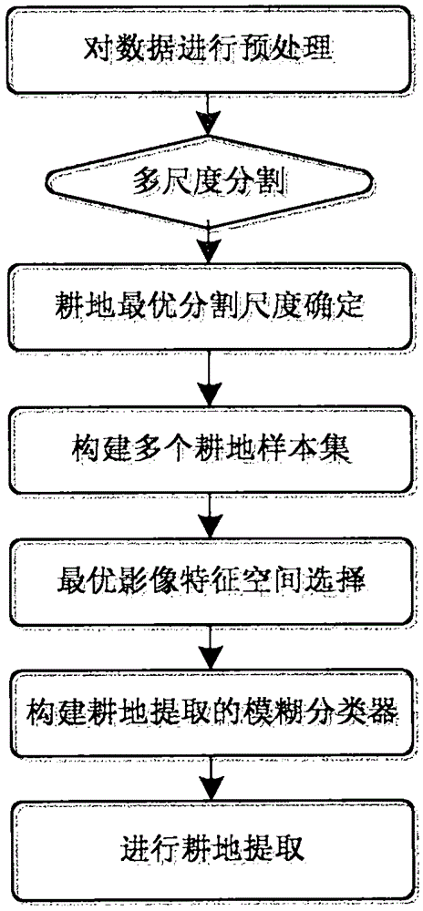
[0060] A region-adaptive cultivated land extraction method based on high-resolution images, such as figure 1 shown, including:
[0061] S1, preprocessing the data
[0062] The high-resolution images are selected as multiple SPOT6 multispectral and panchromatic remote sensing images in Hebei Province, the main time phase is October, and the multispectral images (including four bands of blue, green, red and near-red) have a spatial resolution of 6m. The spatial resolution of the panchromatic remote sensing image is 1.5m. The high-resolution image has undergone radiation, geometric correction and image fusion. If it is a single high-resolution image, image fusion is not required.
[0063] At the same time, the 30mDEM (Digital Elevation Model) of the research area is selected for auxiliary classification, and the digital elevation model is subjected to slope generation, projection transformation and cropping processing (not necessary processing) to ensure that its projection and ...
PUM
 Abstract
Description
Claims
Application Information
 - R&D
- Intellectual Property
- Life Sciences
- Materials
- Tech Scout
- Unparalleled Data Quality
- Higher Quality Content
- 60% Fewer Hallucinations
Browse by: Latest US Patents, China's latest patents, Technical Efficacy Thesaurus, Application Domain, Technology Topic, Popular Technical Reports.
© 2025 PatSnap. All rights reserved.Legal|Privacy policy|Modern Slavery Act Transparency Statement|Sitemap|About US| Contact US: help@patsnap.com


