
Positioning method, device and system

A location information and satellite positioning technology, applied in location information-based services, electrical components, wireless communications, etc., can solve problems such as easy loss of satellites, positioning failure, and long time to search for satellites, so as to improve accuracy and precise positioning The effect of the service

Active Publication Date: 2015-11-25
TENCENT TECH (SHENZHEN) CO LTD
View PDF12 Cites 5 Cited by
  • Summary
  • Abstract
  • Description
  • Claims
  • Application Information

AI Technical Summary

Problems solved by technology

[0004] However, the stability of satellite positioning technology is poor, it is easy to lose satellites and cause positioning failure, and sometimes it takes a long time to search for satellites, resulting in the inability to quickly locate

Method used


Image

  • Positioning method, device and system
  • Positioning method, device and system
  • Positioning method, device and system

Examples


specific Embodiment approach

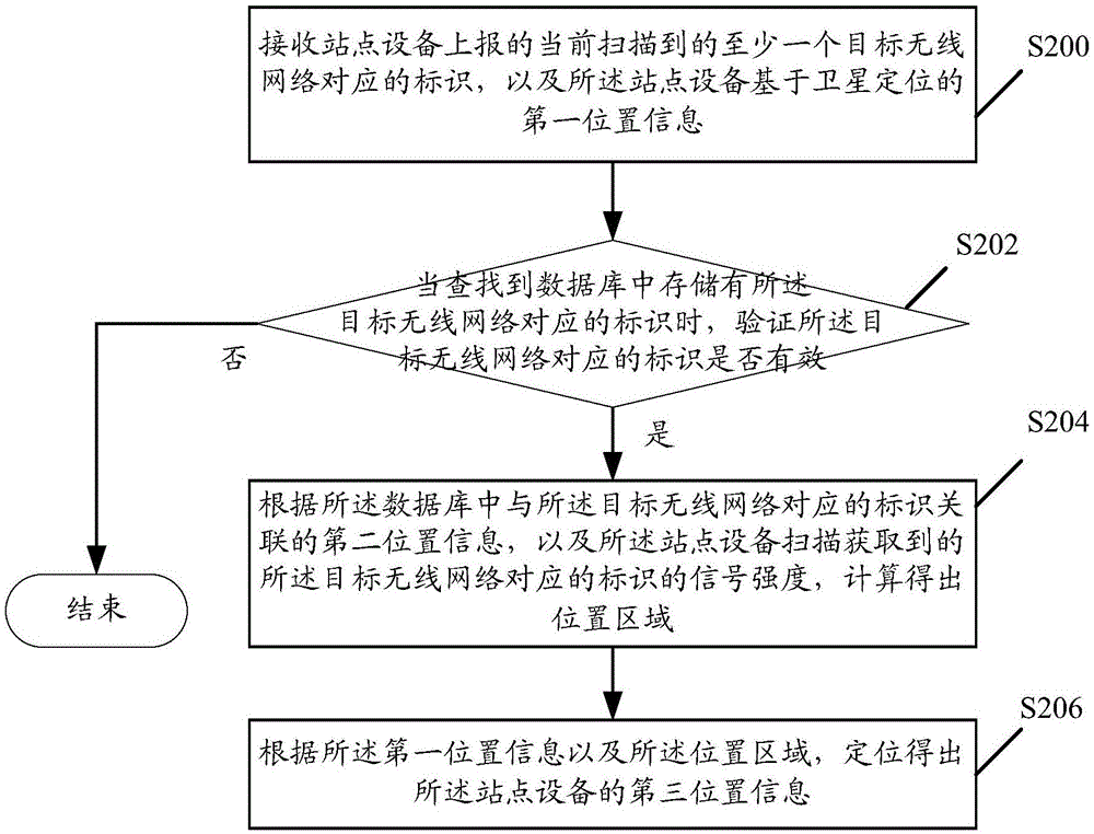
[0063] like figure 2 A schematic flow chart of a method for realizing positioning provided by an embodiment of the present invention is shown, including:

[0064] Step S200: Receive the identification corresponding to at least one currently scanned target wireless network reported by the station device, and the first location information based on satellite positioning of the station device;

[0065] Specifically, after the wireless network function is enabled on the station device, it will scan nearby wireless networks and obtain the identifier corresponding to at least one target wireless network currently scanned. The station device can pass the connected wireless network or the mobile data of the base station. The service sends the identifier corresponding to the at least one target wireless network to the server; at the same time, the site device has enabled the satellite positioning function, and can also send the first location information based on satellite positioning...


PUM


Abstract

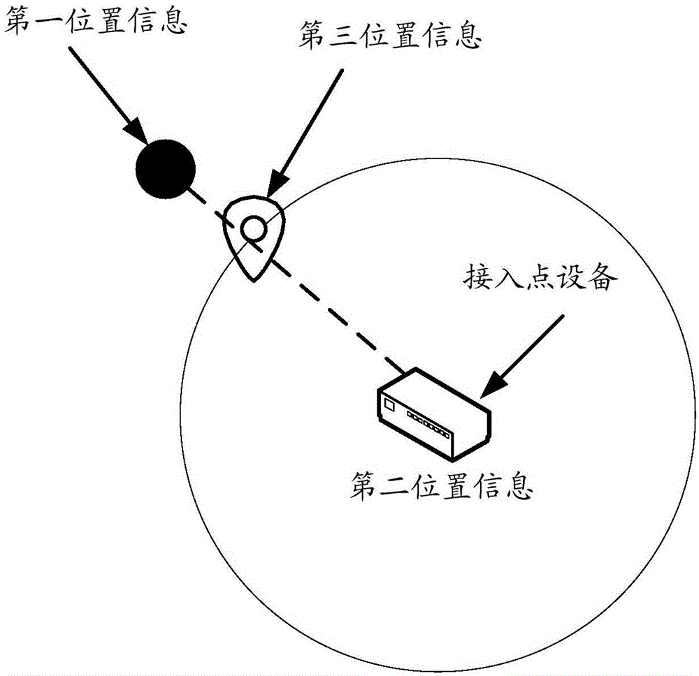
The invention discloses a positioning method. The method comprises that identification corresponding to at least one scanned target wireless network reported by a site device as well as first position information based on satellite positioning are received; when the identification corresponding to the target wireless network is found in a database, whether the identification is valid is verified; if the identification is valid, a position area is calculated according to second position information, associated with the identification, in the database as well as the signal intensity of the identification; and third position information of the site device is obtained by carrying out positioning according to the first position information and the position area. The identification corresponding to the target wireless network is valid is verified to extract valid information from mass data, malicious invalid identification reported by the user can be combined for mutual verification, and the positioning accuracy is greatly improved.

Description

technical field [0001] The invention relates to the field of computer internet, in particular to a positioning method, a related device and a system. Background technique [0002] With the rapid development of communication networks and the widespread application of smart phones, location-based services (Location Based Service, referred to as LBS) are being accepted by more and more users under the strong promotion of the mobile Internet. Users have become accustomed to using mobile phones to view surrounding maps. and perform positioning navigation. [0003] At present, most of the location-based services provided on mobile phones are based on the global positioning system (Global Positioning System, referred to as GPS) and Beidou and other satellite positioning technologies, such as positioning and navigation, surrounding search and other services, but users' demand for positioning services continues to grow. For example, users want to You can also enjoy accurate position...

Claims


Application Information

Patent Timeline
Patent Type & Authority Applications(China)
IPC IPC(8): H04W4/02H04W64/00
CPCH04W4/02H04W64/003
Inventor 陈林峰李龙飞
Owner TENCENT TECH (SHENZHEN) CO LTD
Learn More