Artificial Building Recognition Algorithm Based on Texture Segmentation and Fusion of Radar Remote Sensing Image
A remote sensing image and texture segmentation technology, applied in character and pattern recognition, computing, computer components, etc., to achieve the effects of easy implementation, improved recognition accuracy, and low computational complexity
- Summary
- Abstract
- Description
- Claims
- Application Information
AI Technical Summary
Problems solved by technology
Method used
Image
Examples
Embodiment 1
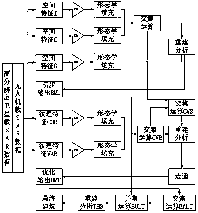
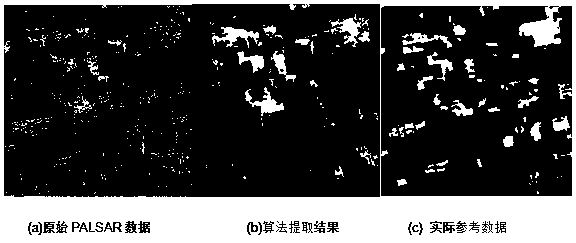
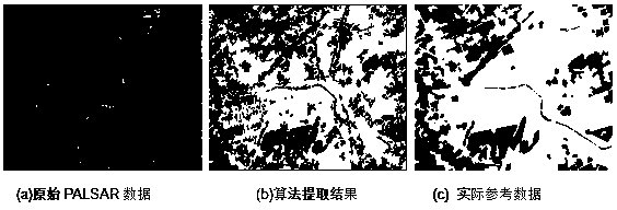
[0067] Embodiment 1: The artificial building recognition algorithm of UAV-borne / space-borne radar remote sensing images based on texture segmentation and fusion is the same as the specific implementation method, figure 2 (a) and image 3 (a) is the original image of spaceborne SAR remote sensing used by the present invention, which is the phased array L-band synthetic aperture radar (PALSAR) sensor data of Japan's earth observation satellite ALOS, which is not affected by clouds, weather and day and night, and can be used for All-weather and all-weather land observation, the acquisition time is November 12, 2008, the polarization mode is HH, the spatial resolution is 10m, and the coverage area is the coal mine area to the east of Jiawang District, Xuzhou City, Jiangsu Province, the coal mine area to the west of Tongshan County and Xuzhou urban area. In order to verify the effectiveness of the method of the present invention, UAV-borne SAR data is used for verification. The ...
PUM
 Abstract
Description
Claims
Application Information
 - R&D
- Intellectual Property
- Life Sciences
- Materials
- Tech Scout
- Unparalleled Data Quality
- Higher Quality Content
- 60% Fewer Hallucinations
Browse by: Latest US Patents, China's latest patents, Technical Efficacy Thesaurus, Application Domain, Technology Topic, Popular Technical Reports.
© 2025 PatSnap. All rights reserved.Legal|Privacy policy|Modern Slavery Act Transparency Statement|Sitemap|About US| Contact US: help@patsnap.com


