
Urban road/ road segment vehicle speed evaluation method

A vehicle speed and road technology, applied in location information-based services, special data processing applications, instruments, etc., can solve problems such as low reliability and low coverage, and achieve the effect of improving range and reliability

Inactive Publication Date: 2015-05-20
上海奕行信息科技有限公司
View PDF3 Cites 13 Cited by
  • Summary
  • Abstract
  • Description
  • Claims
  • Application Information

AI Technical Summary

Problems solved by technology

[0007] However, at present, 3G big data has not been widely and rationally used. Facing the shortcomings of the current traffic information collection methods, such as low reliability and low coverage, it is necessary to propose a new method to make full use of mobile phone big data in the collection. huge advantage in information

Method used


Image

  • Urban road/ road segment vehicle speed evaluation method
  • Urban road/ road segment vehicle speed evaluation method
  • Urban road/ road segment vehicle speed evaluation method

Examples


Embodiment Construction

[0061] The present invention will be further described below in conjunction with the embodiments and accompanying drawings, but the protection scope of the present invention should not be limited thereby.

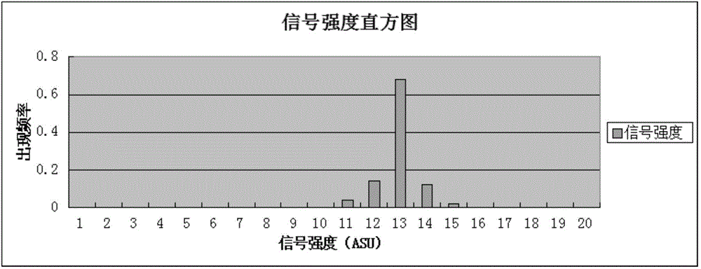
[0062] The mobile phone system needs the App of the Internet instant messaging service to interactively connect with the base station during the wake-up process in the background, and provide the signal data of the base station to the communication service provider. The format of the mobile phone signal data is as follows: figure 2 shown.

[0063] Firstly, the mobile phone positioning database is constructed, the purpose of which is to establish a database of the signal strength of the mobile phone receiving nearby visible base stations (sorted according to the signal strength), and the coverage of the database is every position of every road in the city.

[0064] The database construction steps are as follows:

[0065] 1.1 Collect the signal strength and geographic locat...


PUM


Abstract

The invention discloses an urban road / road segment vehicle speed evaluation method based on big data of 3G mobile phone mobile signals. The urban road / road segment vehicle speed evaluation method comprises the steps of 1, establishing a positioning database, of 2, online positioning user phones, and of 3, calculating an average speed index of vehicle roads / road segments. According to the urban road / road segment vehicle speed evaluation method, by processing mobile phone APP heartbeat data and by the combination of data from base stations and road networks, phone positions and vehicle speed data are obtained, and the problems that data sizes in 'switch' events by a traditional positioning method are small, and the positioning precision is low are solved. Further, the urban road / road segment vehicle speed evaluation method has the advantages of being high in reliability, low in error rate of matching roads, big in data sizes, and the like.

Description

technical field [0001] The invention relates to a vehicle speed evaluation method for urban roads / road sections based on big data of 3G mobile signaling, and belongs to the technical field of mobile phone positioning and traffic information collection and processing. Background technique [0002] In recent years, with the general improvement of the scientific level and people's quality of life, the number of motor vehicles has also increased significantly, which has brought a series of serious traffic problems, and congestion can be seen everywhere. Urban traffic congestion has brought new challenges to urban traffic planning. In order to ease and solve urban traffic problems, the collection and processing of traffic information is becoming more and more important. [0003] At present, traffic information collection technology is divided into two types: fixed collection technology and mobile collection technology. Fixed collection technologies include coil detection, infrar...

Claims


Application Information

Patent Timeline
Patent Type & Authority Applications(China)
IPC IPC(8): G06F19/00H04W4/02
Inventor 孙健梁笃国任广杰李喆
Owner 上海奕行信息科技有限公司
Learn More