
UAV (unmanned aerial vehicle), and UAV control system and method

A control system and UAV technology, applied in the field of long-distance communication, can solve the problems of not being able to understand the content of the UAV in time, unable to monitor the operation of the UAV, etc., and achieve the effect of improving user experience and real-time communication.

Inactive Publication Date: 2015-05-13
SHENZHEN HUAHAI TECH
View PDF10 Cites 48 Cited by
  • Summary
  • Abstract
  • Description
  • Claims
  • Application Information

AI Technical Summary

Problems solved by technology

[0002] UAVs can be used in monitoring applications such as aerial photography, forest protection, and disaster investigation. The image is saved in the memory card. After the shooting is completed, the environmental image captured by the drone is taken out from the memory card. Although this method can capture the required environmental image, the user needs to wait for the drone to shoot the whole process. The required environmental images can be obtained from the memory card, and the content captured by the drone cannot be understood in time, and the drone cannot be monitored and operated in real time.

Method used


Image

  • UAV (unmanned aerial vehicle), and UAV control system and method
  • UAV (unmanned aerial vehicle), and UAV control system and method
  • UAV (unmanned aerial vehicle), and UAV control system and method

Examples


Embodiment Construction

[0035] It should be understood that the specific embodiments described here are only used to explain the present invention, not to limit the present invention.

[0036] The invention provides an unmanned aerial vehicle.

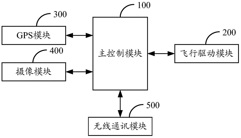
[0037] refer to figure 1 , figure 1 It is a structural schematic diagram of an embodiment of the drone of the present invention.

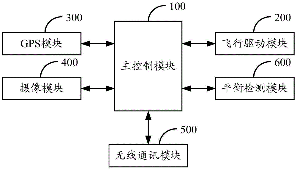
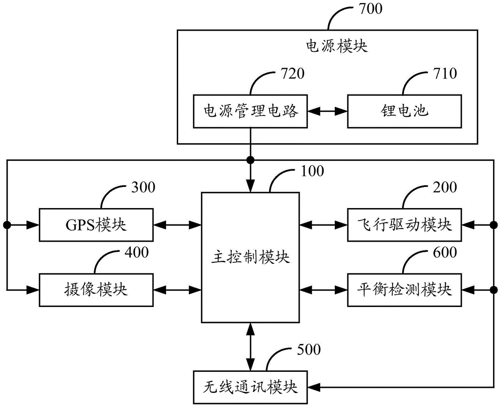
[0038] Such as figure 1 As shown, the unmanned aerial vehicle of the present invention comprises main control module 100, flight drive module 200, GPS module 300, camera module 400 and wireless communication module 500, flight drive module 200, GPS module 300, camera module 400 and wireless communication module 500 Both are connected with the main control module 100, the main control module 100 is the micro control unit of the drone, the flight drive module 200 can be a motor or a motor, and the camera module 400 is a camera. The drone is wirelessly connected to the cloud server through the wireless communication module 500, a...


PUM


Abstract

The invention discloses an UAV (unmanned aerial vehicle), and UAV control system and method. The UAV comprises a main control module, a flight driving module, a GPS module, a camera module and a wireless communication module; the UAV is in wireless connection with a cloud sever through the wireless communication module and communicates with an intelligent terminal device through the cloud server; the flight driving module of the UAV drives the UAV to flight; the GPS module navigates and acquires the location information of the UAV; the camera module acquires an environmental image and acquires corresponding image information; the main control module sends the location position and the image information to the cloud server so that the intelligent terminal device can gain the location information and the image information from the cloud server. The UAV can be monitored and operated on real time and can communicate with the intelligent terminal device on real time, and therefore, the user experience can be effectively increased.

Description

technical field [0001] The invention relates to the technical field of remote communication, in particular to an unmanned aerial vehicle, an unmanned aerial vehicle control system and a control method. Background technique [0002] UAVs can be used in monitoring applications such as aerial photography, forest protection, and disaster investigation. At present, when users use UAVs for aerial photography and other applications, they usually use UAVs to take pictures of the current environmental scene, and the captured environment The image is saved in the memory card. After the shooting is completed, the environmental image captured by the drone is taken out from the memory card. Although this method can capture the required environmental image, the user needs to wait for the drone to complete the shooting. In order to obtain the required environmental images from the memory card, the content captured by the drone cannot be understood in time, and the drone cannot be monitored...

Claims


Application Information

Patent Timeline
Patent Type & Authority Applications(China)
IPC IPC(8): G05D1/10
Inventor 吕学刚
Owner SHENZHEN HUAHAI TECH
Learn More