A three-dimensional terrain traversability analysis method for autonomous vehicles
A technology of three-dimensional topography and analysis methods, applied in image analysis, image data processing, special data processing applications, etc., can solve problems such as low analysis efficiency, failure to meet real-time requirements, redundant calculations, etc.
- Summary
- Abstract
- Description
- Claims
- Application Information
AI Technical Summary
Problems solved by technology
Method used
Image
Examples
Embodiment Construction
[0056] The present invention will be further described in detail below in conjunction with the accompanying drawings and specific embodiments.
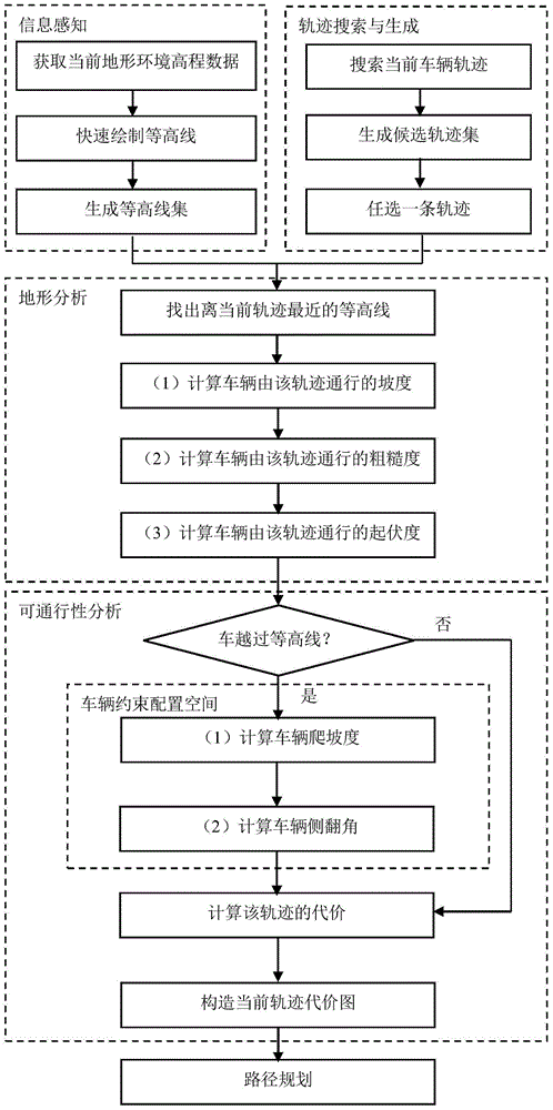
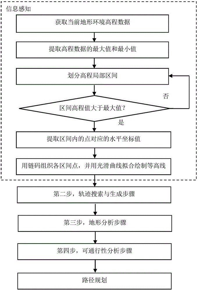
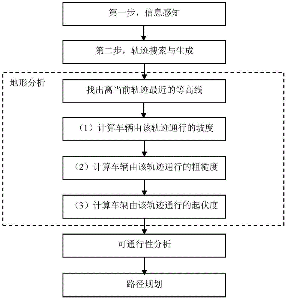
[0057] Such as Figure 1 ~ Figure 4 As shown, the autonomous vehicle three-dimensional terrain traversability analysis method of the present invention comprises the following steps:
[0058] The first step is the information perception step. Provide environmental information and current vehicle movement status information through on-board sensors. Among them, the environmental information is mainly the terrain elevation data set D={(x i ,y i ,z i ) T |x i ,y i ,z i ∈R,i=1,...,n}, the vehicle motion state information is conf=(x v ,y v ,yaw), (x v ,y v ) is the horizontal plane position of the vehicle at the current moment, yaw is the heading angle, and according to the terrain elevation data obtained by information perception, the contour line of the current terrain is quickly drawn.
[0059] The second step is trajectory ...
PUM
 Abstract
Description
Claims
Application Information
 - R&D
- Intellectual Property
- Life Sciences
- Materials
- Tech Scout
- Unparalleled Data Quality
- Higher Quality Content
- 60% Fewer Hallucinations
Browse by: Latest US Patents, China's latest patents, Technical Efficacy Thesaurus, Application Domain, Technology Topic, Popular Technical Reports.
© 2025 PatSnap. All rights reserved.Legal|Privacy policy|Modern Slavery Act Transparency Statement|Sitemap|About US| Contact US: help@patsnap.com


