Coordinate transformation method aiming at mobile platform positioned near south and north poles of earth
A mobile platform and coordinate transformation technology, which is applied in measuring devices, instruments, surveying and mapping and navigation, etc., to achieve good engineering application prospects, simple and easy-to-understand coordinate transformation methods, and strong operability
- Summary
- Abstract
- Description
- Claims
- Application Information
AI Technical Summary
Problems solved by technology
Method used
Image
Examples
Embodiment Construction
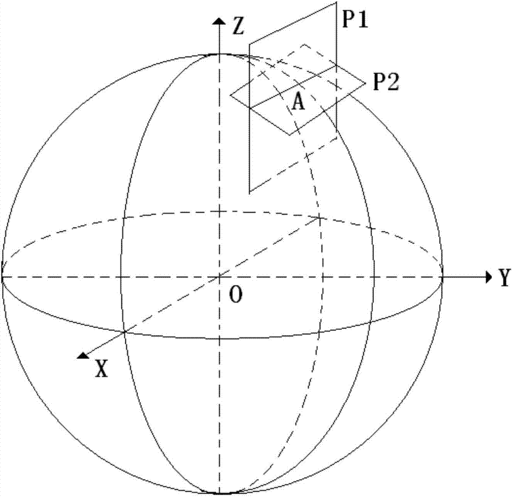
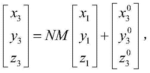
[0019] refer to figure 1 . In the coordinate transformation method described below for when the mobile platform is located near the polar region, the airborne geographic Cartesian coordinate system and the attitude angle of the mobile platform are redefined as the coordinates of the target position from the airborne Cartesian coordinate system to the ECEF Cartesian coordinate system Intermediate transition. On the basis of defining the new airborne geographic rectangular coordinate system and the new mobile platform attitude angle, the mutual transformation of the target position coordinates between the airborne rectangular coordinate system and the earth-centered ground-fixed ECEF rectangular coordinate system is completed.
[0020] First, set the origin as the current position A of the mobile platform, the X-axis is the intersection of plane P1 and plane P2, P1 is the plane passing through point A and parallel to the XZ plane in the ECEF coordinate system, P2 is the horizon...
PUM
 Abstract
Description
Claims
Application Information
 - R&D Engineer
- R&D Manager
- IP Professional
- Industry Leading Data Capabilities
- Powerful AI technology
- Patent DNA Extraction
Browse by: Latest US Patents, China's latest patents, Technical Efficacy Thesaurus, Application Domain, Technology Topic, Popular Technical Reports.
© 2024 PatSnap. All rights reserved.Legal|Privacy policy|Modern Slavery Act Transparency Statement|Sitemap|About US| Contact US: help@patsnap.com


