A tropospheric long-distance sub-centimeter-level real-time dynamic satellite navigation positioning method

A satellite navigation and real-time dynamic technology, applied in the field of satellite navigation positioning, can solve the problems of not reflecting the real-time changes of the flow layer well and the attenuation of positioning accuracy

Active Publication Date: 2016-11-30
TONGJI UNIV
View PDF3 Cites 1 Cited by
  • Summary
  • Abstract
  • Description
  • Claims
  • Application Information

AI Technical Summary

Problems solved by technology

However, there are two main factors restricting the application of existing RTK technology in geoscience research: (1) The current RTK technology can reach the centimeter level, but the accuracy in the height direction is 1.5 to 2 times worse than that in the horizontal direction
(2) The positioning accuracy of RTK technology decays rapidly with the increase of the distance between the base station and the rover
However, the filtering method used to solve the tropospheric parameters is at best the average value of the tropospheric delay of multiple epochs, which cannot reflect the real-time changes of the troposphere well, especially when the mobile station is in a complex atmospheric environment and moving at a high speed, so the present invention is A possible way to solve this problem

Method used


Image

  • A tropospheric long-distance sub-centimeter-level real-time dynamic satellite navigation positioning method
  • A tropospheric long-distance sub-centimeter-level real-time dynamic satellite navigation positioning method
  • A tropospheric long-distance sub-centimeter-level real-time dynamic satellite navigation positioning method

Examples


Embodiment Construction

[0073] The present invention will be described in detail below in conjunction with the accompanying drawings and specific embodiments. This embodiment is carried out on the premise of the technical solution of the present invention, and detailed implementation and specific operation process are given, but the protection scope of the present invention is not limited to the following embodiments.

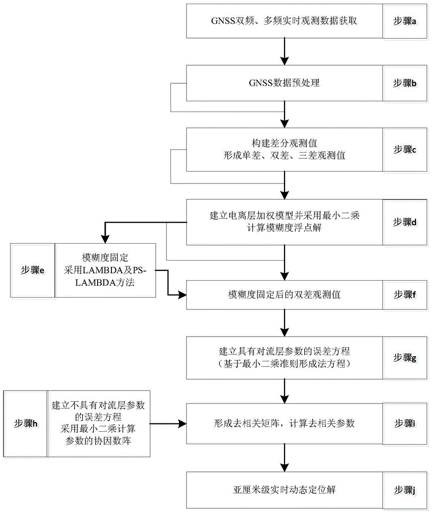
[0074] A tropospheric long-distance sub-centimeter-level real-time dynamic satellite navigation positioning method, the implementation steps of the method are:

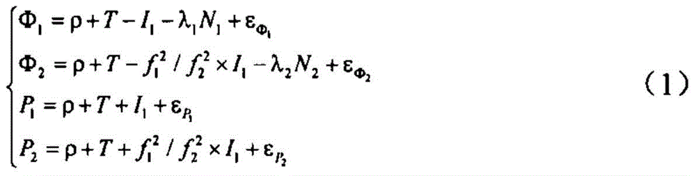
[0075] Firstly, the double-difference ambiguity of L1 and L2 carriers is fixed, and after the ambiguity is fixed, the ionospheric weighted double-difference observation equation including tropospheric parameters is established.

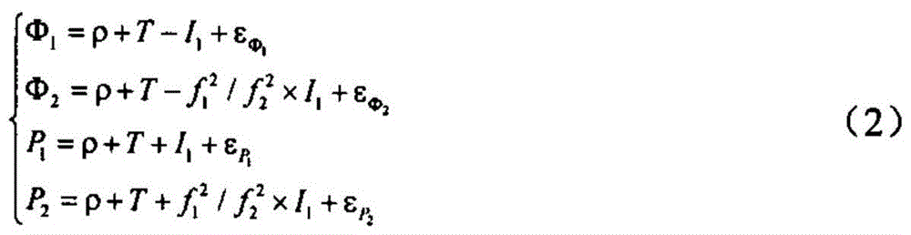
[0076] Second, determine the descending correlation parameters. Obtaining the descending correlation parameters is the premise of finding the descending correlation solution. The descending correla...


PUM


Abstract

The invention relates to a tropospheric long-distance sub-centimeter-level real-time dynamic satellite navigation and positioning method. The method includes: firstly, fixing the double-difference ambiguity of L1 and L2 carriers, and after fixing the ambiguity, establishing an ionospheric weighted double-difference with tropospheric parameters Observation equation; secondly, determine the descending correlation parameters. In the process of calculating the descending correlation parameters, the true value of the unknown number needs to be used, and the cofactor matrix of the least squares position parameters without tropospheric parameters is used to replace the parameters in the process of solving the descending correlation parameters. The quadratic matrix of true values; finally, the optimal descending correlation solution is obtained according to the descending correlation parameters, so as to obtain reliable subcentimeter-level coordinate estimates. Compared with the prior art, the invention has the advantages of high precision, strong stability, wide application range and the like.

Description

technical field [0001] The invention relates to a positioning technology for satellite navigation, in particular to a troposphere long-distance sub-centimeter level real-time dynamic satellite navigation positioning method. Background technique [0002] In the past two decades, GNSS RTK precision positioning technology has made great progress and has been widely used in many fields, such as geodesy, engineering and instrument automation. In geoscience applications, high-frequency GNSS data can capture coseismic displacements over a range of frequencies and amplitudes, and in some ways, the breadth of such measurements is wider than that of seismic sensors. It is capable of detecting ground motion and coseismic plane waves of any size from hundreds or even thousands of kilometers away. On the other hand, GNSS RTK can also be used to determine the local geoid model. However, there are two main factors restricting the application of existing RTK technology in geoscience resea...

Claims


Application Information

Patent Timeline
Patent Type & Authority Patents(China)
IPC IPC(8): G01S19/44
Inventor 李博峰沈云中楼立志葛海波
Owner TONGJI UNIV
Why Eureka
Try Eureka