
A Layout Optimization Method for Planetary Navigation Orbiter Based on Predicted Trajectory

A layout optimization and orbiter technology, applied in the field of deep space exploration, can solve the problem of lack of ground beacons that can provide navigation support

Inactive Publication Date: 2016-08-24
BEIJING INSTITUTE OF TECHNOLOGYGY
View PDF4 Cites 0 Cited by
  • Summary
  • Abstract
  • Description
  • Claims
  • Application Information

AI Technical Summary

Problems solved by technology

Although some scholars have conducted in-depth analysis on the impact of the position of beacons on the planet's surface on navigation performance, there are currently no ground-based beacons that can provide navigation support.

Method used


Image

  • A Layout Optimization Method for Planetary Navigation Orbiter Based on Predicted Trajectory
  • A Layout Optimization Method for Planetary Navigation Orbiter Based on Predicted Trajectory
  • A Layout Optimization Method for Planetary Navigation Orbiter Based on Predicted Trajectory

Examples


Embodiment Construction

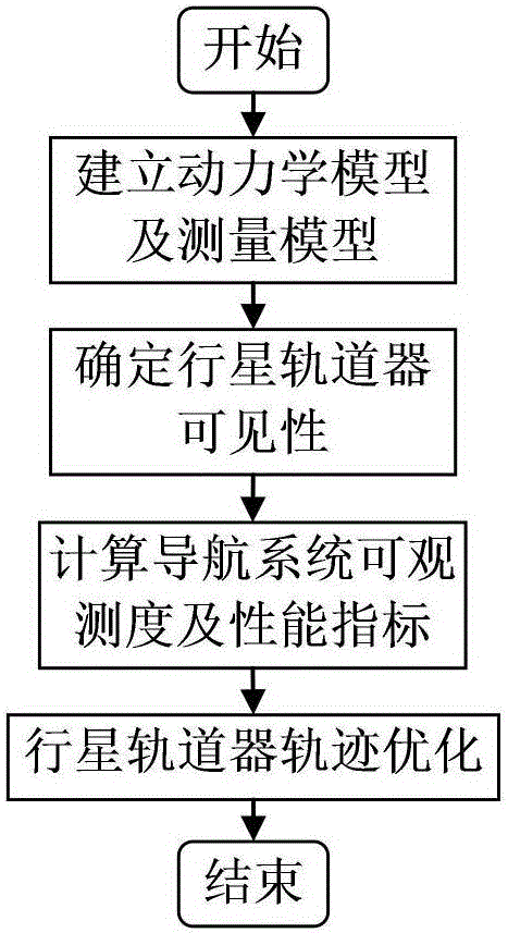
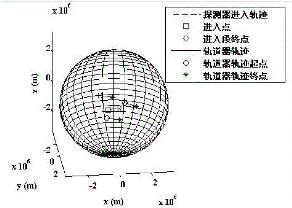
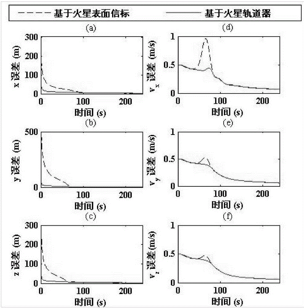
[0066] This example aims at the autonomous navigation scheme based on radio measurement communication in the Martian atmosphere entry section, considers the radio ranging information between the probe and the three Mars navigation orbiters, and optimizes the initial layout of the Mars navigation orbiter, so that the navigation system can be observed maximum. The concrete implementation method of the present invention is as follows:

[0067] Step 1: Establish a dynamic model of the Martian atmosphere entry segment.

[0068] A dynamic model of the probe is established in the Martian inertial coordinate system. The origin of the coordinate system is the center of mass of Mars, the Z axis points to the North Pole perpendicular to the equator, the X axis points to the vernal equinox on the equator, and the Y axis forms a right-handed coordinate system with the X and Z axes. Consider the aerodynamic force and gravity, and ignore the rotation of Mars. The 6D state vector of the de...


PUM


Abstract

The invention relates to a layout optimization method of a planet navigation orbiter based on a prediction track, belonging to the technical field of deep space detection. The layout optimization method provided by the invention has the advantages that a dynamic moving track of a navigation orbiter and a detector in an inlet section in a process that the initial layout of the planet navigation orbiter is optimized is considered, the observability of a Fisher information matrix derivation navigation system is utilized for representing a navigation property, the initial layout of the planet navigation orbiter is optimized based on the integral of the observability to a navigation system, the maximization of the observability of the navigation system is realized, the estimated accuracy of the state when a detector enters is improved, and the optimum of a navigation property is guaranteed.

Description

technical field [0001] The invention relates to a method for optimizing the layout of a planetary navigation orbiter based on a predicted trajectory, and belongs to the technical field of deep space exploration. Background technique [0002] Planetary landing detection is a necessary stage for human beings to carry out planetary exploration activities. In order to obtain more lucrative scientific returns, it is necessary for the probe to have the ability to land in a specific area of ​​high scientific value. The target planet is generally far away from the earth, and the communication delay is serious, so the support of autonomous navigation technology is needed. The planetary atmosphere entry stage is the most complicated and dangerous stage for planetary landing detection. The characteristics of the aerodynamic environment and gravity field have great uncertainty. Accurate autonomous navigation in the entry stage is urgently needed to ensure the accuracy of planetary land...

Claims


Application Information

Patent Timeline
Patent Type & Authority Patents(China)
IPC IPC(8): G01C21/24
CPCG01C21/24
Inventor 崔平远于正湜朱圣英高艾徐瑞
Owner BEIJING INSTITUTE OF TECHNOLOGYGY
Learn More