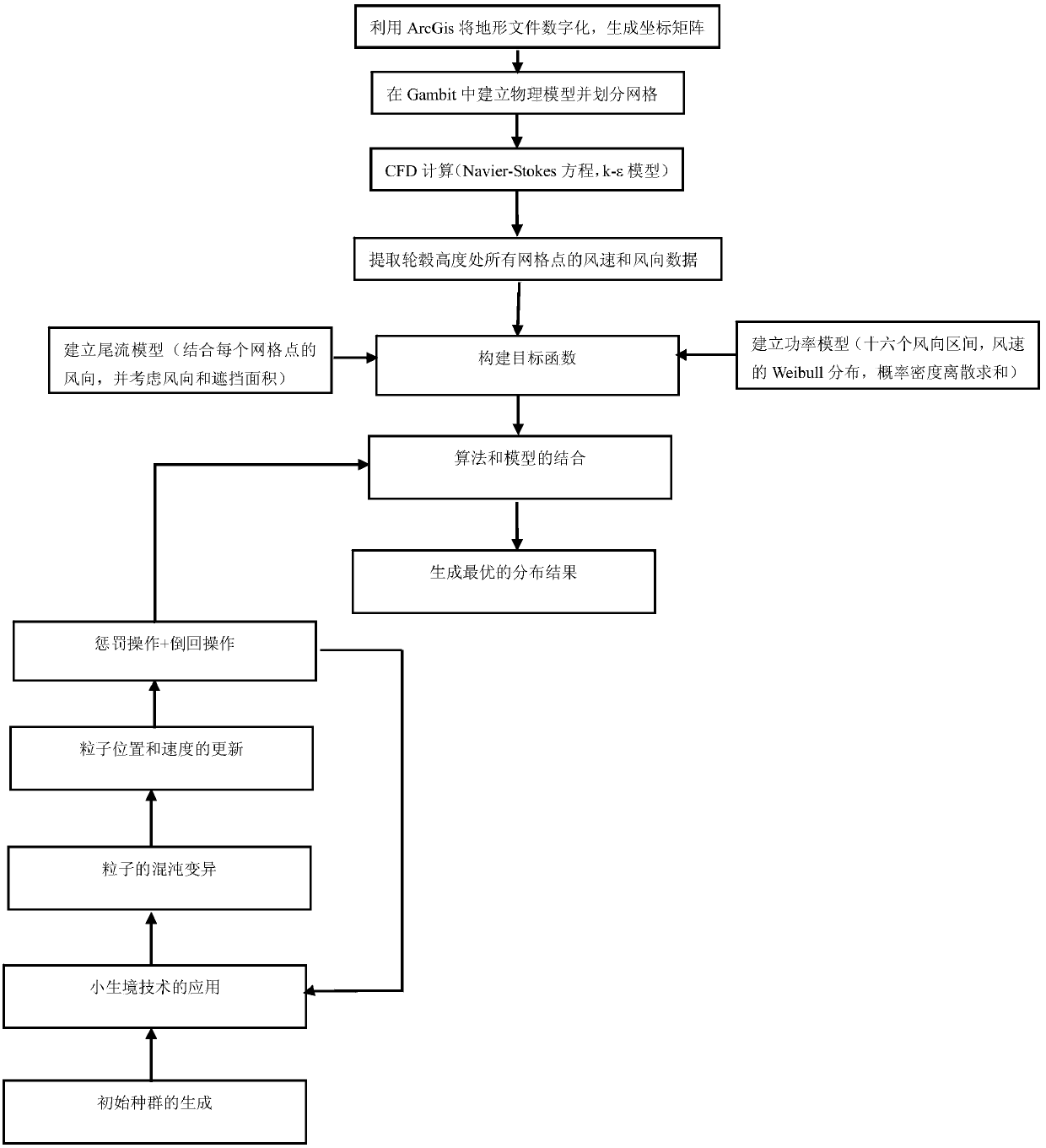
CFD and improved PSO based microscopic wind-farm site selection method of complex terrain
A complex terrain and micro-site selection technology, applied in the fields of instruments, data processing applications, prediction, etc., can solve the problems of less research, achieve layout optimization, maintain high efficiency, and increase population diversity.
- Summary
- Abstract
- Description
- Claims
- Application Information
AI Technical Summary
Problems solved by technology
Method used
Image
Examples
Embodiment Construction
[0036] Below in conjunction with accompanying drawing, the technical scheme of invention is described in detail:
[0037] (1) Numerical simulation of complex terrain wind farms using CFD
[0038] 1.1 Terrain digitization and grid generation
[0039] At present, topographic maps of wind farms are usually represented by Autocad contour lines. To establish a CFD physical model including terrain, the terrain needs to be digitized first. ArcGIS is the most powerful and widely used software in the geographic information system industry. Use Arcgis to separate the contour lines in Autocad and generate a tin file, then convert the generated tin file into a dem file of coordinate points, and perform discrete processing on the dem file, and finally generate the Cartesian coordinates of the topographic map.
[0040] The selected topographic map plane is a standard rectangle, and the height direction is taken to be 5 times the hub height above the average height. According to the disc...
PUM
 Abstract
Description
Claims
Application Information
 - R&D
- Intellectual Property
- Life Sciences
- Materials
- Tech Scout
- Unparalleled Data Quality
- Higher Quality Content
- 60% Fewer Hallucinations
Browse by: Latest US Patents, China's latest patents, Technical Efficacy Thesaurus, Application Domain, Technology Topic, Popular Technical Reports.
© 2025 PatSnap. All rights reserved.Legal|Privacy policy|Modern Slavery Act Transparency Statement|Sitemap|About US| Contact US: help@patsnap.com


