A Geographic Information Graphics Data Integration Method

A graphic data and geographic information technology, applied in the field of information, can solve problems such as inconsistency in system storage, incomplete spatial description, and inconsistent graphic data formats, so as to improve decision-making efficiency, optimize work effects, and improve spatial information.

Active Publication Date: 2017-10-03
CHONGQING UNIV
View PDF8 Cites 0 Cited by
  • Summary
  • Abstract
  • Description
  • Claims
  • Application Information

AI Technical Summary

Problems solved by technology

[0006] The object of the present invention is to provide a geographic information graphic data integration method, which converts, divides and integrates multi-source graphic data from different places without changing the information contained in the graphic data, and solves the problem of a large number of graphic data formats. Uniformity, incomplete system storage, and incomplete spatial description have significantly improved the response speed of the geographic information system, optimized the data structure, and improved the accuracy of work

Method used


Image

  • A Geographic Information Graphics Data Integration Method
  • A Geographic Information Graphics Data Integration Method
  • A Geographic Information Graphics Data Integration Method

Examples


Embodiment Construction

[0042] The present invention will be further described below in conjunction with drawings and embodiments.

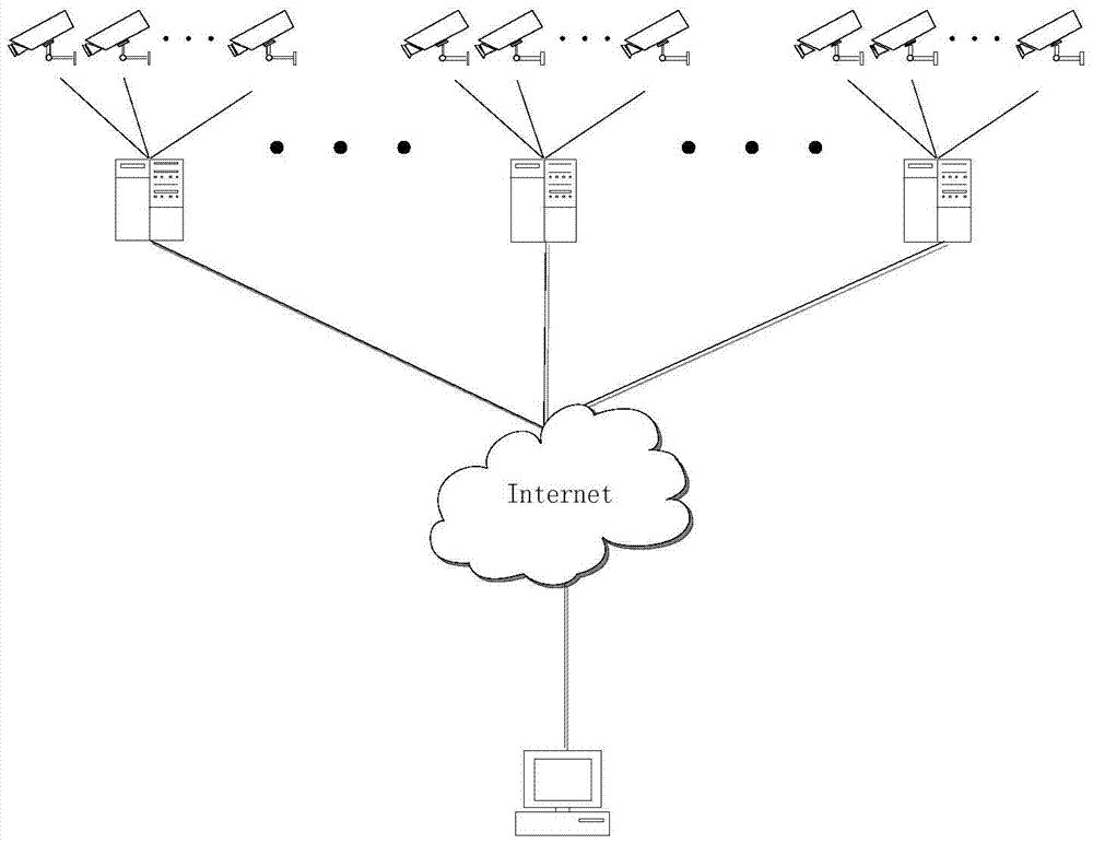
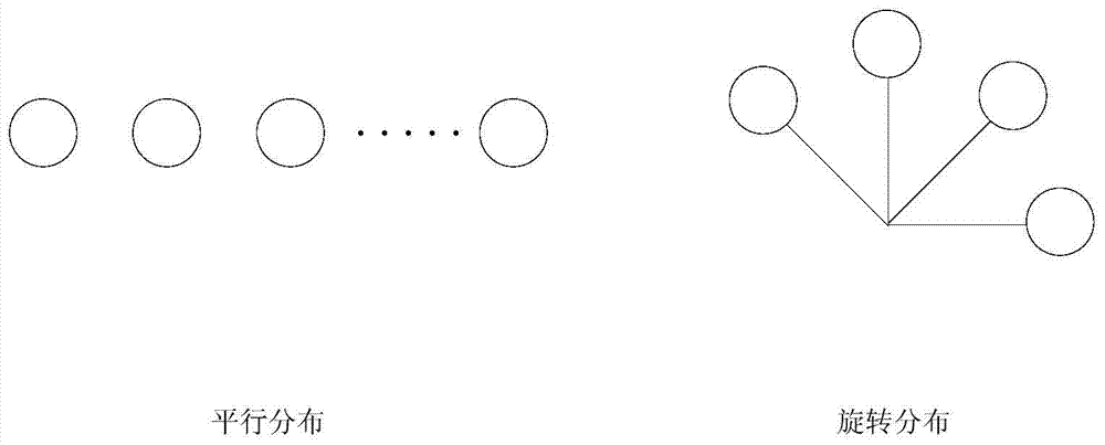
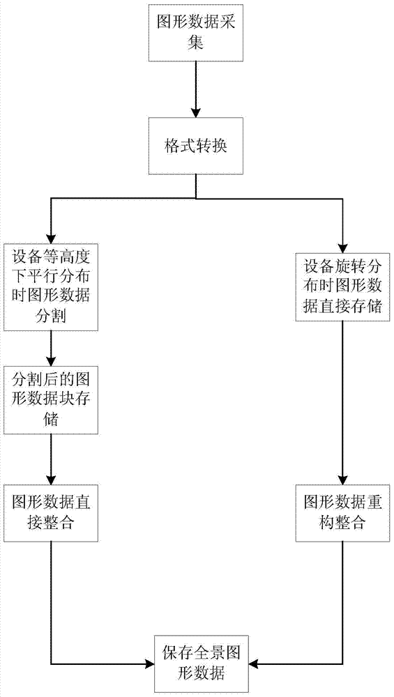
[0043]A geographic information graphics data integration method, there are several spaces in each region, and in each space there are several electronic cameras or electronic cameras that are distributed in parallel at the same height or rotated at the same height, and a distributed server The image acquisition equipment will collect a large amount of graphic data and send it to the distributed server in the area, and then the distributed server will transmit it to the main computer through the internet. The present invention transmits a large number of heterogeneous graphics data with different characteristics and different formats to the host computer, and then performs a series of analysis and processing work on them after format conversion. The specific steps are as follows:

[0044] 1) Establish a distributed server in a different place to receive the original data...


PUM


Abstract

Provided is a geographic information graphic data integration method. The format conversion process is simplified by calling conversion macroblocks of a large number of graphic data of a distributed server, graph analysis and processing work is simplified through format conversion of the graphic data, complication of graphic identification is reduced, the error rate of operations is reduced, and operation time is saved. Meanwhile, by recognizing, segmenting, assembling and integrating the graphic data of the distributed server, the redundancy of the graphic data in the server is reduced, the data structure is optimized, spacial information is improved, a client of an ultimate computer end can quickly and accurately obtain various spacial graph data which meet specific requirements and are based on geographic information and policy making efficiency is improved.

Description

technical field [0001] The invention relates to the field of information technology, in particular to a graphic data processing method for geographic information systems. Background technique [0002] In the geographic information system, the distributed servers distributed in different places are respectively connected with several digital cameras and digital cameras, and they collect the graphic data information of the place and send them to the distributed servers, but these devices are often provided by different software manufacturers, so Graphical data is often in different formats. At the same time, since there may be multiple digital cameras or digital video cameras in the same space, the graphics data provided by these devices may overlap, which will lead to an increase in system redundancy. In addition, when a user requests to obtain certain spatial graphic data information, since a digital camera or digital video camera cannot take a complete spatial picture, the...

Claims


Application Information

Patent Timeline
Patent Type & Authority Patents(China)
IPC IPC(8): G06F17/30G06T3/40
CPCG06F16/217G06F16/258G06F16/29
Inventor 张可柴毅田甜钱锟熊英志
Owner CHONGQING UNIV
Why Eureka
Try Eureka