
Method of constructing fine discrete road grid in urban drainage simulation system

A simulation system and urban drainage technology, applied in special data processing applications, instruments, electrical digital data processing, etc., can solve the problem of low accuracy of digital elevation models, and the accuracy of water accumulation and waterlogging models that do not consider the complex terrain characteristics of roads from the design point of view Simulation and other issues to achieve the effect of avoiding mix-and-match phenomena

Inactive Publication Date: 2013-11-20
BEIJING UNIV OF TECH
View PDF5 Cites 68 Cited by
  • Summary
  • Abstract
  • Description
  • Claims
  • Application Information

AI Technical Summary

Problems solved by technology

[0005] The present invention mainly aims to solve the scientific problems that the current digital elevation model constructed based on the traditional road terrain processing method is low in accuracy, and does not consider the expression of road complex terrain features and the accurate simulation of the water accumulation and internal waterlogging model from the design point of view. Road Fine Discrete Grid Construction Method for Drainage Simulation System

Method used


Image

  • Method of constructing fine discrete road grid in urban drainage simulation system
  • Method of constructing fine discrete road grid in urban drainage simulation system
  • Method of constructing fine discrete road grid in urban drainage simulation system

Examples


Embodiment Construction

[0051] The following examples are combined with the attached figure 1 -5 further specify the detailed implementation of the present invention.

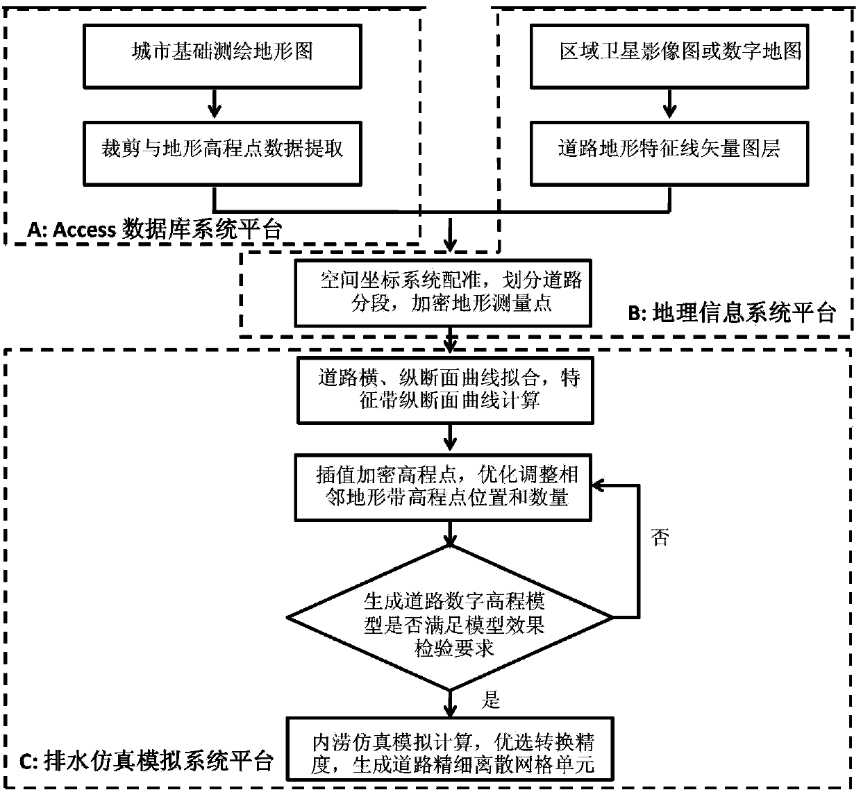
[0052] The specific implementation process of the present invention is as figure 1 shown, including the following steps:

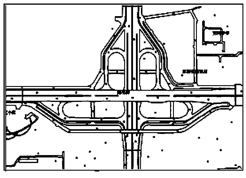
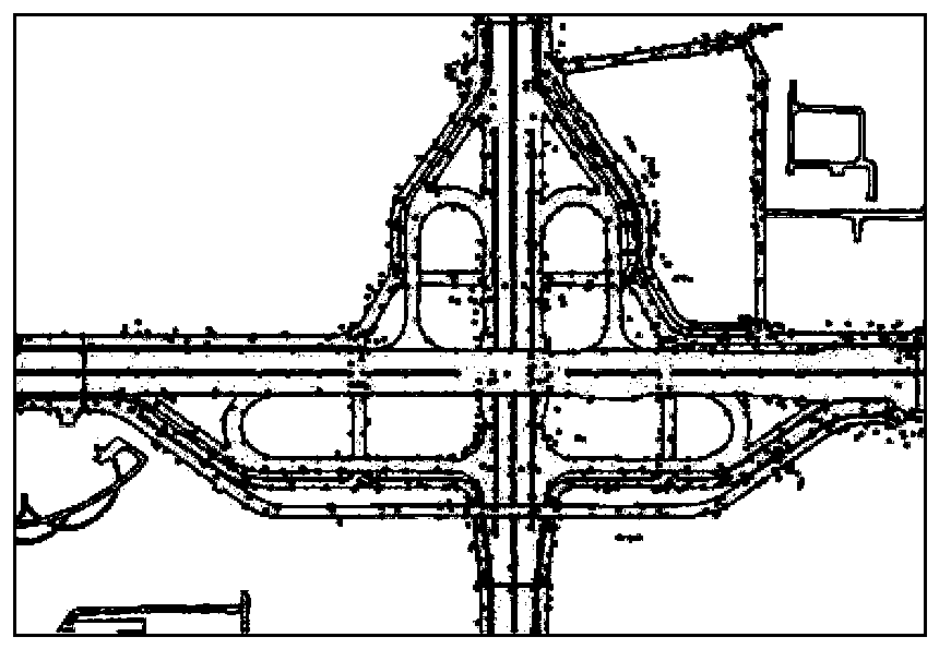
[0053] (1) Data preparation of urban road topographic features, including urban surveying and mapping topographic maps and urban satellite image maps. The topographic map is clipped according to the scope of the modeling area, and the elevation data of topographic points are collected from it, and imported into the Access database for storage, as the data basis of the digital elevation model of the road. The data table structure of the storage database system includes the X coordinate, Y coordinate and elevation fields of the point data. At the same time, after vector conversion and manual correction of urban satellite images, the vector layer of road terrain feature lines is obtained. The storage of this la...


PUM


Abstract

The invention relates to a method of constructing a fine discrete road grid in an urban drainage simulation system and belongs to the cross field of municipal engineering information technology, database technology and geologic information system technology. From the demand on construction of a waterlogging simulation model, under the restraint conditions in road design specifications and on the basis of conventional map measured elevation points, the number and positions of interpolation points are optimized under the drainage simulation system platform by the fitting method of local elevation change curves of cross-longitudinal road section and by road characteristic terrain vector layers according to mathematical model interpolation encryption plane and elevation information of physical road tomography; accordingly, a fine discrete road elevation grid unit is constructed, true tomographic road features are expressed quickly and economically, the demand on precise simulation of waterlogging models is met, especially the dredging and resisting actions of road micro-tomographic features upon waterflow can be correctly expressed, and the method is significant to promotion and application of the drainage simulation technology.

Description

technical field [0001] The invention relates to a method for constructing refined discrete grid units of urban road surface as an input condition of an urban drainage and waterlogging simulation system, and belongs to the cross field of municipal engineering information technology, database technology and geographic information system technology. Background technique [0002] Hydraulic simulation technology is based on a series of basic principles of hydrology and hydraulics, and uses computer as a means to realize the simulation of actual physical processes such as urban surface rainfall, runoff, confluence, and depression water accumulation. The drainage simulation system platform integrates geographic information system technology and hydraulic model technology, and has a wide range of applications in urban drainage and waterlogging prevention planning and design, rainfall event analysis, and daily operation management, especially in the current urban road waterlogging sim...

Claims


Application Information

Patent Timeline
Patent Type & Authority Applications(China)
IPC IPC(8): G06F17/50G06F17/30
Inventor 周玉文刘子龙叶婉露王昊唐颖赵见王宏利刘畅刘珊珊王正吉曾玉蛟
Owner BEIJING UNIV OF TECH
Learn More