Coordinate system data fusion and unification technology on basis of uncertainty

A technology with standard uncertainty and certainty, applied in radio wave measurement systems, instruments, etc., to solve problems affecting the accuracy of lidar measurement results

Inactive Publication Date: 2013-01-09
CHANGCHUN UNIV OF SCI & TECH
View PDF3 Cites 2 Cited by
  • Summary
  • Abstract
  • Description
  • Claims
  • Application Information

AI Technical Summary

Problems solved by technology

The result of the transfer station error will directly affect the accuracy of the lidar measurement results

Method used


Image

  • Coordinate system data fusion and unification technology on basis of uncertainty
  • Coordinate system data fusion and unification technology on basis of uncertainty
  • Coordinate system data fusion and unification technology on basis of uncertainty

Examples


Embodiment Construction

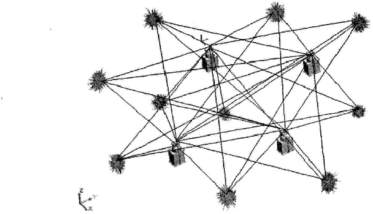
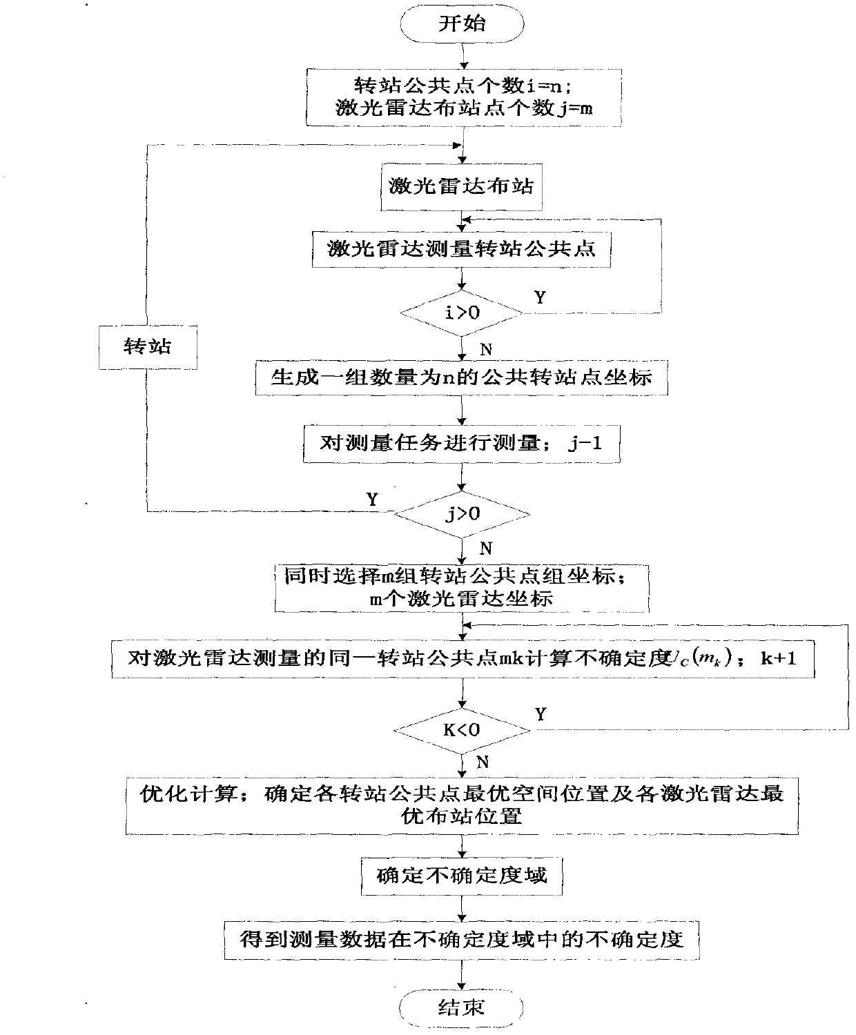
[0040] The purpose of the present invention is to propose a coordinate system data fusion unified technology based on uncertainty, which is suitable for reducing the laser radar integrated transfer error in large-scale precision measurement and improving the accuracy of the measurement result. It is characterized by optimizing the calculation of the optimal spatial position of the public point of each transfer station and the optimal placement position of the lidar after multiple transfers. The standard of each point is calculated from the optimal spatial position of the transfer station public point. In this uncertainty domain, the laser radar integrated transfer station error is the smallest and the quality of the measurement result is the best. The unified process of coordinate system data fusion based on uncertainty is as follows figure 2 Shown.

[0041] 1) The lidar is used to measure large-sized objects through multiple transfer stations.

[0042] 2) When all the public po...


PUM


Abstract

The invention aims to provide a coordinate system data fusion and unification technology on the basis of the uncertainty, which is applicable to reduce the comprehensive transfer error of a laser radar in the large-size precision measurement and improve the accuracy of a measurement result. The coordinate system data fusion and unification technology is characterized in that the space optimal position of each transfer common point which is repeatedly transferred and the optimal station distribution position of the laser radar are optimized and calculated; the standard uncertainty of each point is calculated by the optimal space position of the transfer common point so as to establish an uncertainty range of a measured space, and thus, in the uncertainty range, the laser radar has the minimum comprehensive transfer error and the measurement result has the optimal quality.

Description

Technical field [0001] The invention relates to a coordinate system data fusion unification technology based on uncertainty, which is suitable for reducing the laser radar comprehensive transfer error in large-size precision measurement and improving the accuracy of measurement results, and belongs to the technical field of large-size measurement. Background technique [0002] When the lidar measures and detects the large-size object, it needs multiple stations to complete all measurement tasks. Because the Lidar azimuth angle error is larger than the pitch angle error, and when multiple stations are transferred, due to the external environment and the choice of the position of the Lidar station, the error of each station is different. The comprehensive error after the lidar station is the accumulation of errors from multiple transfers. The result of the transfer error will directly affect the accuracy of the lidar measurement result. Summary of the invention [0003] The purpos...

Claims


Application Information

Patent Timeline
IPC IPC(8): G01S7/497
Inventor 周娜李丽娟林雪竹王劲松高瑀含安志勇
Owner CHANGCHUN UNIV OF SCI & TECH
Why Eureka
Try Eureka