Method for generating variable resolution digital elevation model
A digital elevation model and resolution technology, used in height/level measurement, measurement devices, instruments, etc., can solve the problems of low terrain measurement accuracy, irregular resolution, and inability to effectively express the characteristics of terrain data.
- Summary
- Abstract
- Description
- Claims
- Application Information
AI Technical Summary
Problems solved by technology
Method used
Image
Examples
Embodiment Construction
[0012] The present invention will be described in detail below in conjunction with the accompanying drawings and embodiments.
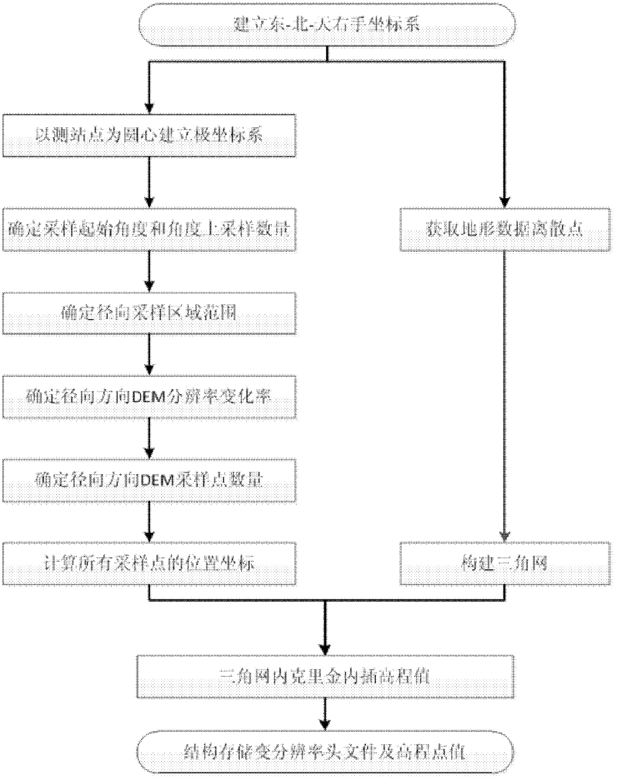
[0013] The present invention obtains the generation method of variable resolution digital elevation model by close-range photogrammetry or ground laser scanning, comprises the following steps (such as figure 1 shown):
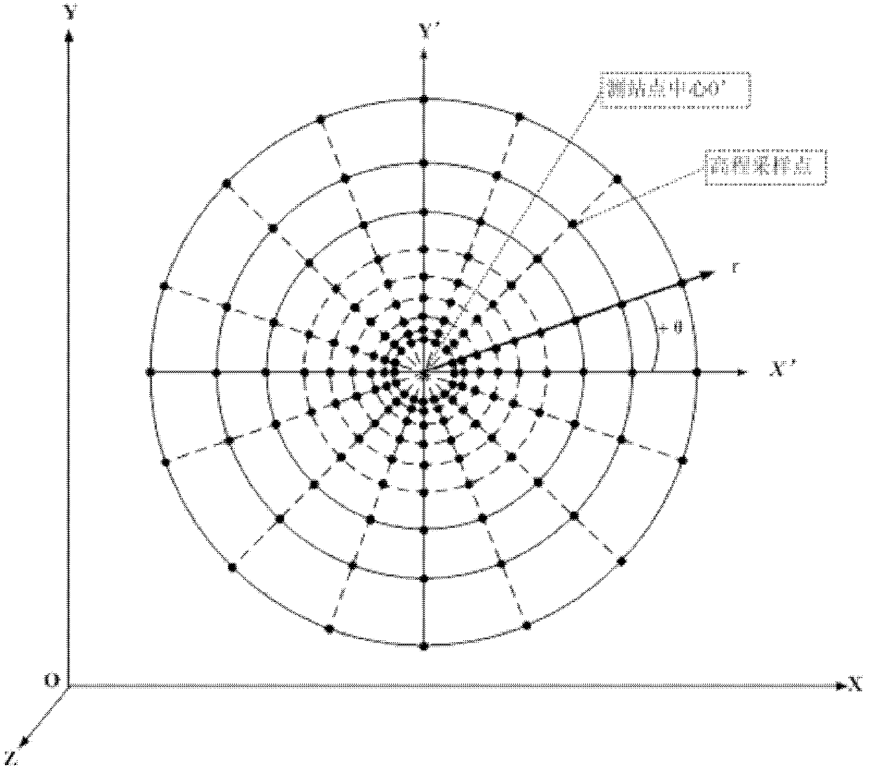
[0014] 1. Establish the east-north-sky right-hand coordinate system according to the measured terrain area, and establish a new plane coordinate system X'O'Y' in the XOY plane of the east-north-sky right-hand coordinate system, and use the new plane The origin of the coordinate system is the pole to establish a polar coordinate system (such as figure 2 shown).
[0015] Taking the east direction of the measured topographic area as the X axis, the north direction as the Y axis, and the direction perpendicular to the XOY plane pointing to the sky as the Z axis, establish the east-north-sky right-handed coordinate system (that is, the O...
PUM
 Abstract
Description
Claims
Application Information
 - R&D
- Intellectual Property
- Life Sciences
- Materials
- Tech Scout
- Unparalleled Data Quality
- Higher Quality Content
- 60% Fewer Hallucinations
Browse by: Latest US Patents, China's latest patents, Technical Efficacy Thesaurus, Application Domain, Technology Topic, Popular Technical Reports.
© 2025 PatSnap. All rights reserved.Legal|Privacy policy|Modern Slavery Act Transparency Statement|Sitemap|About US| Contact US: help@patsnap.com


