Dynamic graphical method and device of geographic information application and analysis model

A technology of geographic information and application analysis, applied in the field of geographic information system, can solve the problem of low degree of automation, and achieve the effect of solving low degree of automation and simple input

Active Publication Date: 2010-06-02
BEIJING SUPERMAP SOFTWARE CO LTD
View PDF0 Cites 9 Cited by
  • Summary
  • Abstract
  • Description
  • Claims
  • Application Information

AI Technical Summary

Problems solved by technology

[0005] The technical problem to be solved by the present invention is to provide a dynamic graphical method of geographic information application analysis model, which can solve the problem of low automation in the graphical process of application analysis model, and can solve the problem of diversified representation types of emergency analysis models question

Method used


Image

  • Dynamic graphical method and device of geographic information application and analysis model
  • Dynamic graphical method and device of geographic information application and analysis model
  • Dynamic graphical method and device of geographic information application and analysis model

Examples


Embodiment Construction

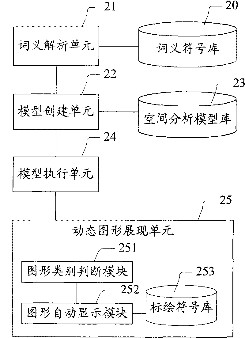
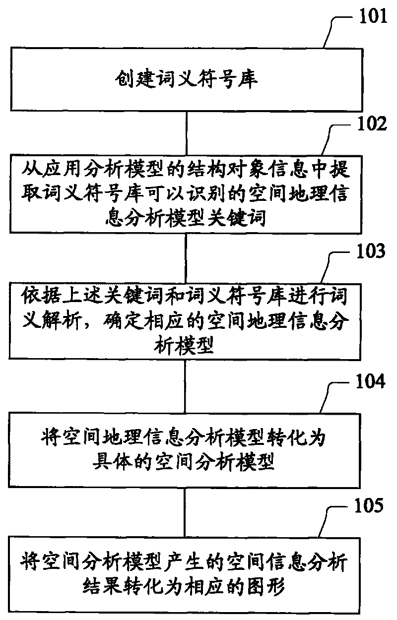
[0021] Before further describing the present invention in detail with reference to the accompanying drawings and specific implementation methods, several concepts related to emergency analysis model analysis in the GIS application system are firstly introduced.

[0022] Word meaning analysis: The difference between machine algorithms and humans is that humans can directly understand the meaning of words, words, and sentences in articles, while machines and algorithms cannot. Word meaning analysis refers to extracting keywords and related participles, searching for corresponding items in the word meaning symbol library, distinguishing and analyzing the meaning and attribute information corresponding to keywords and related participle, understanding the meaning of words in the specified field, and then performing corresponding operations. Before performing word meaning analysis, a word stem library, that is, a word segmentation word meaning symbol library used, must first be esta...


PUM


Abstract

The invention provides dynamic graphical method and device of a geographic information application and analysis model. The method comprises the following steps of: extracting space geographic information analysis model key words from the structural object information of the application and analysis model; establishing a space analysis model according to a word analysis result of the obtained space geographic information analysis model key words; and dynamically displaying a space geographic information analysis result generated by the space analysis model in the graphic form on a map. The analysis result of a geographic information space model of an application and analysis scheme can be dynamically displayed on an electronic map in a visual graphic form through establishing an incidence relation between the structural object information of the application and analysis model and the space analysis model, which solves the problem of low degree of automation of the traditional application and analysis model in a graphical process and realizes the purposes of simple input, intelligent analysis and automatic display.

Description

technical field [0001] The invention relates to the technical field of geographic information systems, in particular to a method and device for dynamic graphics of geographic information application analysis models. Background technique [0002] Geographic Information System (GIS, Geographic Information Systems) technology is a spatial information processing technology that has developed rapidly in recent years. It is based on geographic space and uses geographic model analysis methods to implement and provide a variety of spatial and dynamic geographic information. It is a computer technology system serving geographic research and geographic decision-making. Its basic function is to convert tabular data from databases, spreadsheet files or directly input in the program into geographic graphic display, and then browse, operate and analyze the displayed results. Not only can it effectively manage various resource and environmental information with spatial attributes, it can ...

Claims


Application Information

Patent Timeline
Patent Type & Authority Applications(China)
IPC IPC(8): G06F17/30
Inventor 黎涛孔凡伟邹继媛孙培基谢彦辉
Owner BEIJING SUPERMAP SOFTWARE CO LTD
Why Eureka
Try Eureka