
Method for multi-dimension segmentation of remote sensing image and representation of segmentation result hierarchical structure

A multi-scale segmentation and hierarchical structure technology, applied in the field of remote sensing image processing, can solve the problems of not establishing the hierarchical structure relationship and expression of segmentation results at different scales at the same time, and not establishing a technical solution to realize multi-scale segmentation at the same time, so as to achieve fast switching and access. Effect

Inactive Publication Date: 2009-04-15
REMOTE SENSING APPLIED INST CHINESE ACAD OF SCI
View PDF0 Cites 59 Cited by
  • Summary
  • Abstract
  • Description
  • Claims
  • Application Information

AI Technical Summary

Problems solved by technology

These segmentation methods will give a single-scale segmentation result, and there is no technical solution to realize multi-scale segmentation at the same time, let alone establish the hierarchical structure relationship and expression of different scale segmentation results at the same time

Method used


Image

  • Method for multi-dimension segmentation of remote sensing image and representation of segmentation result hierarchical structure
  • Method for multi-dimension segmentation of remote sensing image and representation of segmentation result hierarchical structure
  • Method for multi-dimension segmentation of remote sensing image and representation of segmentation result hierarchical structure

Examples


Embodiment Construction

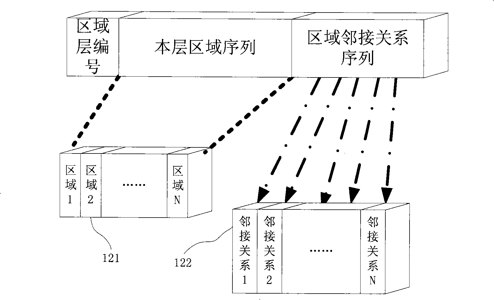
[0030] The implementation process of multi-scale remote sensing image segmentation and multi-scale segmentation region hierarchical structure representation described in the present invention is as follows: figure 1 as shown, figure 1 Includes 10 handling units. The working process of multi-scale image segmentation is as follows:

[0031] The processing unit 111 simplifies the image. After the image is denoised, the multi-scale morphological gradient operator can be used to simplify the image to form a gradient image.

[0032] Image noise reduction can be achieved by Gaussian smoothing filter. The gradient operator MG(f(x,y)) used to form the multi-scale morphology of the gradient image is defined as follows:

[0033]

[0034] In the formula: symbol Indicates the expansion operation;

[0035] The symbol Θ represents the erosion operation;

[0036] The symbol ○ represents an open operation.

[0037] Symbol ● means closed operation;

[0038] B: Structural elements. ...


PUM


Abstract

The invention provides a multi-scale image segmentation method for a remote sensing image, in particular for the remote sensing image with high spatial resolution, and constructs a relation among hierarchical structures of the segmentation results of different scales with consistent segmentation boundary. The method comprises the following steps: obtaining an initial segmentation result by a basic image segmentation method, scanning the segmented regions to establish an adjacency relation among segmented blocks, generating an initial bottom small-scale region structure, and subsequently adding features such as gray scale, texture, shape and the like on the basis to merge, adjust, and form a second-layer larger-scale segmented region structure and a third-layer large-scale segmented region structure. The course can be performed by iteration until the required-scale segmentation hierarchy and structure are formed. The generated hierarchical structures of the multi-scale segmentation regions can realize quick switching and access among the segmentation regions of different scales, and the structures are not only suitable for a watershed image segmentation algorithm, but also suitable for other segmentation methods to construct the hierarchical structures of the multi-scale segmented regions.

Description

technical field [0001] The invention relates to remote sensing image processing technology, in particular to a multi-scale segmentation method of remote sensing images and a data structure for multi-scale representation of segmentation results, the data structure is applicable to multiple segmentation methods. Background technique [0002] High-spatial-resolution images, especially high-spatial-resolution remote sensing images, provide a wealth of information about the geometric structure, texture details, and spectrum of surface objects, making it possible to observe changes in surface details and perform Large-scale remote sensing mapping and monitoring the impact of human activities on the environment become possible and have broad application prospects. [0003] Remote sensing image segmentation is the premise of ground object recognition. Therefore, using image segmentation technology to first segment remote sensing images into homogeneous regions and then use the spect...

Claims


Application Information

Patent Timeline
Patent Type & Authority Applications(China)
IPC IPC(8): G06K9/34G06T7/00
Inventor 冯峥何启翱戢中东唐娉张晓安
Owner REMOTE SENSING APPLIED INST CHINESE ACAD OF SCI
Learn More