Roadway mark data acquisition and analysis apparatus, systems, and methods
a technology of roadway marks and data acquisition, applied in the field of locating and inspection systems based on machine vision, can solve the problems of affecting the accuracy of roadway marks, so as to and minimize the amount of imaged roadway area data.
- Summary
- Abstract
- Description
- Claims
- Application Information
AI Technical Summary
Benefits of technology
Problems solved by technology
Method used
Image
Examples
Embodiment Construction
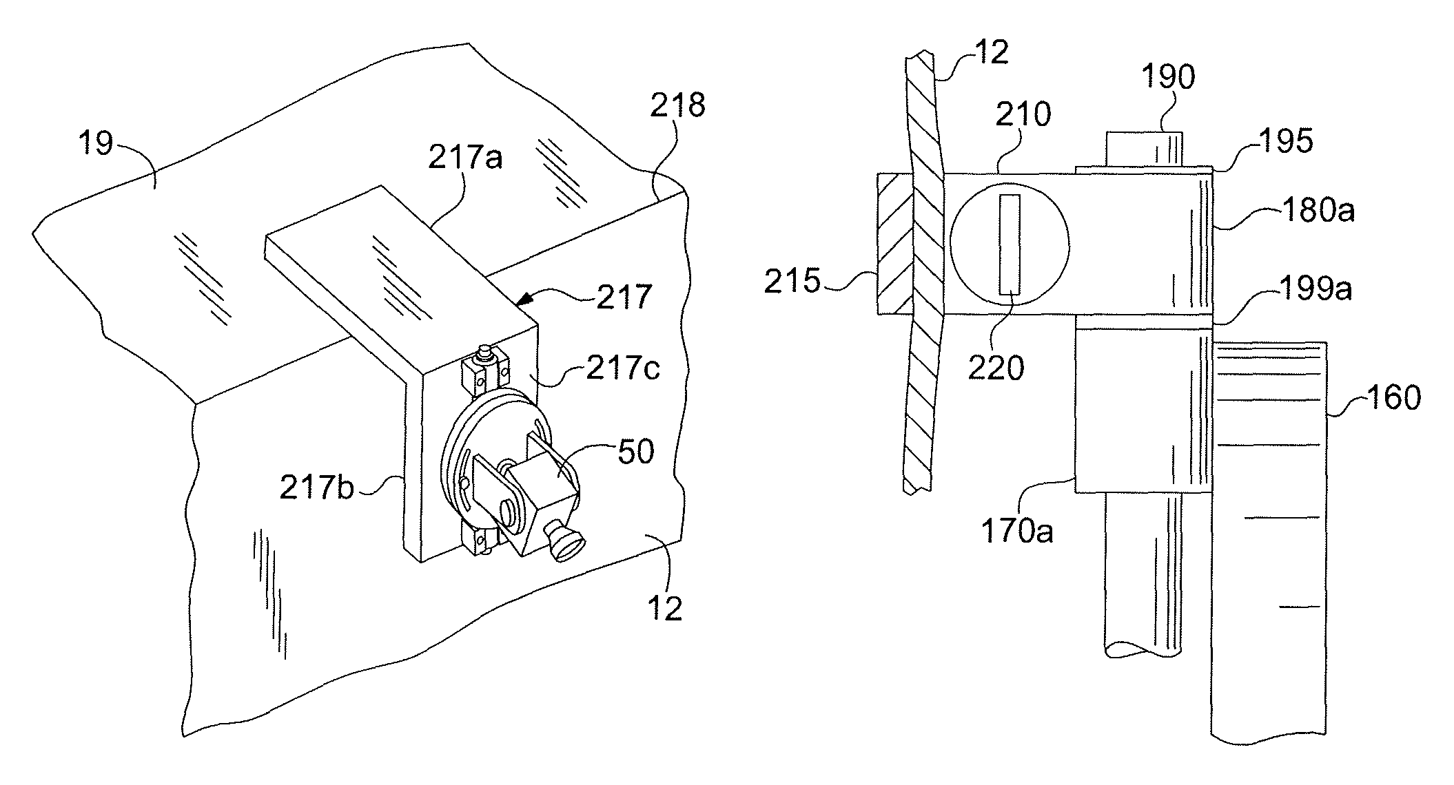
[0095]The present invention provides GPS-based systems used for painting or otherwise marking roadway traffic lane demarcation lines, vehicle mounted locating and inspection systems for determining the geographical location and condition of roadway marks, and apparatus, systems, and methods for acquiring and remotely analyzing roadway mark location and inspection data. Referring now to the drawing, in which like reference numbers refer to like elements throughout the various figures that comprise the drawing, FIG. 1 shows a moving or self-propelled vehicle 1 which is located on a road or roadway 2 near a line 3 applied to the surface of the road 2. Also shown is a roadway edge boundary line 4. The term “vehicle” used in this document is given its broadest meaning, including any conveyance, motorized device, or moving piece of mechanical equipment for transporting passengers or apparatus. More specific and preferred examples of vehicles 1 are cars, vans, trucks, snow plows, construct...
PUM
 Abstract
Description
Claims
Application Information
 - R&D
- Intellectual Property
- Life Sciences
- Materials
- Tech Scout
- Unparalleled Data Quality
- Higher Quality Content
- 60% Fewer Hallucinations
Browse by: Latest US Patents, China's latest patents, Technical Efficacy Thesaurus, Application Domain, Technology Topic, Popular Technical Reports.
© 2025 PatSnap. All rights reserved.Legal|Privacy policy|Modern Slavery Act Transparency Statement|Sitemap|About US| Contact US: help@patsnap.com


