Methods for atmospheric correction of solar-wavelength hyperspectral imagery over land
- Summary
- Abstract
- Description
- Claims
- Application Information
AI Technical Summary
Benefits of technology
Problems solved by technology
Method used
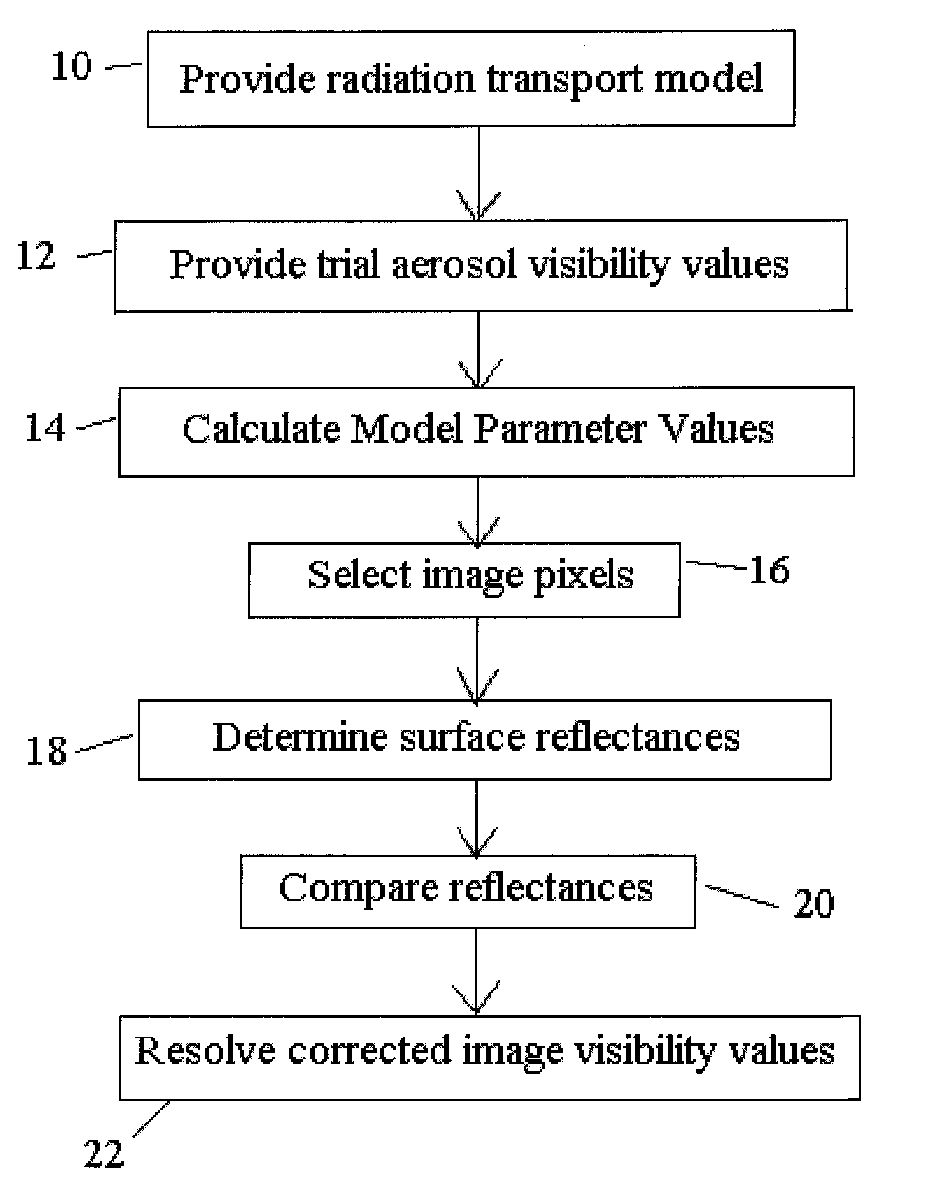
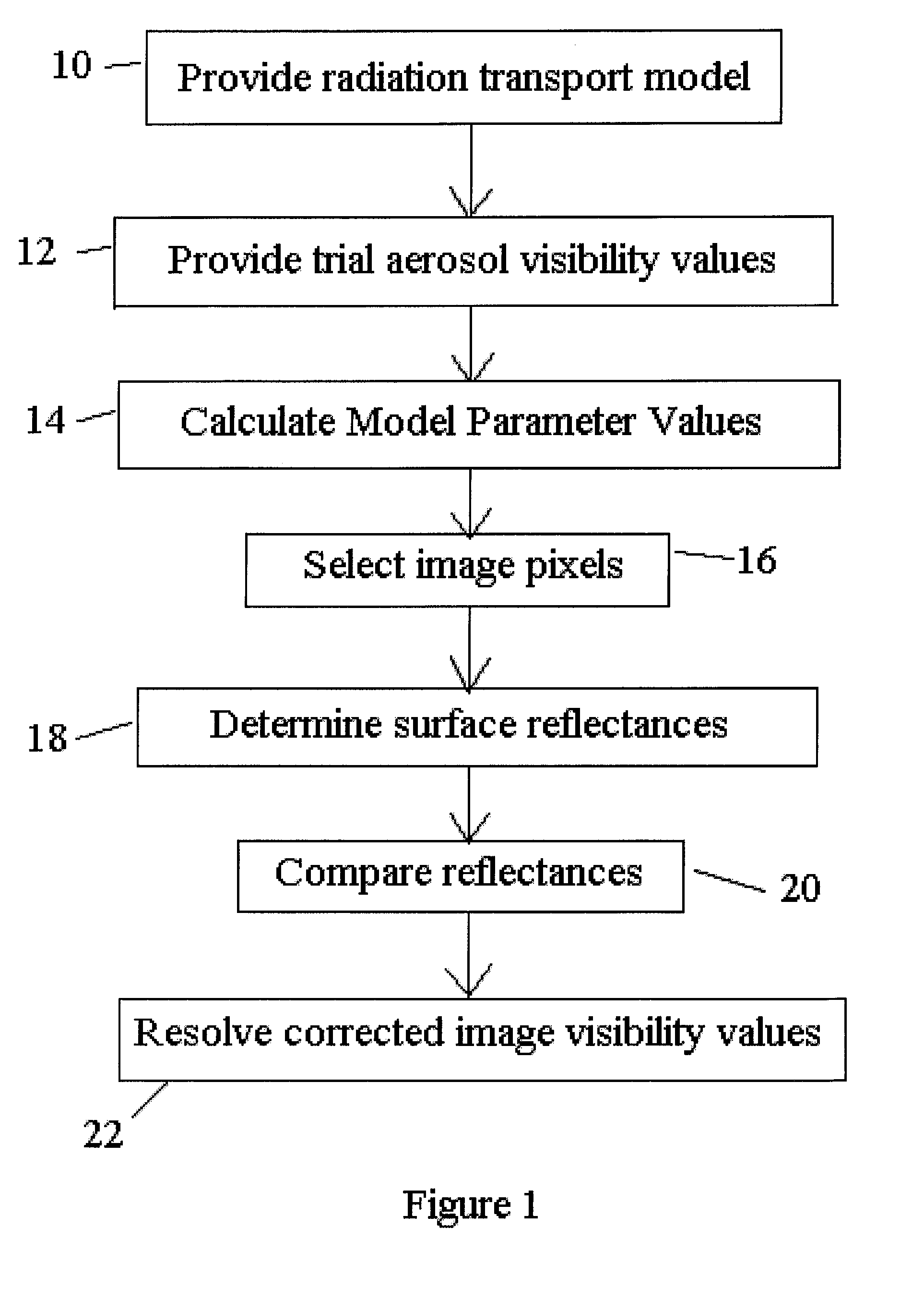
Image

Examples
Embodiment Construction
Aerosol Retrieval Method
[0027]The prior art method for aerosol / haze retrieval used in both the SSI / AFRL and ATCOR2 atmospheric correction codes involves (1) establishing a set of MODTRAN radiance calculations assuming a certain aerosol / haze type (e.g., rural, urban, etc.) and covering a range of visibility (the meteorological visible range in km at 550 nm); (2) identifying specific pixels in the image that are known to have a certain reflectance value in a given wavelength band selected by the analyst; (3) matching the in-band radiances for those pixels to the MODTRAN calculations and reporting a visibility value for each pixel, accounting for the “adjacency effect”. This method is not well suited to automated data processing, however, because of the need for user selection of the pixels. Even when user supervision is permitted, the image may not contain a target whose reflectance is accurately known a priori.
[0028]The features of the invention described below is a method for retrie...
PUM
 Abstract
Description
Claims
Application Information
 - R&D
- Intellectual Property
- Life Sciences
- Materials
- Tech Scout
- Unparalleled Data Quality
- Higher Quality Content
- 60% Fewer Hallucinations
Browse by: Latest US Patents, China's latest patents, Technical Efficacy Thesaurus, Application Domain, Technology Topic, Popular Technical Reports.
© 2025 PatSnap. All rights reserved.Legal|Privacy policy|Modern Slavery Act Transparency Statement|Sitemap|About US| Contact US: help@patsnap.com