
Stereo image processing apparatus and method of processing stereo image

a stereo image and processing apparatus technology, applied in image enhancement, scene recognition, instruments, etc., can solve the problems of complex operation, significant damage to buildings, and difficult application to complex images with a large number of buildings such as those of urban areas, and achieve accurate three-dimensional shapes

Inactive Publication Date: 2005-11-29
NEC CORP
View PDF12 Cites 46 Cited by
  • Summary
  • Abstract
  • Description
  • Claims
  • Application Information

AI Technical Summary

Benefits of technology

[0016]Hence, an object of the present invention is to solve the above described problems and provide a stereo image processing apparatus and stereo image processing method and a program for processing stereo images, by which sufficiently accurate three-dimensional data can be obtained from satellite stereo images and aerial stereo images with no intervention by operators and for complicated objects such as buildings in urban areas.
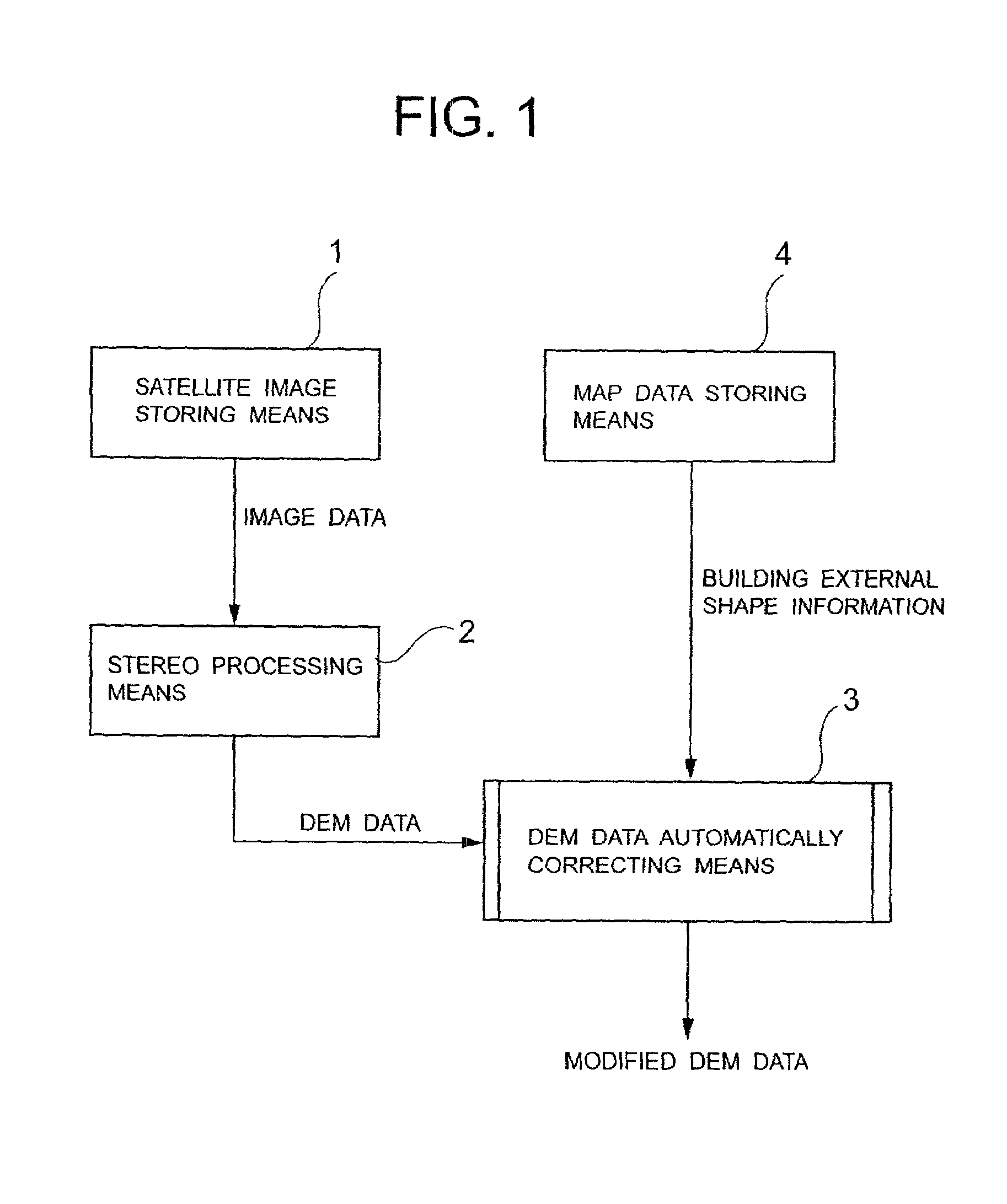
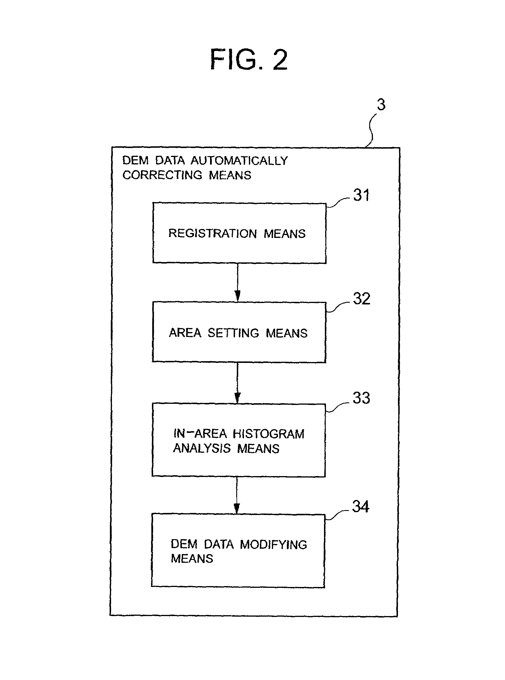
[0058]More specifically, the stereo image processing apparatus of the present invention extracts shape information of a building from images by image processing means or obtains the same from vector data included in existing map data, superimposes the shape information of the building on the three-dimensional data obtained by stereo matching processing, and replaces internal three-dimensional data values with several values of high frequency to modify the same for each building area. Thereby, three-dimensional data can be generated automatically without operator involvement, and sufficiently accurate three-dimensional shapes can be obtained even for complicated objects such as those in urban areas.

Problems solved by technology

Particularly, since hiding occurs around a building and so oil, the number of points for which correspondence cannot be obtained may become large, which may result in cases where extremely high values are shown, or the building is significantly damaged.
Thus, for methods of generating three-dimensional data by conventional stereo matching, errors due to mismatching of corresponding points are caused, and accurate three-dimensional information cannot be obtained, thus raising a disadvantage that application to complicated images with a large number of buildings such as those of urban areas is difficult.
Also, because a satellite image or aerial photograph has usually enormous amounts of image data, there is also a disadvantage that modification operations by operators are difficult and complicated.

Method used


Image

  • Stereo image processing apparatus and method of processing stereo image
  • Stereo image processing apparatus and method of processing stereo image
  • Stereo image processing apparatus and method of processing stereo image

Examples


first embodiment

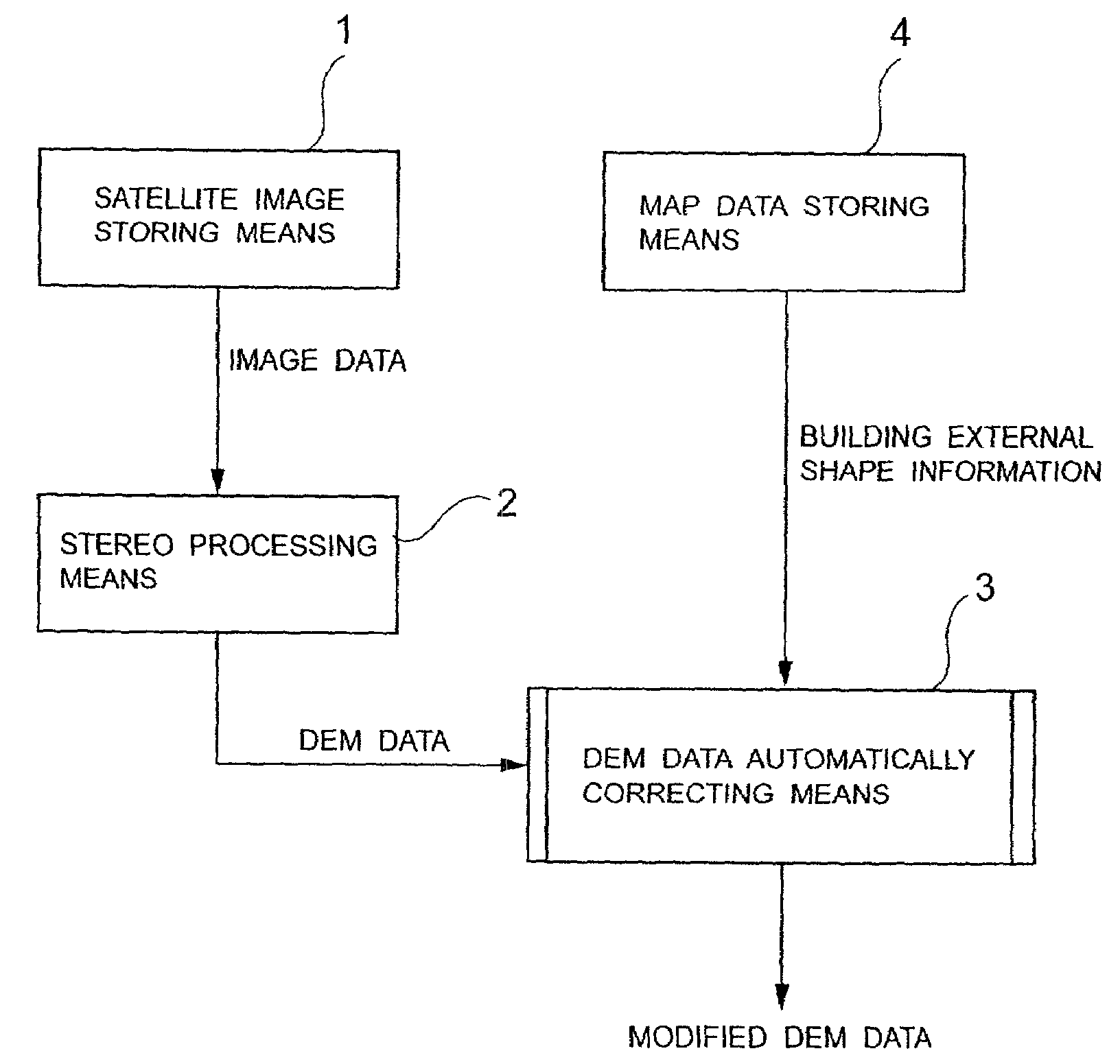
[0124]In the present invention, the satellite stereo images as described above, previously stored in the satellite image storing means 1, are given to the stereo processing means 2, and the stereo matching processing is automatically performed on the computer in the same fashion as a conventional method.

[0125]Here, the stereo matching processing is to determine corresponding points in images having the same point imaged therein, for two images obtained by photographing an object from different viewpoints, and use their parallax to determine the depth dimension and form up to the target according to the principle of triangulation technique. Various methodologies have already been proposed for this stereo matching processing, but in this embodiment, an area correlation method that is widely used is used in the same fashion as the method described in the above described Japanese Patent Publication No. 8-16930 specification.

[0126]In this area correlation method, the range in which the s...

second embodiment

[0179]In accordance with such modification conditions, the DEM data modifying means 34 uses representative values obtained for each area by the in-area histogram analysis means 33 to correct automatically the three-dimensional data in each area. The above process operations are process operations of the present invention.

[0180]FIG. 21 is a block diagram showing the configuration of the stereo image processing apparatus according to the third embodiment of the present invention. In FIG. 21, the stereo image processing apparatus according to the third embodiment of the present invention comprises satellite image storing means 1, stereo processing means 2, DEM data automatically correcting means 3 and building external shape information detecting means 6.

[0181]The satellite image storing means 1 stores satellite image data. The stereo processing means 2 subjects the satellite image data obtained from the satellite image storing means 1 to stereo matching processing to generate three-di...

third embodiment

[0218]The satellite stereo images stored in the satellite image storing means 1 are further analyzed by the building external shape information detecting means 6, and for the photographed building, vector information showing its external shape is extracted by a method similar to that of the present invention.

[0219]The obtained vector information is given to the building external shape information comparing / combining means 7 together with data showing the external shapes of buildings in the map stored in the map data storing means 4, and processing of combining the external shapes of buildings is performed.

[0220]If a time when the map data is created is different from a time when the satellite image is obtained, there are many cases where information does not match each other because map data corresponding to a new building does not exist, or a building that would have existed for the map data has already been demolishes at the time of taking a picture for the satellite image and thu...


PUM


Abstract

To provide a stereo image processing device enabling sufficiently accurate three-dimensional data to be obtained from satellite stereo images and aerial stereo images automatically with no involvement of operators and for complicated objects such as buildings in urban areas. A satellite image storing unit stores satellite image data. A stereo processing unit subjects satellite image data obtained from the satellite image storing unit to stereo matching processing to generate three-dimensional data. A DEM data automatic correcting unit uses information of external shape of buildings and the like obtained from map data in a map data storing unit to correct automatically erroneous data such as noises and losses in the three-dimensional data obtained with the stereo processing unit. The map data storing unit provides map data such as external shapes of buildings and the like to the DEM data automatically correcting unit.

Description

BACKGROUND OF THE INVENTION[0001]1. Field of the Invention[0002]The present invention relates to a stereo image processing apparatus and a stereo image processing method, and a recording medium in which a program for processing stereo image is recorded, and particularly relates to a method of automatically generating three-dimensional data from satellite stereo image or aerial stereo image.[0003]2. Description of the Prior Art[0004]Conventionally, in this type of method of automatically generating three-dimensional data, methods of generating three-dimensional data indicative of geographical features [DEM (Digital Elevation Map) Data] by stereo matching based on images obtained from an artificial satellite and aircraft are widely used, and methods in which operators are involved in correcting points for which correspondence cannot be obtained have also been proposed.[0005]Here, the stereo matching processing is to determine corresponding points in images having the same point imaged...

Claims


Application Information

Patent Timeline
IPC IPC(8): G01B11/24G09B29/00G01C11/00G06T1/00G06T5/00G06T7/00G06T17/05G06V20/13H04N13/00
CPCG06K9/0063G06T7/0075G06T17/05G06T2207/10012H04N13/0003H04N13/0055H04N2013/0081G06T7/593H04N13/189H04N13/10G06V20/13
Inventor FURUKAWA, HISAO
Owner NEC CORP
Learn More