
Method for Labeling Images of Street Scenes

a street scene and image technology, applied in the field of image processing, can solve the problems of not respecting the layered constraint that is preserved, and the general time taken for an approach to be completed is long

Active Publication Date: 2016-08-25
MITSUBISHI ELECTRIC RES LAB INC
View PDF1 Cites 63 Cited by
  • Summary
  • Abstract
  • Description
  • Claims
  • Application Information

AI Technical Summary

Benefits of technology

The invention provides a four-layered model for a street scene and a method for labeling semantic classes for components, such as ground, moving objects, buildings, and the sky. The method uses a neural network to extract features from stereo images and obtains the layered model using an inference procedure. The technical effect is the development of an effective and efficient method for labeling and analyzing street scenes using a combination of neural networks and deep learning techniques.

Problems solved by technology

Such approaches generally take a long time and may not respect the layered constraint that is preserved for street scenes.

Method used


Image

  • Method for Labeling Images of Street Scenes
  • Method for Labeling Images of Street Scenes
  • Method for Labeling Images of Street Scenes

Examples


Embodiment Construction

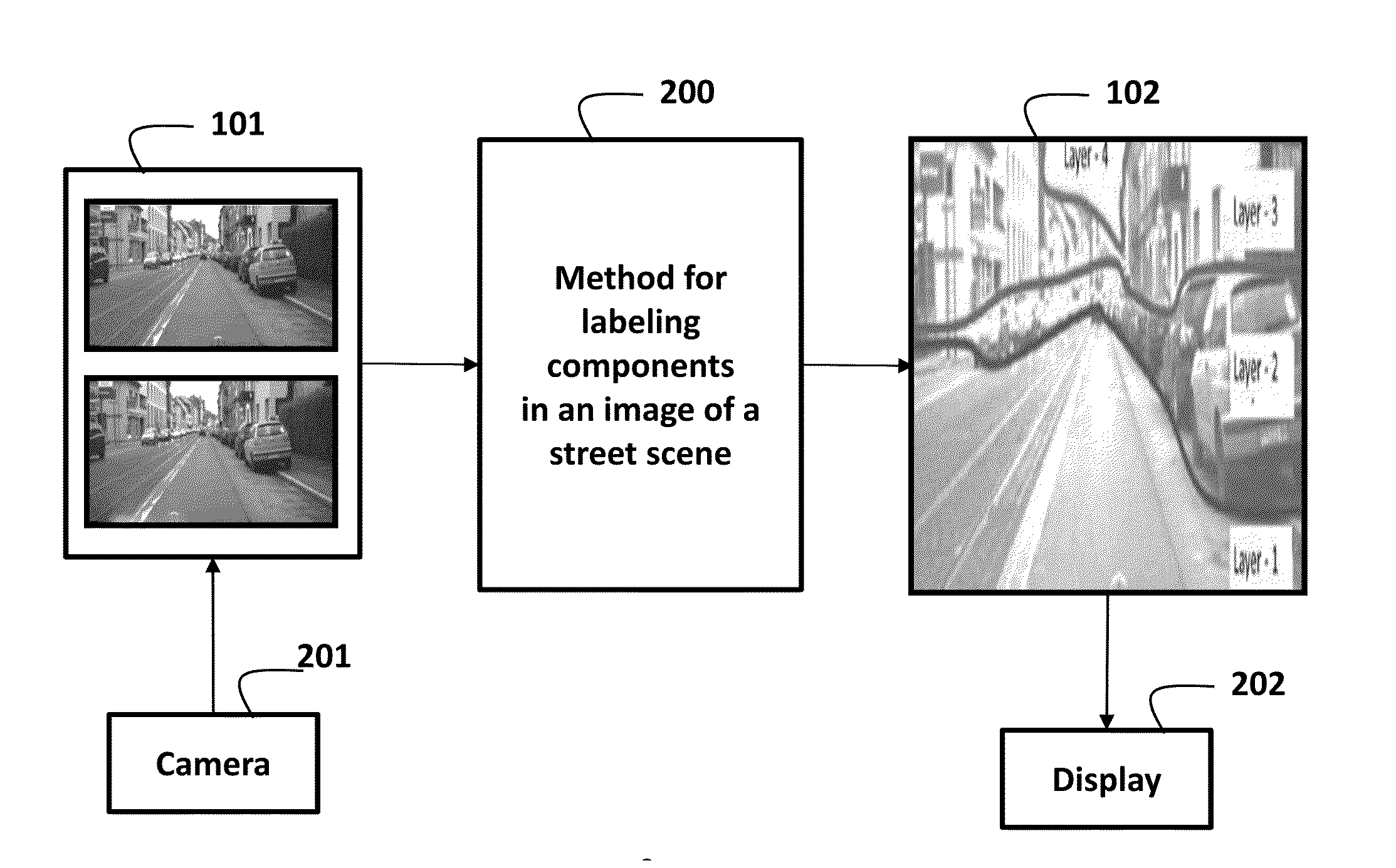
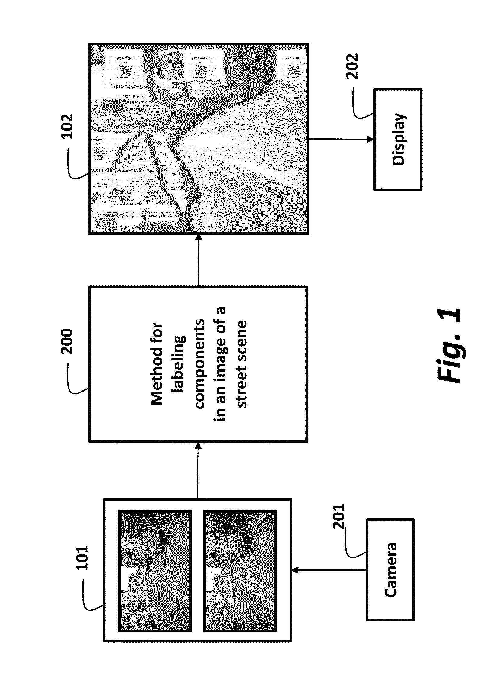
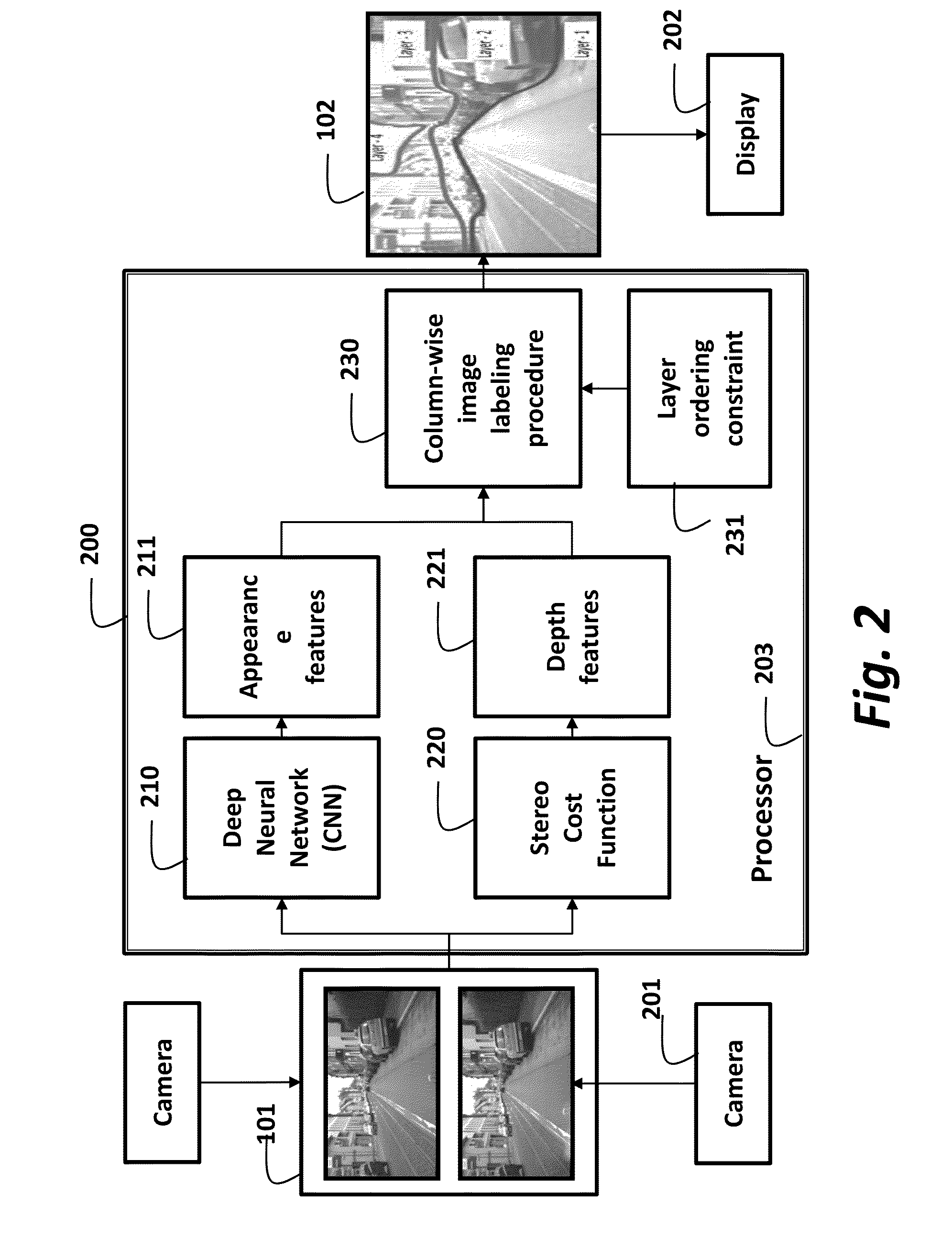
[0014]As shown in FIGS. 1 and 2, the embodiments of our invention provide a four-layered model for a street scene and a method 200 for labeling components in a pair of stereo images 101, such as ground, e.g., a road, objects such as pedestrians and vehicles, buildings, and the sky. The images can be acquired by a camera 201. A labeled image 102 can be output on a display 202. The steps of the method can be performed in a processor 203 connected to memory, input / output interfaces by buses as known in the art. In one embodiment, the display and the processor can be arranged in a vehicle. This way, a driver of the vehicle can be apprised of an enhanced image of the scene.

[0015]A deep neural network, e.g., a convolutional neural network (CNN) 210, is used to extract image features 211 for the semantic classes from the stereo images 101. A stereo cost function 220 is used to extract depth features 221. The image and depth features are processed by a column-wise image labeling procedure 2...


PUM


Abstract

A method labels an image of a street view by first extracting, for each pixel, an appearance feature for inferring a semantic label, a depth feature for inferring a depth label. Then, a column-wise labeling procedure is applied to the features to jointly determine the semantic label and the depth label for each pixel using the appearance feature and the depth feature, wherein the column-wise labeling procedure is according to a model of the street view, and wherein each column of pixels in the images includes at most four layers.

Description

FIELD OF THE INVENTION[0001]This invention relates generally to image processing, and more particularly to labeling images of street scene based on semantic and depth features in the images.BACKGROUND OF THE INVENTION[0002]Online street view applications are often combined with online mapping applications. For example, a user selects a specific geographical point of interest from a map or a satellite image, and then switches to a panoramic street view. The street view enables the user to navigate to the point of interest as it would be seen, for example, by a driver of a vehicle. Street view can also be used for in many other computer vision, augmented reality, smart car and safety applications.[0003]A typical street scene includes components, such as roads in a ground plane, objects such as pedestrians, bicyclists, other vehicles, buildings and sky. Understanding and labeling images of such a scene require understanding the components and their relative spatial locations. Most conv...

Claims


Application Information

Patent Timeline
Patent Type & Authority Applications(United States)
IPC IPC(8): G06T7/00G06K9/46
CPCG06T7/0081G06T2207/10021G06K9/4604G06V20/56G06V40/53
Inventor LIU, MING-YURAMALINGAM, SRIKUMARTUZEL, ONCEL
Owner MITSUBISHI ELECTRIC RES LAB INC
Learn More