Water surface generation

a technology of water surface and water bottom, applied in instruments, cathode-ray tube indicators, computing, etc., can solve the problems of approximation and especially simple mesh simplification, and have significant failings, and achieve the effect of simplifying the initial water surface mesh and/or initial water bottom mesh

Inactive Publication Date: 2014-01-30
GOOGLE LLC
View PDF3 Cites 5 Cited by
  • Summary
  • Abstract
  • Description
  • Claims
  • Application Information

AI Technical Summary

Benefits of technology

[0010]In another embodiment, a computer-implemented method for approximating terrain data representing a water surface for transmission over a network to a client device for display is provided. The method includes steps of storing terrain data in memory, converting the terrain data into an initial water surface mesh and an initial water bottom mesh, and simplifying the initial water surface mesh and / or initial water bottom mesh. The method further includes correcting the simplified water surface mesh and / or simplified water bottom mesh to avoid having a water bottom surface incorrectly appear above a corresponding water surface relative to a viewpoint during rendering for display.
[0011]In a further embodiment, a system for altering tile information received at a client device for display is provided. The client device includes a mesh manipulator. The mesh manipulator manipulates mesh information in a tile to displace boundary vertices towards an exterior of the tile based on the respective tile resolution level and to adjust one or more selected vertices to avoid surface inversions between water bottom and water surface meshes associated with the tile.
[0012]In another embodiment, a method for altering tile information received at a client device for display is provided which includes manipulating mesh information in a tile, and displaying a rendered display view of the tile based on the manipulated mesh information. The manipulating includes displacing boundary vertices towards an exterior of the tile based on the respective tile resolution level and adjusting one or more selected vertices to avoid surface inversions between water bottom and water surface meshes associated with the tile.

Problems solved by technology

As recognized by the inventors, however, such approximations and especially simple mesh simplification, have significant failings especially when rendering a water surface on a curved body or near land boundaries or shallow areas, such as, a shoreline.

Method used


Image

  • Water surface generation
  • Water surface generation
  • Water surface generation

Examples


Embodiment Construction

[0027]While the present invention is described herein with reference to illustrative embodiments for particular applications, it should be understood that the invention is not limited thereto. Those skilled in the art with access to the teachings provided herein will recognize additional modifications, applications, and embodiments within the scope thereof and additional fields in which the invention would be of significant utility.

Overview

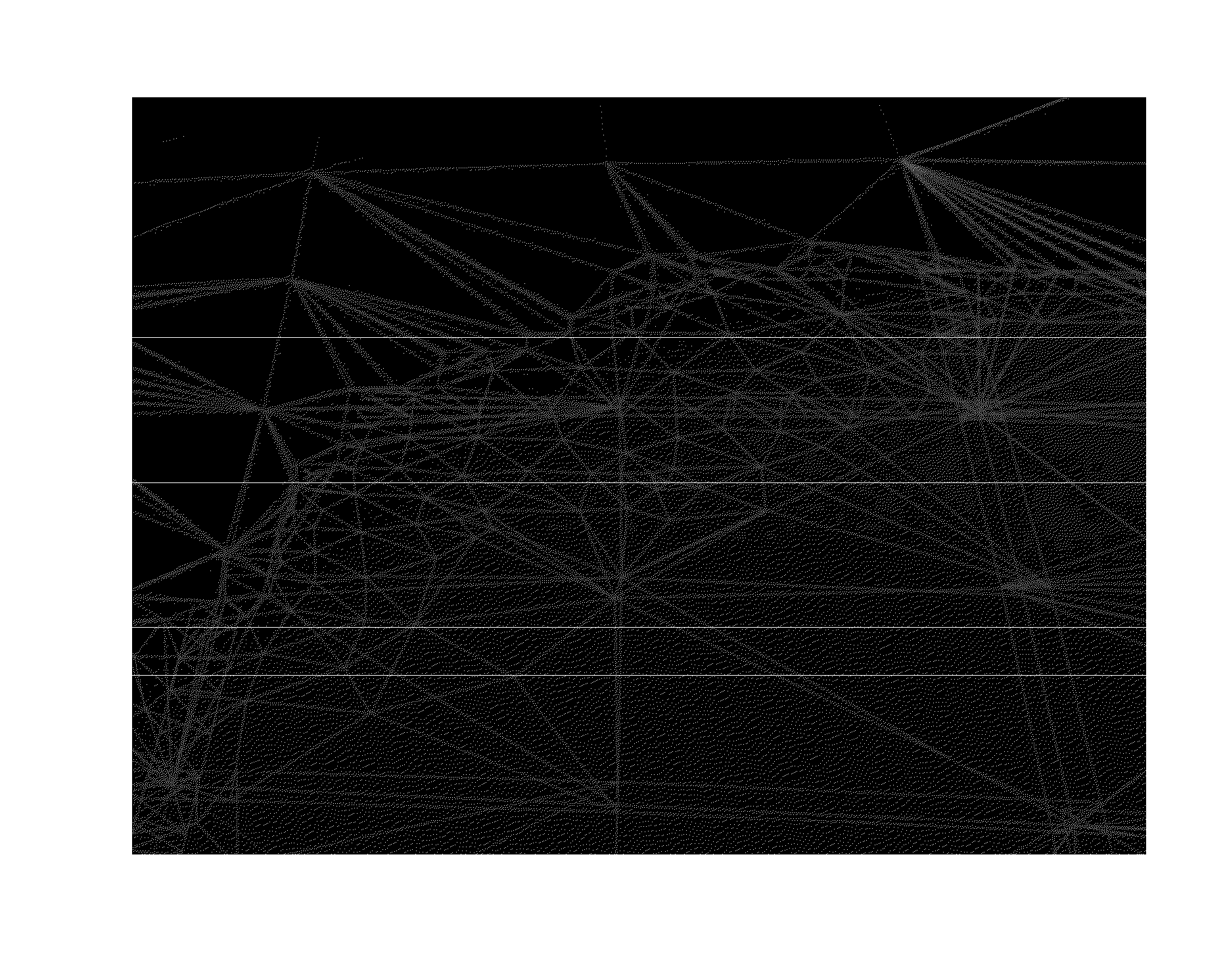
[0028]The inventors recognized that conventional approximations and especially simple mesh simplification have significant failings when applied to a mesh covering an intrinisically curved surface such as the Earth or other body. These failings are even more pronounced when two meshes near one another, such as, a water surface mesh and a water bottom mesh, need to be simplified. For instance, the inventors found that because of these approximations and the curvature of the Earth, undesirable surface inversions can occur where a water bottom surfac...


PUM


Abstract

Systems and methods for approximating terrain data representing a water surface are disclosed. A computer-based geographical information system for approximating terrain data representing a water surface is provided. The system includes a mesh simplifier and a surface inversion corrector. The mesh simplifier simplifies initial water surface and water bottom meshes. The surface inversion corrector corrects simplified water surface and / or water bottom meshes to avoid having a water bottom surface incorrectly appear above a corresponding water surface in a display view. In one example, the mesh simplifier simplifies the initial water surface mesh while accounting for water / land boundaries. The mesh simplifier also simplifies the initial water bottom mesh while accounting for geographic features and / or water / land boundaries. A computer-implemented method for approximating terrain data representing a water surface is provided. In further embodiments, systems and methods for altering tile information received at a client device are provided.

Description

RELATED APPLICATIONS [0001]This application is a division of and claims priority to U.S. patent application Ser. No. 12 / 588,812 filed on Oct. 28, 2009, and titled “Water Surface Generation,” the entire disclosure of which is hereby expressly incorporated by reference herein.FIELD OF THE INVENTION [0002]Embodiments of the present invention relate to geographical information systems and applications.BACKGROUND ART [0003]Geographical information is increasingly being made available to users in a variety of systems and applications. Geographical information can include terrain data representative of surface features including land and water surfaces. In many applications, terrain data can cover a large surface area such as a surface of the Earth. Different resolutions of the terrain data are used to facilitate rendering and viewing of the terrain data from different viewing distances relative to the terrain. Multi-resolutional terrain information can also be provided in tiles. Such tile...

Claims


Application Information

Patent Timeline
Patent Type & Authority Applications(United States)
IPC IPC(8): G06T1/00
CPCG06T1/00G06T17/05G06T17/205G06T2210/21
Inventor PRAUN, EMIL CONSTANTINROHLF, JOHNROMASZEWICZ, MARCIN
Owner GOOGLE LLC
Why Eureka
Try Eureka