Method for marine electrical survey of oil-and-gas deposits
a technology of marine electrical survey and oil and gas deposits, applied in the field of marine geoelectrical survey, can solve the problems of significant decrease in low spatial resolution, technological difficulties, etc., and achieve the effect of increasing the accuracy of prognosis
- Summary
- Abstract
- Description
- Claims
- Application Information
AI Technical Summary
Benefits of technology
Problems solved by technology
Method used
Image
Examples
Embodiment Construction
[0027]While the invention may be susceptible to embodiment in different forms, there are shown in the drawing, and will be described in detail herein, specific embodiments of the present invention, with the understanding that the present disclosure is to be considered an exemplification of the principles of the invention, and is not intended to limit the invention to that as illustrated and described herein.
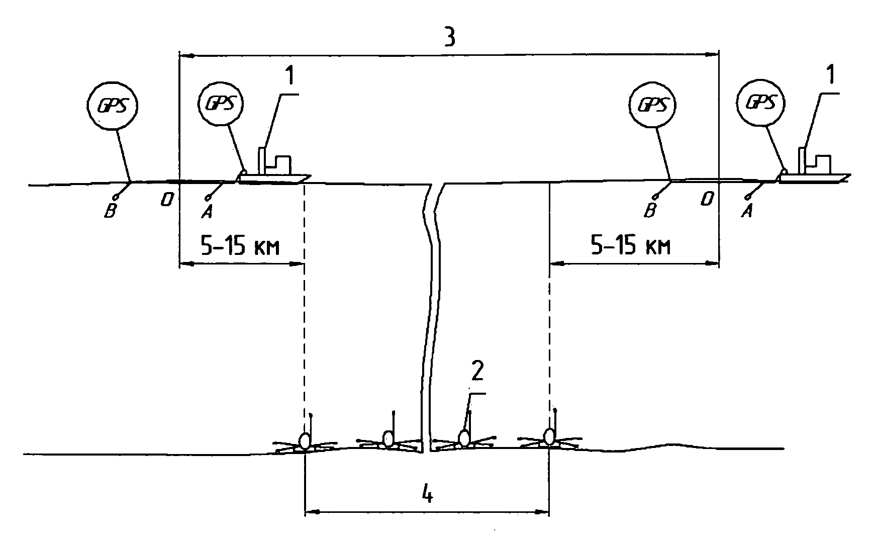
[0028]The general scheme of positional relationship of the vessel and the sea-bottom stations is shown at the FIG. 1, wherein (1) denotes a vessel with a towed generator line, (2) denotes a plurality of sea-bottom stations, (3) denotes a researched profile, (4) denotes a line of disposition of the sea-bottom stations, (A) denotes a first end (electrode) of the generator line, and (B) denotes a second end (electrode) of the generator line.
[0029]The flow chart of exemplary data processing and joint data inversion is shown on FIG. 2. The three upper boxes represent the synchronizati...
PUM
 Abstract
Description
Claims
Application Information
 - R&D
- Intellectual Property
- Life Sciences
- Materials
- Tech Scout
- Unparalleled Data Quality
- Higher Quality Content
- 60% Fewer Hallucinations
Browse by: Latest US Patents, China's latest patents, Technical Efficacy Thesaurus, Application Domain, Technology Topic, Popular Technical Reports.
© 2025 PatSnap. All rights reserved.Legal|Privacy policy|Modern Slavery Act Transparency Statement|Sitemap|About US| Contact US: help@patsnap.com


