
Method and system for three-dimensional feature attribution through synergy of rational polynomial coefficients and projective geometry

a technology of rational polynomial coefficients and projective geometry, applied in the field of cartography, can solve the problems of laborious and costly process for extracting height information from stereo photographs, laborious and costly, and generation of relatively high quality stereo photographs and stereo digital images, and achieve the effect of low cos

Inactive Publication Date: 2008-12-18
OPEN INVENTION NEWTORK LLC
View PDF6 Cites 4 Cited by
  • Summary
  • Abstract
  • Description
  • Claims
  • Application Information

AI Technical Summary

Problems solved by technology

The extraction of height information from stereo photographs is typically a labor intensive and costly process.
Not only is the extraction of height information from stereo photographs and stereo digital images relatively tedious, labor intensive, and costly, the generation of relatively high quality stereo photographs and stereo digital images is also relatively costly.
For example, the generation of a set of stereo digital images often requires exclusive control of a satellite for a relatively lengthy period of time.

Method used


Image

  • Method and system for three-dimensional feature attribution through synergy of rational polynomial coefficients and projective geometry
  • Method and system for three-dimensional feature attribution through synergy of rational polynomial coefficients and projective geometry
  • Method and system for three-dimensional feature attribution through synergy of rational polynomial coefficients and projective geometry

Examples


Embodiment Construction

[0021]The present invention provides computerized techniques for extracting height information for an arbitrary-image point on an image mapped to a coordinate system and for generating a representation of the image that includes the height information. Specifically, computerized techniques are provided for extracting height information for arbitrary-image points on a map given a pair of aerial images having respective sets of rational polynomial coefficients and generating a representation of the map, such as a contour map or topographic image map that includes the extracted height information.

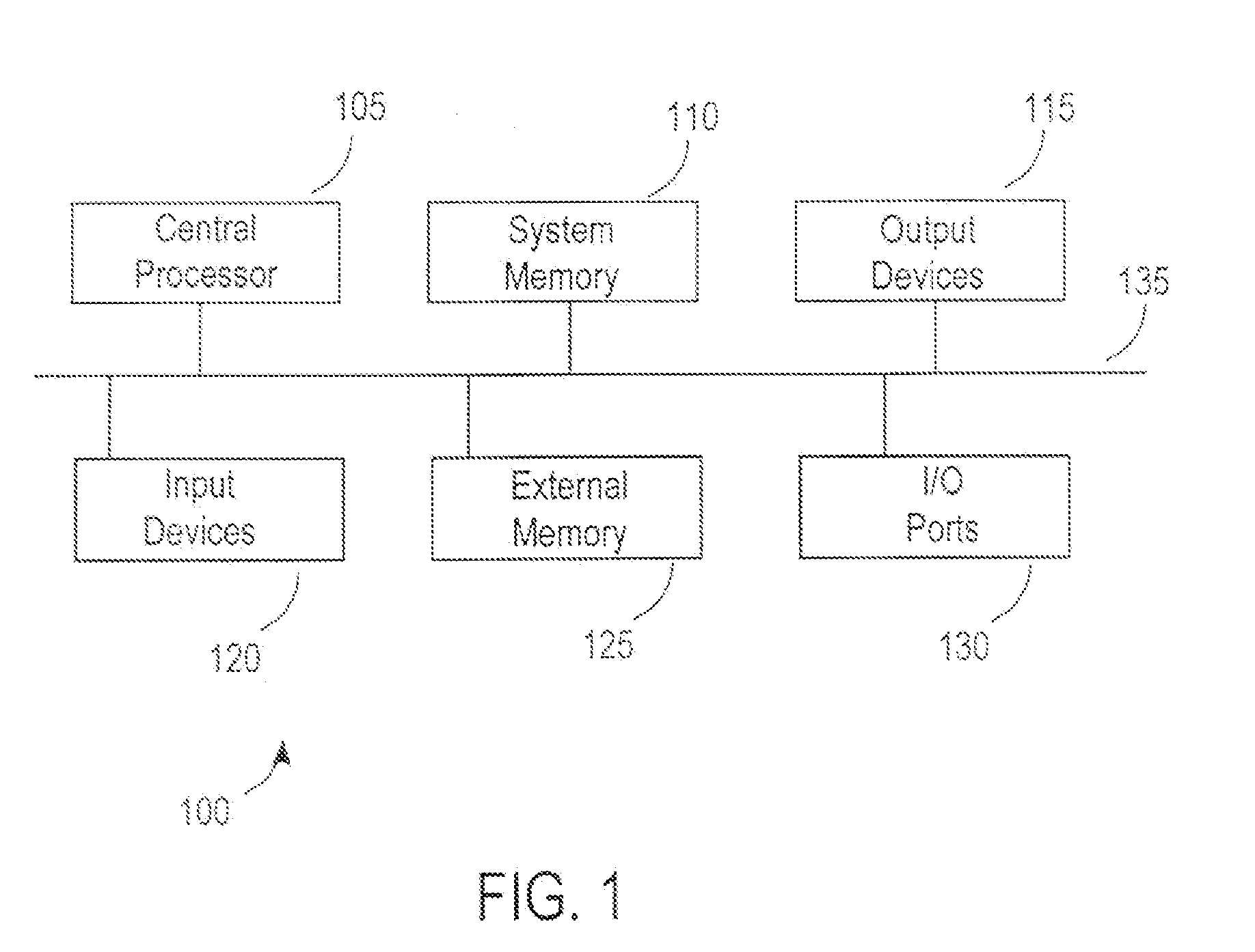
[0022]Embodiments of the present invention are best understood by first discussing mathematical constructs implemented in various embodiments, and then discussing various embodiments implementing the mathematical constructs FIG. 1 is a block diagram of a computer system 100 in which embodiments of the present invention may be implemented. According to one embodiment, computer system 100 includ...


PUM


Abstract

A method is provided for generating height information for an image point on a rectified image from first and second aerial images having respective first and second sets of rational polynomial coefficients (RPCs), the first and second aerial images and the rectified image including overlapping image locations. The method comprises steps for generating epipolar lines and RPC lines and intersection points of epipolar lines and RPC lines. The method also comprises steps for equating line and sample coordinates to cubic polynomial equations and simultaneously solving the cubic polynomial equations to generate a height of the image point.

Description

RELATED APPLICATION AND PRIORITY CLAIM[0001]This application is a continuation of, and claims priority to, application Ser. No. 10 / 689,777, filed Oct. 20, 2003, now U.S. Letters patent Ser. No. ______, which is incorporated by reference as if fully rewritten herein.COPYRIGHT NOTICE[0002]A portion of the disclosure of this patent document contains material which is subject to copyright protection. The copyright owner has no objection to the facsimile reproduction by anyone of the patent document or the patent disclosure as it appears in the Patent and Trademark Office patent file or records, but otherwise reserves all copyright rights whatsoever.BACKGROUND OF THE INVENTION[0003]The present invention relates generally to cartography. In particular, the present invention relates to computerized techniques for extracting height information for an arbitrary-image point on an image that is mapped to a coordinate system and to generating a representation of the image that includes the heig...

Claims


Application Information

Patent Timeline
Patent Type & Authority Applications(United States)
IPC IPC(8): G06K9/00G06V20/13G06V10/10
CPCG06K9/0063G06K9/20G06K2209/40G06V20/13G06V10/10G06V2201/12
Inventor PAYTON, PAUL M.
Owner OPEN INVENTION NEWTORK LLC
Learn More