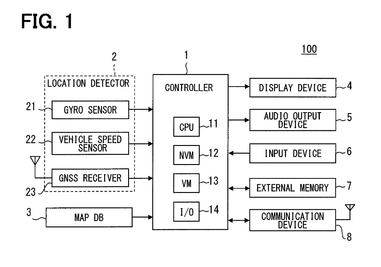
Navigation apparatus displaying information related to target intersection
a navigation apparatus and information technology, applied in navigation instruments, maps/plans/charts, instruments, etc., can solve the problem of reducing the possibility of a driver erroneously recognizing an irrelevant intersection
- Summary
- Abstract
- Description
- Claims
- Application Information
AI Technical Summary
Benefits of technology
Problems solved by technology
Method used
Image

Examples
first modification
[0151](First Modification)
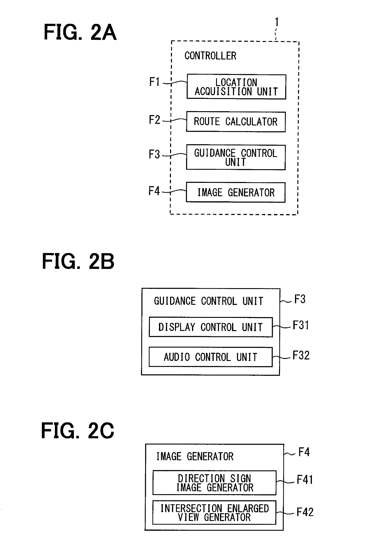
[0152]The above-described embodiment is configured so that the direction sign image generator F41 generates the direction sign image. The present disclosure is not limited to such a configuration. As a first modification, the direction sign image may be preliminarily stored in the map DB 3 as the map data instead of generating the direction sign image. In this configuration, the guidance control unit F3 accesses the map DB 3, reads out the direction sign image to be displayed, and displays the readout direction sign image. Image data about a direction sign may be stored in association, for instance, with a location where the direction sign is actually installed on a link. For example, the link data may be prepared as the direction sign data.
[0153]In addition, the intersection enlarged view may also be prepared as the map data in the map DB 3. Further, pre-generated intersection enlarged views and direction sign images may be stored in the external memory 7 ...
second modification
[0154](Second Modification)
[0155]The above-described embodiment is configured so that the display of a direction sign image terminates when, for instance, the intersection guidance image is changed to an intersection enlarged view or the vehicle has passed an intersection indicated by an associated direction sign. The present disclosure is not limited to such a configuration. For example, the display of the direction sign image may terminate before the intersection enlarged view is displayed or before the vehicle pass an intersection indicated by the direction sign image.
[0156]A second modification is achieved by using an alternative configuration that retains the direction sign image as a displayable image when the host vehicle exists between a direction sign image display point and a direction sign installation location. Further, the intersection enlarged view is retained as a displayable image from when the vehicle reaches a point apart from the target intersection by the enlarge...
third modification
[0182](Third Modification)
[0183]In the above-described embodiment and the second modification, the point where the display of the direction sign image starts is determined based on a location (namely, coordinates) where a direction sign is actually installed on a link. The method of determining the point where the display of the direction sign image starts is not limited to the above. A third modification is achieved by using an alternative configuration that determines the point where the display of the direction sign image starts based on an intersection related to the direction sign image. For example, the rule R11 and the rule R21, which are described in conjunction with the above-described embodiment, may be changed to a rule R11a and a rule R21a as indicated below.
[0184]Rule R11a (rule R21a): The direction sign image is displayed when the distance between the host vehicle and an intersection related to the direction sign image is within the sign display distance Df2 from the i...
PUM
 Abstract
Description
Claims
Application Information
 - R&D
- Intellectual Property
- Life Sciences
- Materials
- Tech Scout
- Unparalleled Data Quality
- Higher Quality Content
- 60% Fewer Hallucinations
Browse by: Latest US Patents, China's latest patents, Technical Efficacy Thesaurus, Application Domain, Technology Topic, Popular Technical Reports.
© 2025 PatSnap. All rights reserved.Legal|Privacy policy|Modern Slavery Act Transparency Statement|Sitemap|About US| Contact US: help@patsnap.com