Long-distance laser radar point cloud data processing method
A technology of lidar and point cloud data, applied in image data processing, image analysis, image enhancement, etc., can solve problems such as unsatisfactory real-time performance and complex algorithms, and achieve improved recovery accuracy, low information loss, and preservation of environmental features Effect
- Summary
- Abstract
- Description
- Claims
- Application Information
AI Technical Summary
Problems solved by technology
Method used
Image
Examples
Embodiment Construction
[0047] The preferred embodiments of the present invention are described in detail below in conjunction with the accompanying drawings, so that the advantages and features of the present invention can be more easily understood by those skilled in the art, and the protection scope of the present invention can be more clearly defined.
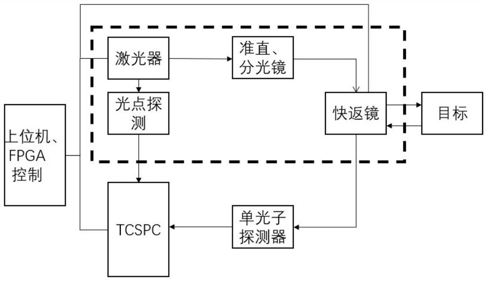
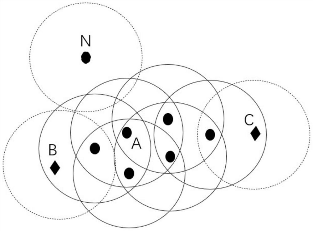
[0048] like Figure 1-5 As shown, a method for processing long-distance laser radar point cloud data implemented by the present invention, the specific process includes:
[0049] Step 1: Use the long-distance lidar point cloud acquisition system to scan the target environment where the data is to be collected, collect the flight time of each pixel point, and export and extract the collected data. The collected point cloud is the three-dimensional data composed of the target pixel coordinates and the time of flight of the returned photons of the pixel target.
[0050] figure 2 This is a schematic diagram of the principle of a long-distance laser...
PUM
 Abstract
Description
Claims
Application Information
 - R&D
- Intellectual Property
- Life Sciences
- Materials
- Tech Scout
- Unparalleled Data Quality
- Higher Quality Content
- 60% Fewer Hallucinations
Browse by: Latest US Patents, China's latest patents, Technical Efficacy Thesaurus, Application Domain, Technology Topic, Popular Technical Reports.
© 2025 PatSnap. All rights reserved.Legal|Privacy policy|Modern Slavery Act Transparency Statement|Sitemap|About US| Contact US: help@patsnap.com


