Soil physical property and remote sensing data fused surface soil water content inversion method

A soil water content and surface soil technology, which is applied in the field of surface soil water content inversion integrating soil physical properties and remote sensing data, can solve the problems of low inversion accuracy and difficulty in obtaining soil volumetric water content, and improve inversion accuracy. Effect

Pending Publication Date: 2022-05-10
GUILIN UNIVERSITY OF TECHNOLOGY
View PDF0 Cites 0 Cited by
  • Summary
  • Abstract
  • Description
  • Claims
  • Application Information

AI Technical Summary

Problems solved by technology

Therefore, in view of the problems that the surface soil moisture remote sensing inversion method fails to consider the difference in water holding capacity of different soils, it is difficult to obtain soil volumetric water content, and the inversion accuracy is low, there is an urgent need for an integrated soil physical property model that takes soil physical properties into account. Surface Soil Moisture Retrieval Method Based on Properties and Remote Sensing Data

Method used


Image

  • Soil physical property and remote sensing data fused surface soil water content inversion method
  • Soil physical property and remote sensing data fused surface soil water content inversion method
  • Soil physical property and remote sensing data fused surface soil water content inversion method

Examples


Embodiment 1

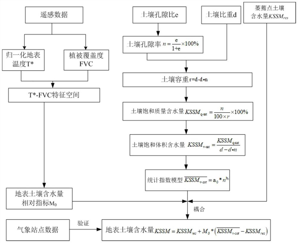
[0050] A surface soil water content inversion method that integrates soil physical properties and remote sensing data, comprising the following steps:

[0051] Step 1: determine the input data required by the method, and construct an input data set;

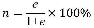
[0052] Said step 1 includes: constructing the input data set of surface soil water content inversion method, specifically including meteorological station data (such as surface temperature, surface soil water content), geotechnical data (such as soil sampling depth, soil void ratio, soil bulk density, soil type, soil saturation, soil saturated volumetric water content and surface soil volumetric water content at vegetation wilting points) and remote sensing data (such as MODIS NDVI data, surface temperature, TRMM rainfall data).

[0053] It should be noted that the geotechnical data come from field collection and calculation of geotechnical test points. According to the number of soil types and the complexity of distribution in t...


PUM


Abstract

The invention discloses a surface soil water content inversion method fusing soil physical characteristics and remote sensing data. The method comprises the following steps: constructing an input data set; selecting a vegetation coverage index FVC and a surface temperature T * to construct a T *-FVC feature space; calculating a surface soil water content relative index M0 according to the feature space; according to soil test point data, a statistical model of soil saturated volumetric water content and soil porosity is established, and the saturated volumetric water content of each pixel of different types of soil is calculated according to the model. And finally, coupling the soil water content relative index M0 with the soil saturation volumetric water content and the wilting point surface soil volumetric water content, and constructing a surface soil volumetric water content quantitative inversion model. According to the model, soil physical characteristics and remote sensing data are fused for surface soil volumetric water content inversion, the problem that high-precision calculation of the volumetric water content is difficult due to the fact that a traditional remote sensing method ignores the difference of different types of soil water holding capacities is solved, and high-precision inversion of the surface soil volumetric water content is achieved.

Description

technical field [0001] The invention belongs to the technical field of soil water content inversion, and in particular relates to a surface soil water content inversion method which integrates soil physical properties and remote sensing data. Background technique [0002] Soil moisture is a key parameter of the earth-atmosphere energy exchange in the terrestrial system, and it has been identified as one of the basic terrestrial climate variables by the Global Climate Observing System. Accurately determining the amount, distribution and dynamic changes of surface soil moisture is becoming more and more important in the research of hydrology, ecology, agriculture, geological disaster monitoring and global climate change. At present, the thermal inertia method and temperature-vegetation index method based on remote sensing data, as well as some improved methods developed on this basis, have been widely used in surface soil moisture retrieval. The calculation models of these me...

Claims


Application Information

Patent Timeline
IPC IPC(8): G06F17/11G06F17/18
CPCG06F17/11G06F17/18Y02A90/10
Inventor 卢献健晏红波韦晚秋梁月吉甘磊黎振宝
Owner GUILIN UNIVERSITY OF TECHNOLOGY
Why Eureka
Try Eureka