A method for removing thick clouds from optical remote sensing images based on constructing virtual images
A virtual image and optical remote sensing technology, which is applied in image enhancement, image memory management, image data processing, etc., can solve the problems that optical remote sensing images cannot obtain surface information, etc., and achieve the effect of improving application capabilities and overcoming accuracy differences
- Summary
- Abstract
- Description
- Claims
- Application Information
AI Technical Summary
Problems solved by technology
Method used
Image
Examples
Embodiment 1
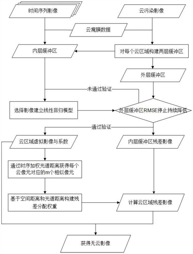
[0060] see figure 1 The present invention proposes a method for removing thick clouds from optical remote sensing images based on constructing virtual images. The specific method steps are as follows:
[0061] S1. Obtain the time-series Landsat surface reflectance product images of the target study area for data preparation;
[0062] S2. Mask the time series Landsat remote sensing image through the quality detection band in the data. When the quality detection band data identifies the pixel as a cloud or cloud shadow, the pixel value is set to a null value, that is, it is necessary to The part where cloud removal is performed;
[0063] S3. Select the cloud pollution image to be processed by the target, and build an inner buffer and an outer buffer for each cloud area. Based on the principle of the dilation algorithm, taking the construction of the inner buffer as an example, by using a sliding window, when the window memory In the case of cloud pixels, all pixels in the wind...
Embodiment 2
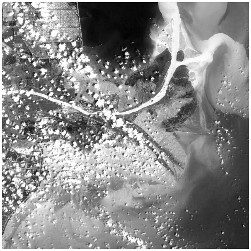
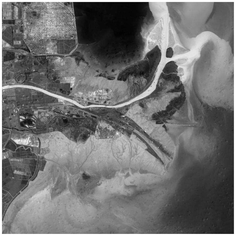
[0092] see Figure 2-3 , the difference between this embodiment and the specific embodiment one is:
[0093] This implementation case selects the Yellow River Delta as the study area. This method mainly performs code writing and calculation on MATLAB software. The following is a further supplementary proof of the feasibility of the present invention by applying the method proposed by the present invention to practical cases.
[0094] Step 1. Obtain the Landsat 8 satellite surface reflectance product covering the Yellow River Delta region in 2019.
[0095] Step 2: Obtain the cloud and shadow distribution area corresponding to each scene image through the quality detection band in the Landsat 8 data, use ENVI software to perform mask processing, and set the cloud area to a null value.
[0096] Step 3. Select the Landsat 8 image on July 18, 2019 ( figure 2 ), as the target processing data, write code on MATLAB software, first extract each cloud area, and the corresponding buf...
PUM
 Abstract
Description
Claims
Application Information
 - Generate Ideas
- Intellectual Property
- Life Sciences
- Materials
- Tech Scout
- Unparalleled Data Quality
- Higher Quality Content
- 60% Fewer Hallucinations
Browse by: Latest US Patents, China's latest patents, Technical Efficacy Thesaurus, Application Domain, Technology Topic, Popular Technical Reports.
© 2025 PatSnap. All rights reserved.Legal|Privacy policy|Modern Slavery Act Transparency Statement|Sitemap|About US| Contact US: help@patsnap.com


