Satellite locating method

A satellite positioning and satellite technology, applied in the field of radio orientation, can solve problems such as the inability to use high-directivity directional antennas, high operating costs, and inability to use three-dimensional positioning for users

Inactive Publication Date: 2004-03-17
杨晓宇
View PDF1 Cites 0 Cited by
  • Summary
  • Abstract
  • Description
  • Claims
  • Application Information

AI Technical Summary

Problems solved by technology

These methods have the following disadvantages. Method 1: ①. The system requires 24 dedicated satellites, which requires large investment, long construction period, and high operating costs; ②. The receiver needs to receive at least 4 dedicated satellite signals that are running non-stop, so it cannot be used High directivity directional antenna is easy to be interfered; ③. Due to the inevitable large orbital drift of high-speed satellites, the system positioning error is relatively large; Method 2: ①. Three-dimensional positioning of users ca

Method used


Image

  • Satellite locating method
  • Satellite locating method
  • Satellite locating method

Examples


Embodiment Construction

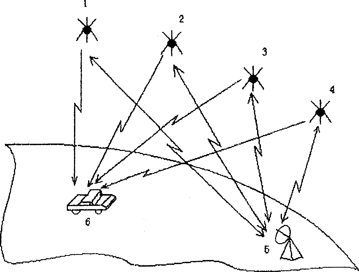
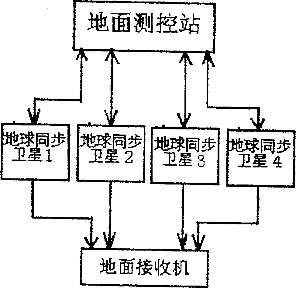
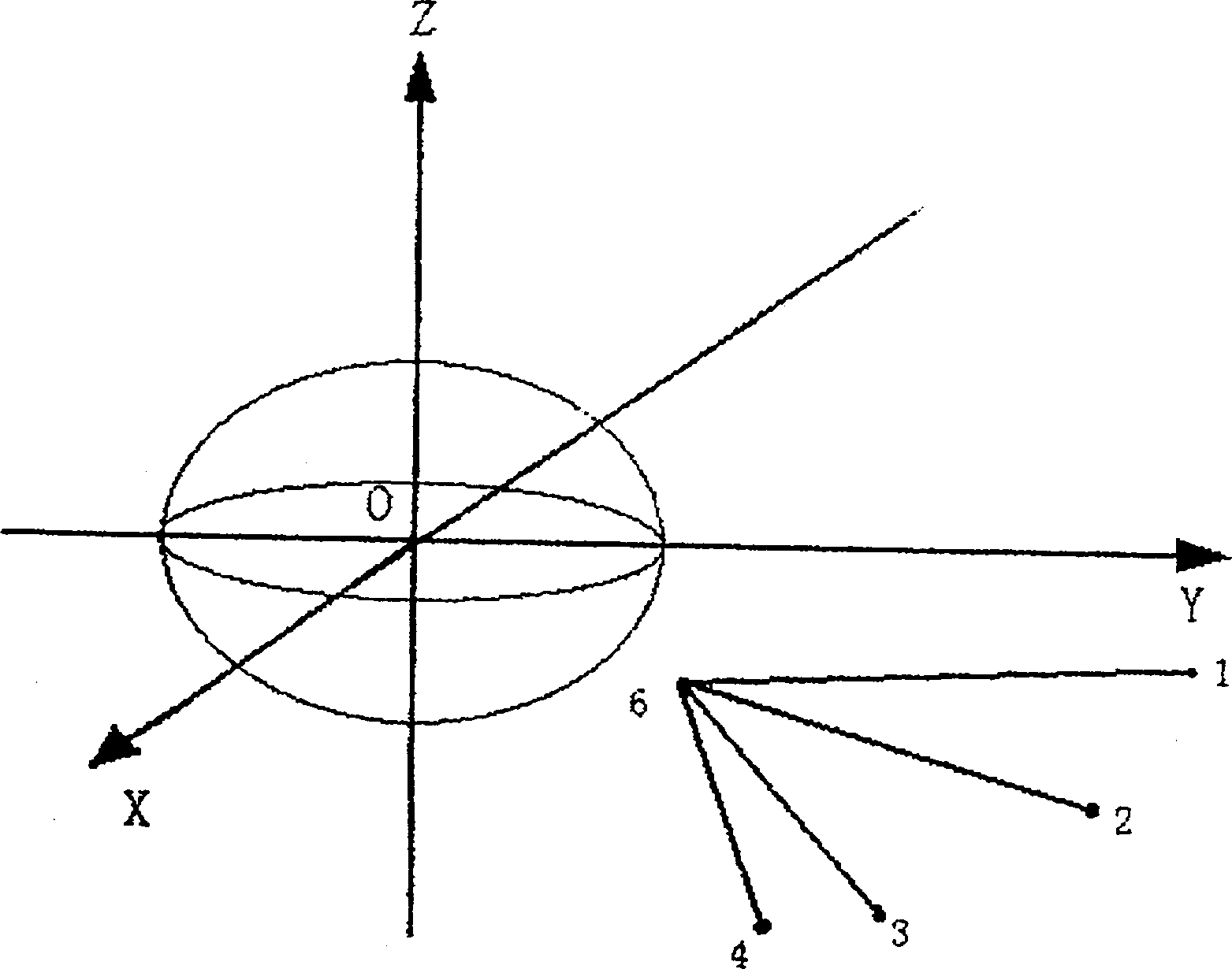
[0019] see figure 1 and figure 2 . The ground measurement and control station 5 sends standard coded signals to the geostationary satellites 1, 2, 3, and 4 with a certain time difference, so that the standard coded signals reach the geostationary satellites 1, 2, 3, and 4 at the same time; 4 After receiving the standard signal, the standard coded signal is transmitted to the ground through the satellite transponder, and the directional antenna or high-directivity antenna of the positioning receiver 6 (such as being located on the ground, on water, in the air, etc.) Standard coded signals transmitted by satellites 1, 2, 3, and 4. Because the distances between the positioning receiver 6 and the geostationary satellites 1, 2, 3, and 4 are different, there is a certain distance difference, so the standard coded signals transmitted by the geostationary satellites 1, 2, 3, and 4 reach the positioning receiver 6 There is also a certain time difference. see Figure 4 . When th...


PUM


Abstract

A satellite locating method features that the ground station sends standard signals to at least 4 synchronous satellites on geostationary orbit and the signals is retransmitted to earth by said satellites, or said satellites send standard signals with time synchronous signals to earth and said signals are received at position to be measured. Based on the time differences of said signals, the longitude, latitude and the height above sea level of said position can be calculated out. Its advantages are less investment, low cost, high anti-interference power and high precision.

Description

(1).Technical field [0001] The invention belongs to the field of radio orientation, in particular to a method for positioning through the cooperation of three or more direction or position lines. (2). Background technology [0002] At present, there are mainly the following methods for global satellite positioning: Method 1. Established by the US Department of Defense DOD, it consists of 24 dedicated satellites and corresponding receivers that operate at high speed relative to the earth and are about 20,000 kilometers above the ground; Method 2 .The double-star positioning system developed by my country utilizes 2 geostationary satellites for positioning; method 3. Chinese patent application (patent application number is 95119688.1) discloses "positioning and communication system using multiple satellite constellations", using two constellations More than 6 basically geosynchronous geostationary satellites are used for positioning. These methods have the following disadvantag...

Claims


Application Information

Patent Timeline
IPC IPC(8): G01S5/10
Inventor 杨哓宇
Owner 杨晓宇
Why Eureka
Try Eureka