Infrared laser intelligent quadrat investigation device and method
An infrared laser and intelligent technology, applied in quadrat experiments and field surveys, can solve the problems that the sample frame is not easy to carry, can not realize the coverage, intelligent measurement and intelligent positioning of sub-coverage, etc.
- Summary
- Abstract
- Description
- Claims
- Application Information
AI Technical Summary
Problems solved by technology
Method used
Image
Examples
Embodiment 1
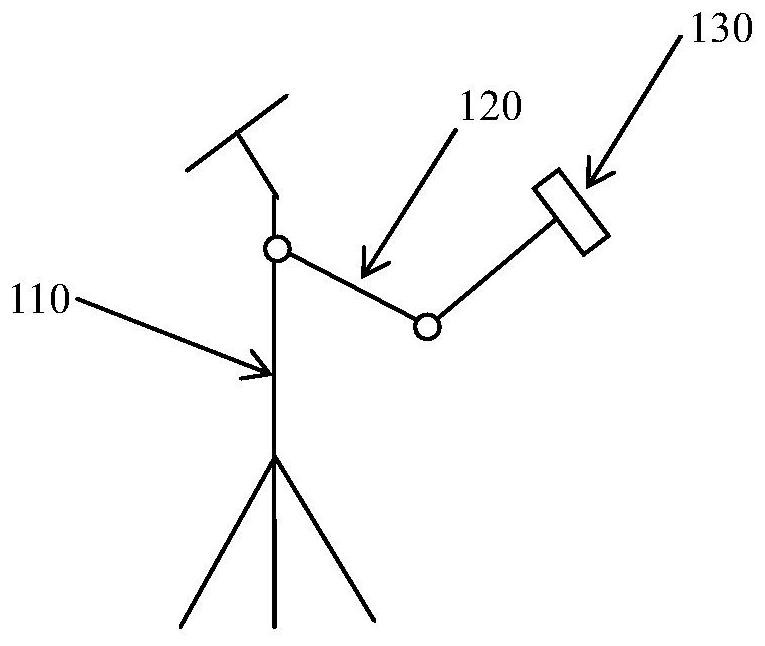
[0027] Such as figure 1 with figure 2 As shown, the present embodiment proposes a smart infrared laser quadrat investigation device, which includes a bracket 110, an infrared laser projector 130, an image acquisition module 140, an image recognition and processing module 150, a GPS positioning module 160, and a display module 170 and a storage module 180 .
[0028] A rotatable arm 120 is installed on the support 110, and an infrared laser projector 130 is arranged on the rotatable arm 120. The infrared laser projector 130 is used to emit an infrared laser and project it on the sampling plot to form a sample frame. The rotatable arm 120 can Adjust the projection angle and position of the infrared laser.
[0029] The image acquisition module 140 is configured to perform image acquisition on the samples within the sample square frame formed by projection.
[0030] The image identification and processing module 150 is used to identify the collected images, and perform sample p...
Embodiment 2
[0037] Corresponding to the above-mentioned embodiment 1, this embodiment proposes an infrared laser intelligent quadrat investigation method, such as image 3 As shown, the method includes the following steps:
[0038] S210, forming a sampling frame by emitting an infrared laser and projecting it on the sampling plot;
[0039] S220. Collect images of the samples in the formed sample box;
[0040] S230. Identify the collected images, and perform sample population analysis and calculation of dominant species and coverage;
[0041] S240. Obtain the latitude and longitude and altitude information of the sampling location through GPS positioning;
[0042] S250, displaying the collected image information, the obtained population analysis results, the coverage calculation results, and the latitude, longitude and altitude information of the current sampling location on the display screen.
PUM
 Abstract
Description
Claims
Application Information
 - Generate Ideas
- Intellectual Property
- Life Sciences
- Materials
- Tech Scout
- Unparalleled Data Quality
- Higher Quality Content
- 60% Fewer Hallucinations
Browse by: Latest US Patents, China's latest patents, Technical Efficacy Thesaurus, Application Domain, Technology Topic, Popular Technical Reports.
© 2025 PatSnap. All rights reserved.Legal|Privacy policy|Modern Slavery Act Transparency Statement|Sitemap|About US| Contact US: help@patsnap.com


