
Unmanned aerial vehicle device for surveying and mapping top surface of ancient building and surveying and mapping method

A surveying and mapping device and drone technology, applied in the field of surveying and mapping, can solve the problems of energy-consuming, low efficiency, waste of drone angle and height, etc., and achieve the effect of improving measurement efficiency, ensuring clarity, and good dynamic measurement advantages

Inactive Publication Date: 2021-12-10
SHANGHAI INST OF TECH
View PDF0 Cites 0 Cited by
  • Summary
  • Abstract
  • Description
  • Claims
  • Application Information

AI Technical Summary

Problems solved by technology

[0003] At present, when ordinary UAVs are surveying and mapping complex environments and terrains, in order to ensure their accuracy, they need to repeatedly survey and map them, resulting in low efficiency and a lot of energy. Most of the time is wasted on adjusting the angle and height of the UAV.

Method used


Image

  • Unmanned aerial vehicle device for surveying and mapping top surface of ancient building and surveying and mapping method
  • Unmanned aerial vehicle device for surveying and mapping top surface of ancient building and surveying and mapping method
  • Unmanned aerial vehicle device for surveying and mapping top surface of ancient building and surveying and mapping method

Examples


Embodiment Construction

[0039] The present invention will be described in detail below in conjunction with specific embodiments. The following examples will facilitate further understanding of the present invention in any form of techniques, but will not limit the invention in any form. It should be noted that several variations and improvements can also be made without departing from the concept of the present invention. These are all of the scope of protection of the present invention.

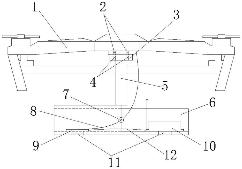
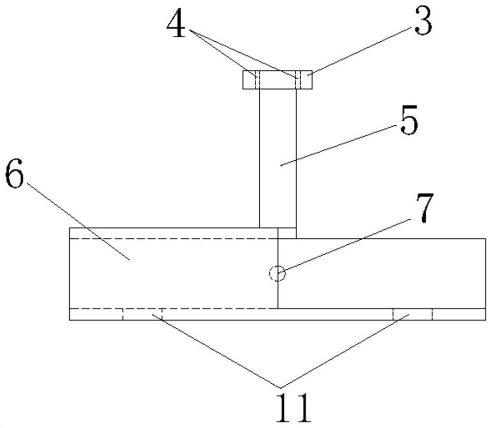
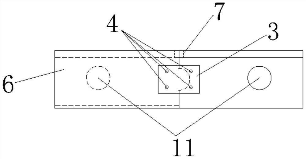
[0040] like figure 1 As shown, the present invention is used to measure the ancient construction of the ancient buildings, including the drone 1 and the mapping apparatus, the lower portion of the drone 1 is provided with a groove 2, and the mapping apparatus is fixed in the concave in the drone 1. Slot 2. The mapping apparatus includes a fixed stage 3, a connecting post 5, a housing 6, a camera 9, and a ranging sensor 10, in this embodiment, the fixing stage 3 is a rectangular parallelepiped, and the connecting post 5...


PUM


Abstract

The invention provides an unmanned aerial vehicle device for surveying and mapping the top surface of an ancient building. The unmanned aerial vehicle device comprises an unmanned aerial vehicle and a surveying and mapping device, the surveying and mapping device comprises a fixed table, a connecting column, a shell, a camera and a distance measuring sensor, the fixed table is fixedly connected with the lower part of the unmanned aerial vehicle, the connecting column is connected with the lower end surface of the fixed table. the shell is connected with the bottom of the connecting column, and a distance measuring sensor and a camera are fixed in the shell. The invention further provides a testing method of the unmanned aerial vehicle device. According to the unmanned aerial vehicle device for surveying and mapping the top surface of the ancient building, rapid and automatic focusing can be carried out, the angle and height of the unmanned aerial vehicle do not need to be additionally adjusted, the measurement efficiency is greatly improved, the shooting definition is guaranteed, and the better dynamic measurement advantage is achieved.

Description

Technical field [0001] The present invention relates to the field of surveying and mapping, and in particular, involving a drone apparatus and surveying method for surveying ancient building top surfaces. Background technique [0002] Drone Air Shooting is a powerful supplement of traditional measurement means, has a flexible, efficient and fast, accurate, low operating cost, wide application range, and has a high-resolution image in difficulty in which it is difficult to reach. It has obvious advantages. With the development of drone and digital camera technology, the drone-based digital avotive technology has shown its unique advantage, and the combination of drone and aerial photographic measurement has become a new direction in the field of surveying and mapping. UAV audio shots can be widely used in national major project construction, disasters emergency and handling, land monitoring and resource development, especially in basic surveys, land resource surveys, land use dyna...

Claims


Application Information

Patent Timeline
Patent Type & Authority Applications(China)
IPC IPC(8): B64D47/00B64D47/08B64C39/02
CPCB64D47/08B64D47/00B64C39/02B64U2101/00B64U2101/30
Inventor 董文澎姜诚华赵雅琦秦茂轩蔡雨玲陈锦锋万衡曹权刘虎刘振勇谭冬莲
Owner SHANGHAI INST OF TECH
Learn More