
Fusion method and fusion device based on spectral information image and medium

A spectral information and image fusion technology, applied in the field of image fusion, can solve the problems of missing spectral information, unsatisfied, and unable to maintain remote sensing data in the spectral band of ocean images

Pending Publication Date: 2021-07-23
深圳市规划国土房产信息中心
View PDF0 Cites 2 Cited by
  • Summary
  • Abstract
  • Description
  • Claims
  • Application Information

AI Technical Summary

Problems solved by technology

At present, the commonly used algorithms mainly include the following categories. One is based on the adaptive space-time fusion algorithm (STARFM) and the IDFM algorithm developed on this basis. This type of algorithm realizes the fusion of hyperspectral and multispectral data of water bodies and the and the fusion results can effectively use MODIS data to make up for the low time resolution of MERIS and TM data, and have a good application in the estimation of microcystin, organic carbon and chlorophyll a concentrations in inland lakes , but the algorithm requires that the data have similar spectral bands, and the generated prediction result spectrum is similar to the high spatial resolution spectral data, focusing on the time-space fusion between images; another commonly used algorithm focuses on the Space-spectrum fusion between the two, such as hybrid pixel decomposition algorithm and fusion algorithm based on sensor diffusion model, etc., the results of this type of algorithm can simultaneously maintain the high spatial resolution of HJ data and the high spectral resolution data information of MERIS data, and inland The estimation of chlorophyll-a concentration in water body has been widely used, but this type of algorithm usually cannot meet the needs of high time resolution monitoring of inland water body
In addition to the above two commonly used algorithms, there is now an algorithm for simultaneously fusing multi-source images with spatial, spectral, and temporal resolutions for inland water bodies. The spatial and spectral data of the results obtained by this method are provided by low-temporal resolution images. , suitable for fusion of geostationary satellite images (such as GOCI and Himawari images), for the fusion of Landsat and Oceanographic satellites with low temporal resolution, important spectral information will still be lost
[0004] In the process of realizing the present invention, the inventors of the present invention found that: at present, the existing fusion methods of ocean and land satellite image data cannot effectively utilize the respective advantages of time, space and spectrum of different remote sensing data to generate images with high spatial resolution, Fusion images with high time resolution, at the same time, cannot maintain remote sensing data in the spectral band of ocean images to meet the short-term dynamic monitoring needs of inland water quality

Method used


Image

  • Fusion method and fusion device based on spectral information image and medium
  • Fusion method and fusion device based on spectral information image and medium
  • Fusion method and fusion device based on spectral information image and medium

Examples


Embodiment Construction

[0048] Embodiments of the technical solutions of the present invention will be described in detail below in conjunction with the accompanying drawings. The following examples are only used to illustrate the technical solutions of the present invention more clearly, and therefore are only examples, rather than limiting the protection scope of the present invention.

[0049] First of all, it should be noted that, in each embodiment of the present invention, the terms involved are:

[0050] Mixed pixels, the ground reflection or emission spectrum signals acquired by the remote sensor are recorded in units of pixels. A cell contains only one type, which is called a pure cell. However, in most cases, a pixel often contains multiple surface types, and such a pixel is a mixed pixel. Mixed pixels record comprehensive spectral information of multiple surface types.

[0051] The process image is the image of the whole process from the initial moment to the final moment.

[0052] In ...


PUM


Abstract

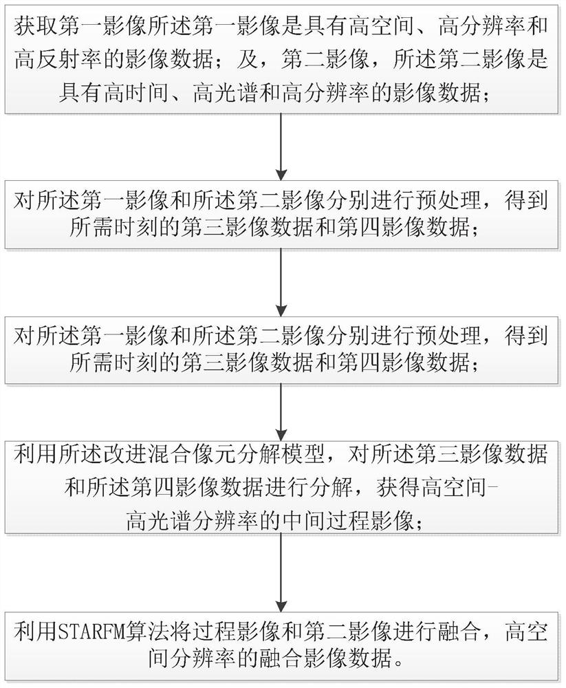
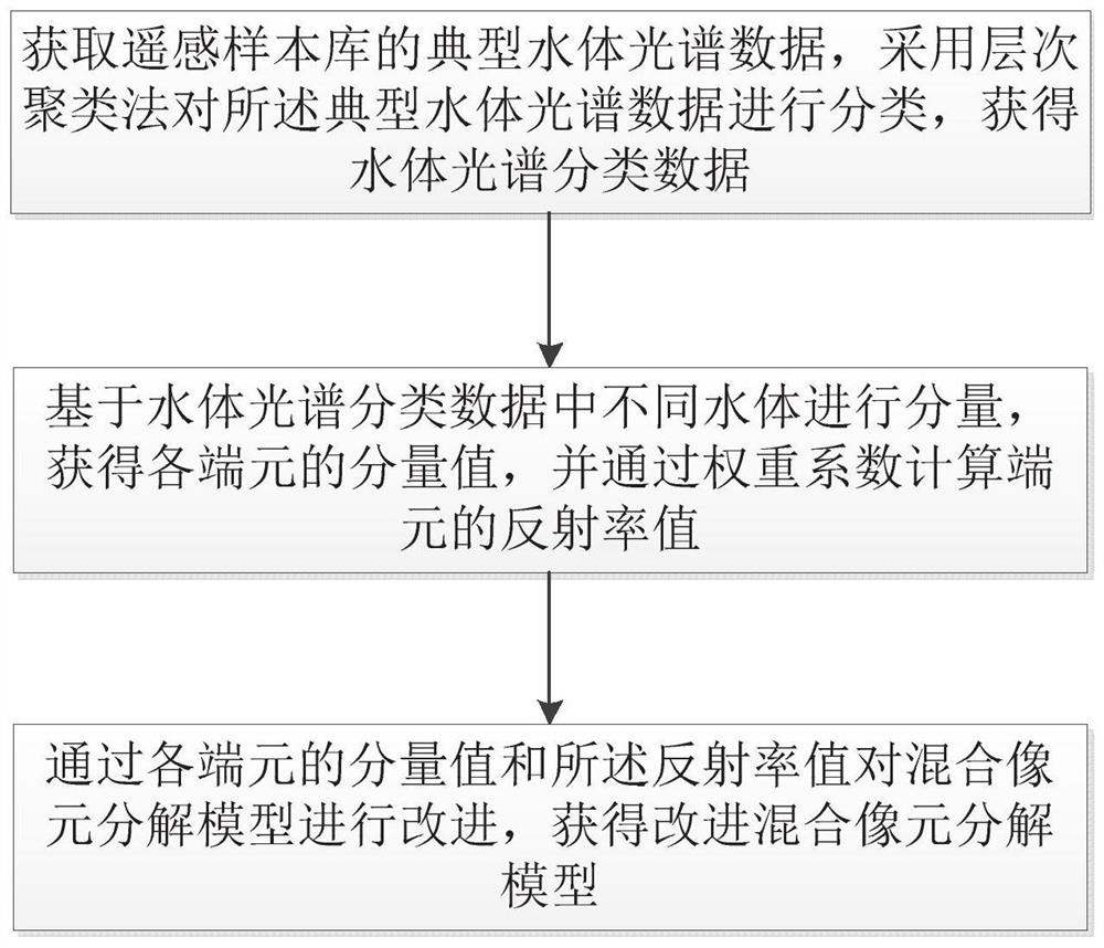
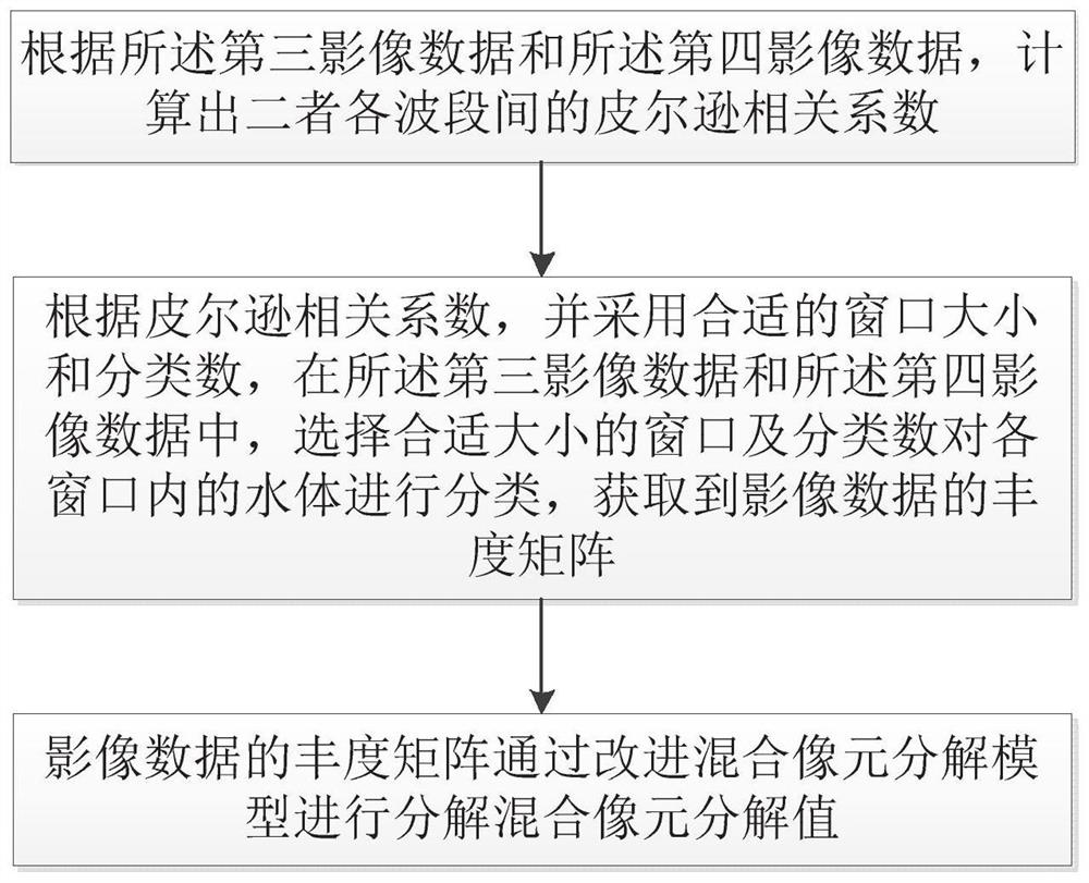
The invention relates to the technical field of image fusion, in particular to a fusion method and device based on a spectral information image and a medium. The fusion method comprises the steps of obtaining a first image and a second image; preprocessing the first image and the second image to obtain third image data and fourth image data at the required moment; improving the mixed pixel decomposition model to obtain an improved mixed pixel decomposition model; decomposing image data by using the improved mixed pixel decomposition model to obtain an intermediate process image with high space-high spectral resolution; and fusing the images to obtain fused image data with high spatial resolution. According to the embodiment of the invention, through fusion of ocean and land satellite image data, the time, space and spectrum advantages of different remote sensing data are effectively utilized, and the remote sensing data which has high spatial resolution and high time resolution and also keeps the ocean image spectrum band is generated, so that the requirement of short-term dynamic monitoring of the water quality of an inland water body is met.

Description

technical field [0001] The present invention relates to the technical field of image fusion, in particular to a fusion method, fusion device and medium based on spectral information images. Background technique [0002] In recent years, the increasingly sound and perfect remote sensing technology has become one of the important means of natural resource investigation and monitoring and ecological environment protection due to its rapid and large-scale characteristics, and has been widely used in the monitoring and early warning of eutrophication pollution in water bodies . At present, due to the lack of sensors for inland water bodies, remote sensing monitoring of eutrophication pollution in water bodies is mostly realized directly using a single ocean satellite image or land satellite image. However, since ocean satellite sensors and land satellite sensors have their own advantages and disadvantages, for example, ocean satellite sensors usually have higher spectral resolut...

Claims


Application Information

Patent Timeline
IPC IPC(8): G06T5/50G06T5/00
CPCG06T5/50G06T2207/10036G06T2207/20221G06T5/90
Inventor 唐岭军彭子凤喻敏包颖李胜汪靖韬
Owner 深圳市规划国土房产信息中心
Learn More