Real-time street view image semantic segmentation method based on deep multi-branch aggregation
A semantic segmentation and multi-branch technology, applied in the field of computer vision, can solve the problems of lower accuracy rate, unacceptable segmentation accuracy, and lagging semantic segmentation method of street view images, etc.
- Summary
- Abstract
- Description
- Claims
- Application Information
AI Technical Summary
Problems solved by technology
Method used
Image
Examples
Embodiment Construction
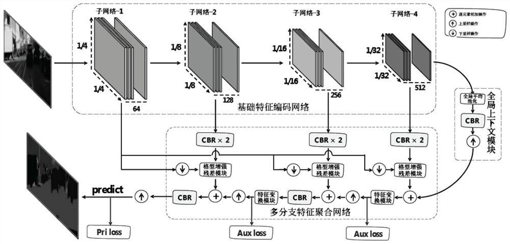
[0028] The following examples will further illustrate the present invention in conjunction with the accompanying drawings. The present embodiment is implemented on the premise of the technical solution of the present invention, and provides implementation and specific operation process, but the protection scope of the present invention is not limited to the following implementation example.
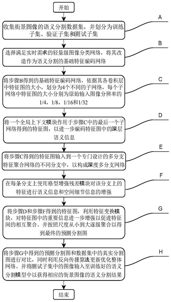
[0029] see figure 1 , the implementation of the embodiment of the present invention includes the following steps:
[0030] A. Collect a semantic segmentation dataset of street view images and divide it into a training subset, a validation subset, and a test subset.
[0031] The dataset used is the public dataset Cityscapes, which is one of the most influential and challenging large-scale datasets in the task of street view semantic segmentation. It mainly contains 25,000 high-resolution (1024×2048) street view images collected from fifty different cities in Germany, including 5,000 ima...
PUM
 Abstract
Description
Claims
Application Information
 - R&D
- Intellectual Property
- Life Sciences
- Materials
- Tech Scout
- Unparalleled Data Quality
- Higher Quality Content
- 60% Fewer Hallucinations
Browse by: Latest US Patents, China's latest patents, Technical Efficacy Thesaurus, Application Domain, Technology Topic, Popular Technical Reports.
© 2025 PatSnap. All rights reserved.Legal|Privacy policy|Modern Slavery Act Transparency Statement|Sitemap|About US| Contact US: help@patsnap.com


