Tectonic altitude determination method based on tectonic model in drilling layering design
A technology of structural model and determination method, applied in the field of oil and gas exploration, can solve the problems of heavy workload, long research time, difficult to pick up accurate velocity of complex structures, etc., and achieve the effect of reducing design error and accurate burial depth
- Summary
- Abstract
- Description
- Claims
- Application Information
AI Technical Summary
Problems solved by technology
Method used
Image
Examples
Embodiment Construction
[0024] In order to make the object, technical solution and advantages of the present invention more clear, the present invention will be further described in detail below in conjunction with the examples. It should be understood that the specific embodiments described here are only used to explain the present invention, not to limit the present invention.
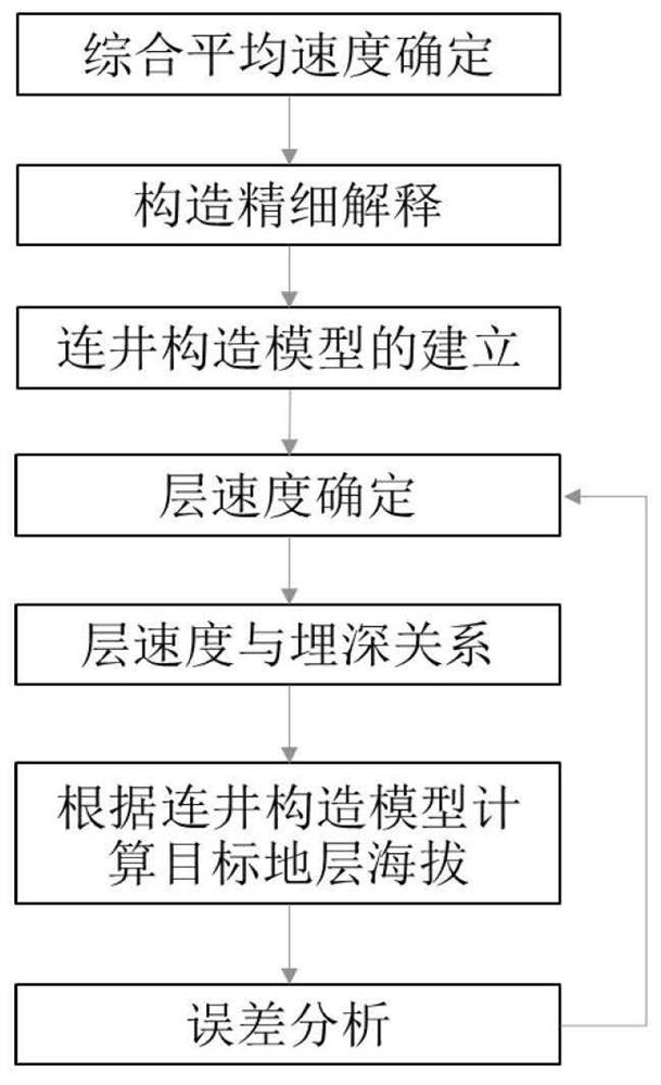
[0025] Such as figure 1 As shown, a structural model-based structural elevation determination method in drilling layer design includes the following steps:
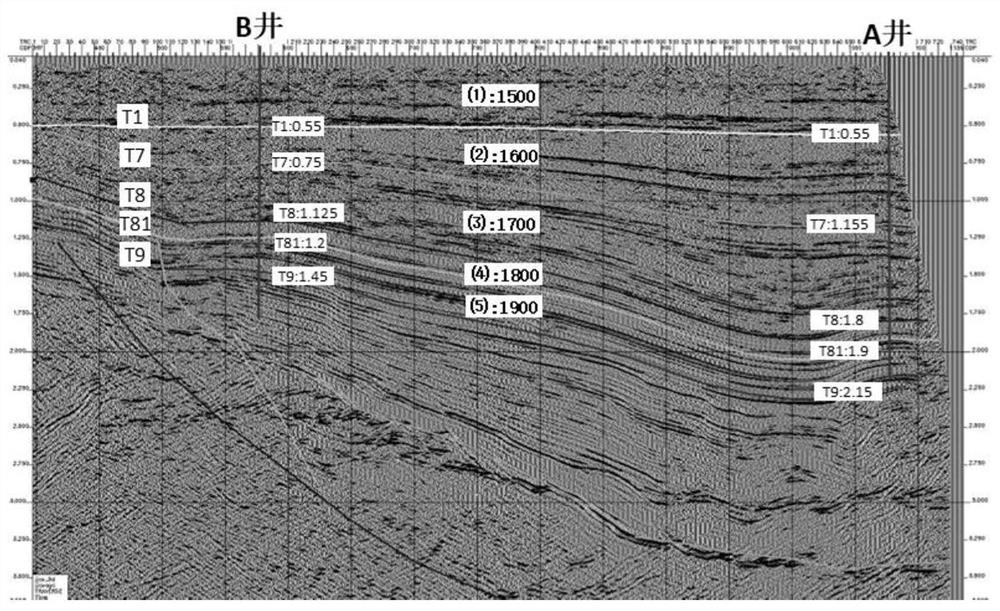
[0026] 1) Determine the stratigraphic framework on the basis of high-precision 3D seismic data interpretation, establish the well-connected time structure model between the target target area and the existing well area, and directly obtain the well-passing time value between the known well area and the target target area;
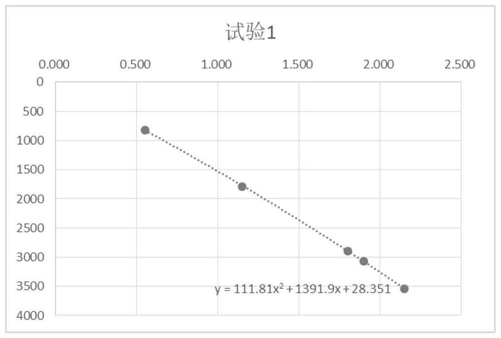
[0027] 2) Determine the comprehensive average velocity in the existing well area by using the synthetic record of seismic data and well logging da...
PUM
 Abstract
Description
Claims
Application Information
 - R&D
- Intellectual Property
- Life Sciences
- Materials
- Tech Scout
- Unparalleled Data Quality
- Higher Quality Content
- 60% Fewer Hallucinations
Browse by: Latest US Patents, China's latest patents, Technical Efficacy Thesaurus, Application Domain, Technology Topic, Popular Technical Reports.
© 2025 PatSnap. All rights reserved.Legal|Privacy policy|Modern Slavery Act Transparency Statement|Sitemap|About US| Contact US: help@patsnap.com


