Eureka AIR delivers breakthrough ideas for toughest innovation challenges, trusted by R&D personnel around the world.

Residential area extraction and type recognition method based on remote sensing and social perception data

A technology for sensing data and type identification, which is applied in the application fields of remote sensing and geographic information systems, and can solve problems that are not suitable for fine-grained residential area extraction and type identification

Pending Publication Date: 2020-10-27
AEROSPACE INFORMATION RES INST CAS
View PDF0 Cites 0 Cited by
  • Summary
  • Abstract
  • Description
  • Claims
  • Application Information

AI Technical Summary

Problems solved by technology

[0004] In the existing technology, by combining remote sensing and geographic information systems, urban residential areas can be extracted (Zhang et al., 2015); however, this technology is only suitable for extracting coarse-grained residential land, not for fine-grained residential area extraction and type recognition

Method used


Image

  • Residential area extraction and type recognition method based on remote sensing and social perception data
  • Residential area extraction and type recognition method based on remote sensing and social perception data
  • Residential area extraction and type recognition method based on remote sensing and social perception data

Examples


Embodiment Construction

[0053] Preferred embodiments of the present invention are described in detail below in conjunction with accompanying drawings;

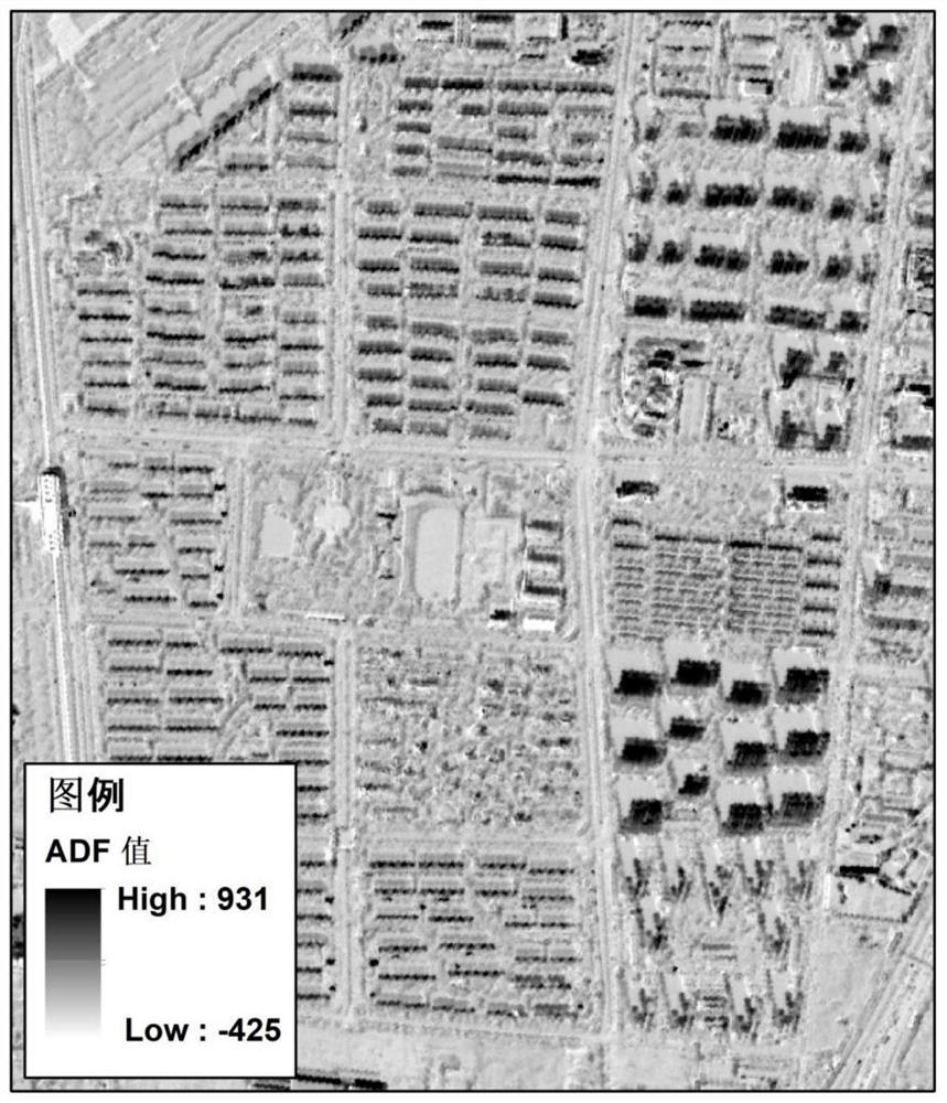
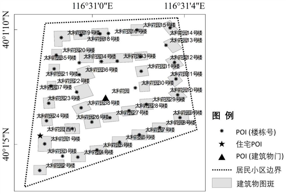
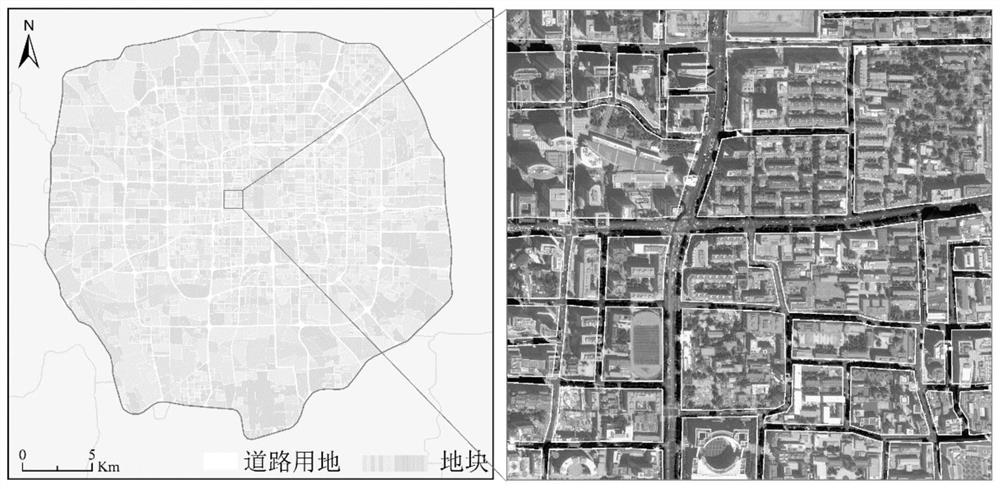
[0054] refer to Figure 1 to Figure 5 As shown in Fig. 1, the residential area extraction and type identification method based on remote sensing and social perception data includes the following technical steps:

[0055] Step 1: Remote sensing image preprocessing;

[0056] Further, the angle difference feature (Angular Difference Feature (ADF)) is extracted using the front-sight, front-sight, and rear-sight remote sensing images provided by the resource satellite, and the angle difference feature will be used to identify the type of residential area;

[0057] As an example, the resource satellite uses the No. 02 satellite of Resource 3;

[0058] Further, before performing the angle difference feature extraction, it is necessary to resample the resolution (2.5 meters) of the front-view and rear-view remote sensing images provided by the resource sat...


PUM


Abstract

The invention relates to a residential area extraction and type recognition method based on remote sensing and social perception data. The method comprises the steps of remote sensing image preprocessing, angle difference feature calculation, residential area Point of Interest recognition, residential area boundary extraction and residential area type recognition. Aiming at the blank of extractionand type recognition of urban residential quarters at present, remote sensing and social perception data are fused, a technical scheme for quickly and effectively carrying out the extraction and typerecognition method of the urban residential quarters is provided, and an accurate data source is provided for urban planning departments and urban researchers; the effect of extracting residential areas in real time can be achieved; in addition, due to the fact that text similarity analysis is combined, residential area surface vector files can be quickly and effectively provided for urban researchers and urban planning departments.

Description

technical field [0001] The invention relates to the technical field of remote sensing and geographic information system applications, in particular to a residential area extraction and type identification method based on remote sensing and social perception data. Background technique [0002] Urban land occupies only 1% of the world's land, but it does accommodate more than 50% of the urban population; although the environmental sustainability of high-rise residential quarters is controversial in terms of energy consumption and social impact, in order to accommodate more urban Population, medium and high-rise residential quarters have gradually become the mainstream of urban residential construction in China; one of the main advantages of medium-high-rise residential quarters is the intensive use of urban land. A typical high-rise residential area in Beijing can accommodate 10,000 to 15,000 residents; For the health of the residents, it is very important to create a good cli...

Claims


Application Information

Patent Timeline
IPC IPC(8): G06K9/00G06K9/62G06F16/29
CPCG06F16/29G06V20/176G06F18/2321G06F18/22
Inventor 黄慧萍陈炜田亦陈
Owner AEROSPACE INFORMATION RES INST CAS
Why Eureka
Eureka Blog
Learn More