
Wave parameter inversion method utilizing high-resolution satellite optical image

An optical image and wave parameter technology, applied in satellite radio beacon positioning system, material analysis by optical means, material analysis and other directions, can solve the problems of land signal interference, high cost of shore-based wave radar, and high observation cost, To achieve the effect of improving the spatial coverage, reducing the cost of ocean wave observation, and improving the observation resolution

Active Publication Date: 2020-10-16
THE FIRST INST OF OCEANOGRAPHY SOA
View PDF6 Cites 7 Cited by
  • Summary
  • Abstract
  • Description
  • Claims
  • Application Information

AI Technical Summary

Problems solved by technology

[0002]Ocean wave information is an important part of ocean operational observation. Now our country’s ocean observation is mainly carried out through moored wave buoys, which can provide hourly waves In addition, the shore-based X-band wave measuring radar can observe two-dimensional offshore wave information, but the observation cost is relatively high, and it does not yet have the potential for large-scale promotion. The microwave scatterometer carried by the satellite is also It can observe the sea surface wave height, but the resolution is low, and coastal areas are often susceptible to land signal interference
The applicant is known to use satellite remote sensing images such as Ziyuan No. 3 to retrieve ocean wave information, but human intervention is required to calculate the initial data when calculating the wave direction. That is to say, the visual direction determines the calculation of the wave direction, so the calculation of the wave direction is not correct accurate
However, the main shortcomings of the existing technology are: 1) buoy fixed-point observation belongs to the time domain measurement, which cannot realize the extraction of ocean wave information in the space domain; 2) the inversion accuracy of ocean waves under small wind and waves is low; 3) the cost of shore-based wave measuring radar High; 4) Satellite microwave sensor resolution is low

Method used


Image

  • Wave parameter inversion method utilizing high-resolution satellite optical image
  • Wave parameter inversion method utilizing high-resolution satellite optical image
  • Wave parameter inversion method utilizing high-resolution satellite optical image

Examples


Embodiment 1

[0037] At present, the number of high-resolution satellites in orbit in my country is increasing, and the observation coverage of my country's oceans is also expanding. The use of high-resolution optical satellite images to invert ocean waves can enrich ocean observation methods, which is beneficial to ocean observation and scientific research. To promote the application of my country's high-resolution optical satellites. Compared with the prior art, the present invention has the following characteristics:

[0038] Through the invention, the ocean wave element information can be obtained by inverting high-resolution satellite optical images. The ability of traditional wave buoys to observe calm sea conditions is limited by the sensitivity of the instrument system, and the effective signal is often submerged by noise. However, the present invention can use satellite optical images to obtain high-precision multi-element information of waves, and it is also very useful for wave in...


PUM


Abstract

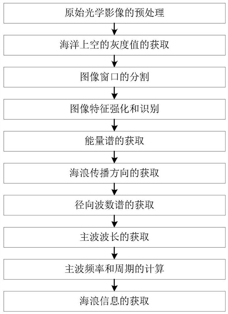
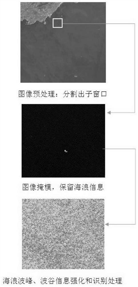
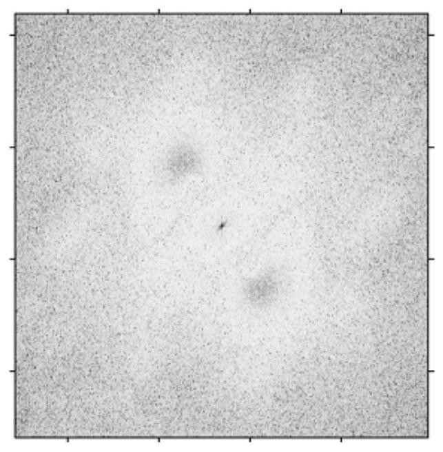
The invention relates to a wave parameter inversion method utilizing a high-resolution satellite optical image, and belongs to the technical field of ocean wave parameter extraction. The method comprises the following steps: step 1, preprocessing an original optical image; step 2, acquiring a gray value above the sea; step 3, segmenting an image window; step 4, image feature enhancement and recognition; step 5, acquiring an energy spectrum; step 6, acquiring a sea wave propagation direction; step 7, obtaining a radial wave number spectrum; step 8, acquiring a main wave length lambda; step 9, calculating a main wave frequency f and a period T; and step 10, obtaining sea wave information: carrying out window sliding to obtain sea wave propagation directions, wavelengths and periods of othersub-windows so as to obtain sea wave information of any area in a satellite observation range. According to the method, a two-dimensional Fourier window segmentation sliding technology is used so thathuman intervention calculation can be avoided, an accurate wave direction is obtained, and information such as wavelength and period can be further obtained.

Description

technical field [0001] The invention relates to a wave parameter inversion method using high-resolution satellite optical images, and belongs to the technical field of ocean wave parameter extraction. Background technique [0002] Ocean wave information is an important part of marine operational observations. Currently, my country’s ocean observations are mainly carried out through moored wave buoys, which can provide information such as wave cycle, wave direction, and wave height once an hour. In addition, shore-based X-band measurements Wave radar can observe two-dimensional coastal wave information, but the observation cost is high, and it does not have the potential for large-scale promotion. The microwave scatterometer carried by satellites can also observe the sea surface wave height, but the resolution is low. Coastal areas often Susceptible to terrestrial signal interference. The applicant is known to use satellite remote sensing images such as Ziyuan No. 3 to retriev...

Claims


Application Information

Patent Timeline
Patent Type & Authority Applications(China)
IPC IPC(8): G01N21/17G01S19/42G06F17/14
CPCG01N21/17G01S19/42G06F17/141G01N2021/1793Y02A90/10
Inventor 杨磊朱琳唐秋华周兴华
Owner THE FIRST INST OF OCEANOGRAPHY SOA
Learn More