Navigation system error correction method based on subsea pipeline node position assistance
A technology of navigation system error and node position, applied in navigation, surveying and mapping and navigation, navigation calculation tools, etc., to achieve tracking and precise positioning, and good versatility
- Summary
- Abstract
- Description
- Claims
- Application Information
AI Technical Summary
Problems solved by technology
Method used
Image
Examples
Embodiment Construction
[0040] The present invention is described in more detail below in conjunction with accompanying drawing example:
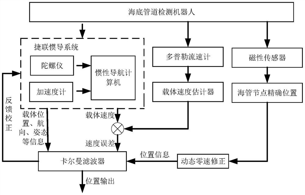
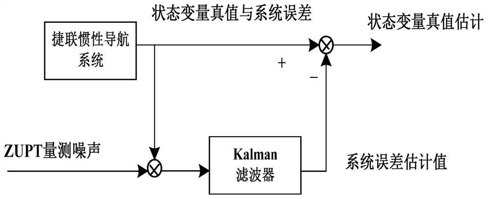
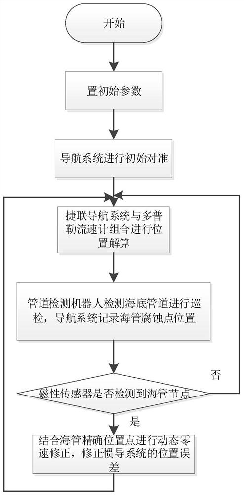
[0041] to combine Figure 1-3 , the basic navigation system of the submarine oil and gas pipeline detection robot is composed of a strapdown inertial navigation system and a Doppler current meter. The strapdown navigation system is composed of three orthogonally arranged fiber optic gyros and three orthogonal angular velocity meters, which can measure the carrier attitude and a relatively accurate position in a short period of time; the Doppler current meter can measure the speed of the carrier relative to the seabed; the speed measured by the Doppler current meter can provide an absolute speed reference for the strapdown navigation system, and then correct the strapdown inertial navigation system The system speed error provides more accurate position information for the carrier. On this basis, the magnetic sensor mounted on the submarine oil and gas pipeline det...
PUM
 Abstract
Description
Claims
Application Information
 - Generate Ideas
- Intellectual Property
- Life Sciences
- Materials
- Tech Scout
- Unparalleled Data Quality
- Higher Quality Content
- 60% Fewer Hallucinations
Browse by: Latest US Patents, China's latest patents, Technical Efficacy Thesaurus, Application Domain, Technology Topic, Popular Technical Reports.
© 2025 PatSnap. All rights reserved.Legal|Privacy policy|Modern Slavery Act Transparency Statement|Sitemap|About US| Contact US: help@patsnap.com


