
Method and system for loading digital geographical map tiles

A technology of maps and tiles, applied in transmission systems, control/regulation systems, geographic information databases, etc., can solve problems such as data channel overload, inability to realize automatic driving, and influence of map server connection quality, and achieve the effect of avoiding requests

Active Publication Date: 2020-05-29
ROBERT BOSCH GMBH
View PDF17 Cites 0 Cited by
  • Summary
  • Abstract
  • Description
  • Claims
  • Application Information

AI Technical Summary

Problems solved by technology

However, the speed of the vehicle may negatively affect the connection quality to the map server
This unstable data connection may cause map tiles to no longer be reliably redownloaded
In the current system, re-downloads of map tiles continue to be implemented despite low connection quality, which can lead to overloading of the data channel and thus data loss
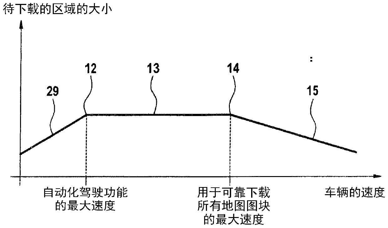
Instead, the re-download of map data is regulated by the current system, since automated driving is currently not possible at high speeds

Method used


Image

  • Method and system for loading digital geographical map tiles
  • Method and system for loading digital geographical map tiles
  • Method and system for loading digital geographical map tiles

Examples


Embodiment Construction

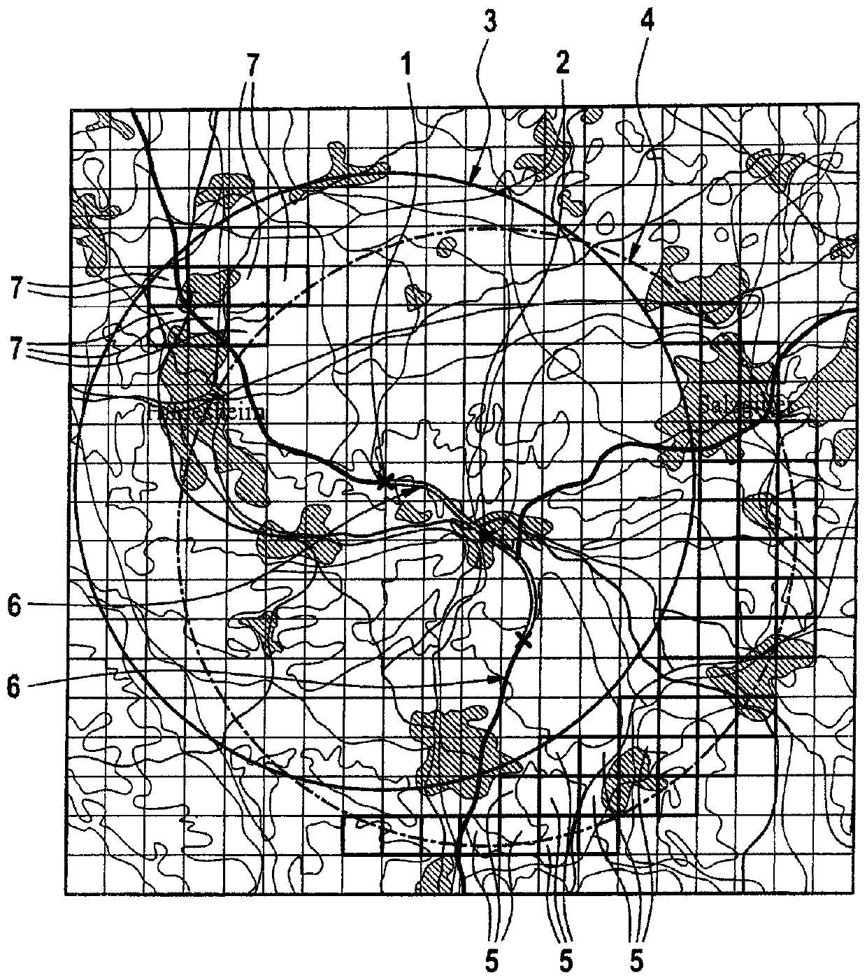
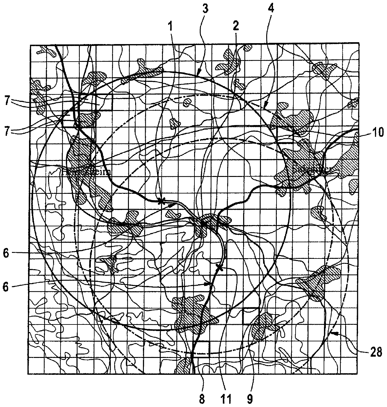
[0030] figure 1 A map is shown with the size of the area to be downloaded according to the method of the invention. The vehicle travels over a road segment from a first location 1 to a second location 2 . Here, the first position 1 is the midpoint of the first radius of the first area size 3 to be downloaded. The second location is the midpoint of the second radius of the second area size 4 to be downloaded. Here, these area sizes are divided into map tiles 5 . During the course of the driving section 6 , the midpoint of the first radius of the first area size 3 to be downloaded is shifted to the midpoint of the radius of the second area size 4 to be downloaded. When the area to be downloaded moves in the direction of the second position 2 , new map tiles 5 must be downloaded by the vehicle. Map tiles 7 that are no longer required can be deleted from the vehicle memory, which are no longer required if further road sections follow 6 .

[0031] figure 2 A map is shown to ...


PUM


Abstract

The invention relates to a method for loading digital geographical map tiles by an autonomous or partially autonomous vehicle from an external server unit, wherein a current speed of the vehicle and aconnection quality of a data connection to an external server unit available at the time is determined. An area size to be loaded for a planned journey is calculated by the vehicle as a function of the speed of the vehicle and the quality of the connection between the vehicle and the at least one external server unit, and a list is compiled of the map tiles to be loaded using the area size to beloaded, excluding map tiles already stored in a control unit in the vehicle. A prioritized sequence of the listed map tiles to be loaded is then determined; this is followed by loading of the map tiles in the priority order. The invention further relates to a system for providing digital geographical map tiles and for executing a method.

Description

technical field [0001] The invention relates to a method and a system for downloading digital geographic map tiles from an external server unit by an autonomous or partially autonomous vehicle. Background technique [0002] For autonomous operation of vehicles with highly automated driving functions, vehicles require highly accurate geographic data of the road segments to be driven. Digital geographic data and its currentness This is of major relevance for the operational safety of automated driving functions. Data is requested and downloaded dynamically by the vehicle from the map server when necessary. [0003] Currently, highly automated driving functions are only available up to a determined maximum speed, which is significantly lower than the maximum speed of the vehicle. If the vehicle does not have sufficient geographic data for the planned route, which is used to detail the course of the route, the driver must manually control the vehicle. During vehicle stop or...

Claims


Application Information

Patent Timeline
Patent Type & Authority Applications(China)
IPC IPC(8): H04W4/44H04W4/02H04L29/08G06F16/29G01C21/32
CPCH04W4/027H04L67/12H04W4/44G06F16/29G01C21/3881H04W4/024G01C21/3407G01C21/3694G05D1/0276G05D2201/0213
Inventor R·霍迈尔O·坎普亨克尔
Owner ROBERT BOSCH GMBH
Learn More