Dynamic wireless monitoring and positioning method and system for side slope rockfall disaster
A technology of positioning system and positioning method, which is applied in satellite radio beacon positioning system, radio wave measurement system, beacon system using radio wave, etc., can solve the problem of high installation and maintenance cost of fiber grating monitoring device and easy error of vibration sensor False touches reported, camera and video poor adaptability, etc.
- Summary
- Abstract
- Description
- Claims
- Application Information
AI Technical Summary
Problems solved by technology
Method used
Image
Examples
Embodiment 1
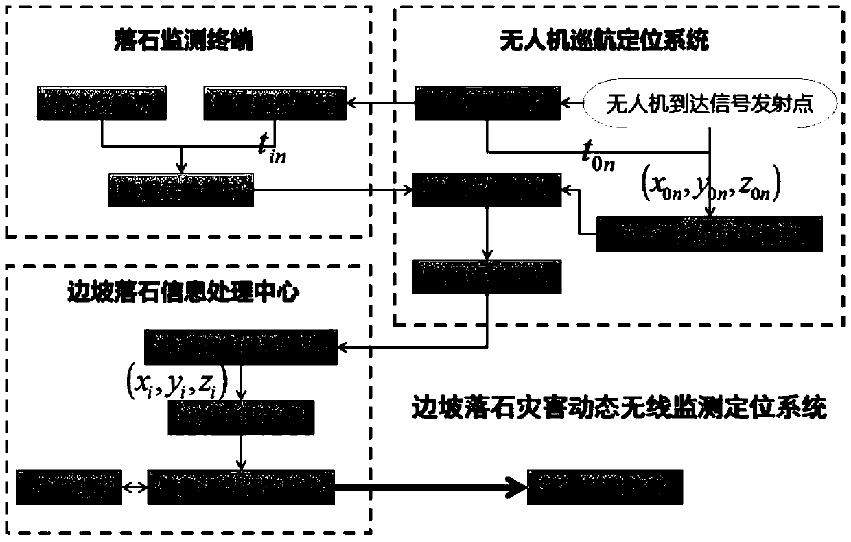
[0056] This embodiment discloses a dynamic wireless monitoring and positioning method for rockfall disasters on slopes, including the following steps:
[0057] Step 1. Arrange more than one rockfall monitoring terminal in the slope monitoring area;
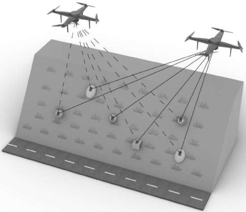
[0058] Each rockfall monitoring terminal is installed on each potential rockfall surface of the slope monitoring area by manual arrangement or drone sowing (if multiple potential rockfalls need to be monitored, a rockfall monitoring terminal is installed on each potential rockfall surface, Such as figure 1 As shown; each rockfall monitoring terminal has a fixed and unique number; when the potential rockfall moves, the rockfall monitoring terminal installed on its surface will move accordingly;
[0059] Step 2. The rockfall monitoring terminal cooperates with the UAV cruise positioning system to obtain rockfall monitoring data;
[0060] In the UAV cruise positioning system, cruise in the slope monitoring area; during each round o...
Embodiment 2
[0064] This embodiment is on the basis of embodiment 1, as figure 1 As shown, the cruise route is planned in advance in the slope monitoring area; on the planned cruise route, a signal emission point is determined at a certain distance; during each round of cruise, the UAV cruises according to the pre-planned cruise route , and transmit a wireless electromagnetic wave signal at each signal transmitting point.
Embodiment 3
[0066] In this embodiment, on the basis of Embodiment 2, the UAV cruise positioning system performs positioning through the GPS high-precision positioning module, and transmits a wireless electromagnetic wave signal of a specific frequency band to the rockfall monitoring terminal through the signal transmission module at the planned signal transmission point, and According to the GPS high-precision timing positioning module, the time for each emission of radio electromagnetic wave signals is determined.
PUM
 Abstract
Description
Claims
Application Information
 - R&D
- Intellectual Property
- Life Sciences
- Materials
- Tech Scout
- Unparalleled Data Quality
- Higher Quality Content
- 60% Fewer Hallucinations
Browse by: Latest US Patents, China's latest patents, Technical Efficacy Thesaurus, Application Domain, Technology Topic, Popular Technical Reports.
© 2025 PatSnap. All rights reserved.Legal|Privacy policy|Modern Slavery Act Transparency Statement|Sitemap|About US| Contact US: help@patsnap.com


