A spatial downscaling method and system for remote sensing precipitation data
A downscaling and data technology, applied in the field of satellite remote sensing data processing, can solve problems such as inability to apply precipitation downscaling, and inability to use hourly average or daily average precipitation downscaling, etc.
- Summary
- Abstract
- Description
- Claims
- Application Information
AI Technical Summary
Problems solved by technology
Method used
Image
Examples
Embodiment 1
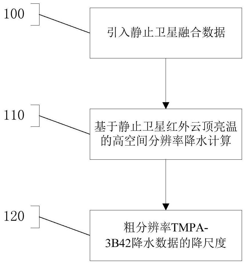
[0055] Such as figure 1 , 2 As shown, step 100 is executed, and the data import module 200 imports geostationary satellite fusion data, and the fusion data is geostationary satellite infrared band fusion data with high temporal and spatial resolution.
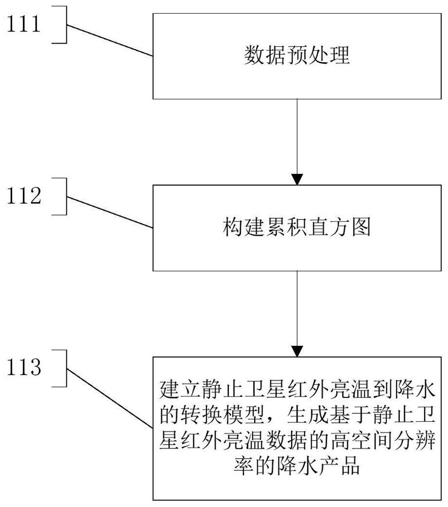
[0056] Step 110 is executed, and the precipitation calculation module 210 performs high spatial resolution precipitation calculation based on the infrared cloud top brightness temperature of the geostationary satellite. In step 110, execute step 111, data preprocessing. The data used include TMPA-3B42 precipitation products with a spatial resolution of 0.25°×0.25° and a temporal resolution of 3 hours and / or NCEP-IR with a spatial resolution of 4km×4km and a temporal resolution of 30 minutes. For the NCEP-IR that matches TPMA-3B42 in time, the selected NCEP-IR is resampled into data with two equal longitude and latitude spatial resolutions: 0.25°×0.25° and 0.05°×0.05°.
[0057] Step 112 is executed to construct a cumulative h...
Embodiment 2
[0064] At present, the spatial resolution of long-term global precipitation fusion products is mostly 0.25°. The precipitation downscaling method proposed in the patent of the present invention can increase the spatial resolution of precipitation data on land and oceans worldwide from 0.25° to 0.05°. It enables users to obtain more refined precipitation spatial distribution data on a global scale, and provides richer information for global flood disaster monitoring, drought monitoring, and water resource distribution investigation. Compared with the existing downscaling method, the precipitation downscaling method provided by the patent of the present invention can improve the spatial resolution of the data while ensuring that the downscaled precipitation data is comparable to the original data in terms of accuracy and time resolution. reduce while retaining the spatial distribution trend of the original precipitation data.
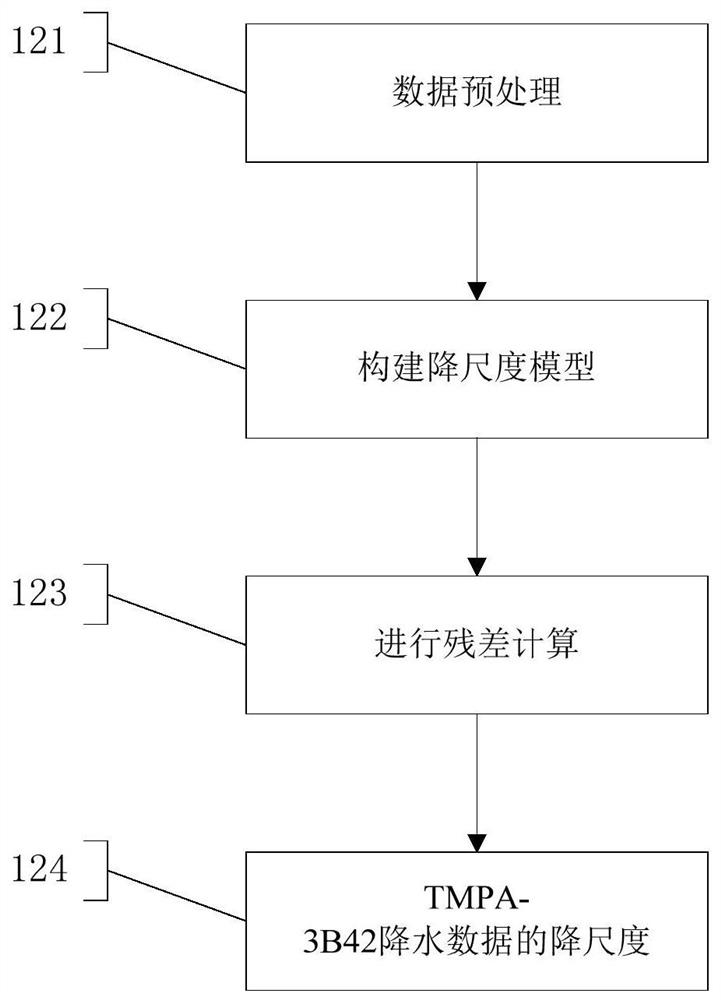
[0065] In this example, if image 3 As shown, the...
Embodiment 3
[0088] In this example, the TMPA-3B42 precipitation data in July 2017 were downscaled. Such as Figure 4 Shown is the comparison of the spatial distribution of daily cumulative precipitation before and after downscaling calculated based on TMPA-3B42 on July 16, 2017. It can be seen from the comparison results that the downscaled precipitation data is more delicate in spatial distribution and can better display the spatial distribution of precipitation. In addition, the present invention also uses the daily accumulated precipitation total amount observed by the surface rain gauge in Thailand to verify the precipitation data before and after downscaling, as Figure 5 shown. It can be seen from the figure that compared with the original data, the downscaled precipitation data has improved both in terms of correlation and root mean square error RMSE.
PUM
 Abstract
Description
Claims
Application Information
 - R&D
- Intellectual Property
- Life Sciences
- Materials
- Tech Scout
- Unparalleled Data Quality
- Higher Quality Content
- 60% Fewer Hallucinations
Browse by: Latest US Patents, China's latest patents, Technical Efficacy Thesaurus, Application Domain, Technology Topic, Popular Technical Reports.
© 2025 PatSnap. All rights reserved.Legal|Privacy policy|Modern Slavery Act Transparency Statement|Sitemap|About US| Contact US: help@patsnap.com


