MTF-based remote sensing image quality evaluation method

A remote sensing image and quality evaluation technology, which is applied in the field of remote sensing, can solve the problems of time-consuming and laborious, unfavorable automatic interpretation of massive remote sensing data, and the inability to apply remote sensing image processing to practical applications, achieving the effect of large application advantages and wide application range

Inactive Publication Date: 2020-02-18
BEIJING RES INST OF URANIUM GEOLOGY
View PDF5 Cites 2 Cited by
  • Summary
  • Abstract
  • Description
  • Claims
  • Application Information

AI Technical Summary

Problems solved by technology

[0007] Aiming at the deficiencies of the prior art, the present invention proposes a method for evaluating the quality of remote sensing images based on MTF, which is used to solve the problem of manual interpretation using subjective evaluation methods in the prior art, which is time-consuming and laborious, which is not conducive to the automatic interpretation of massive remote sensing data and cannot obtain distorted images. The corresponding reference image cannot be applied to the practical application of remote sensing image processing. Medium technical problems

Method used


Image

  • MTF-based remote sensing image quality evaluation method
  • MTF-based remote sensing image quality evaluation method
  • MTF-based remote sensing image quality evaluation method

Examples


Embodiment 1

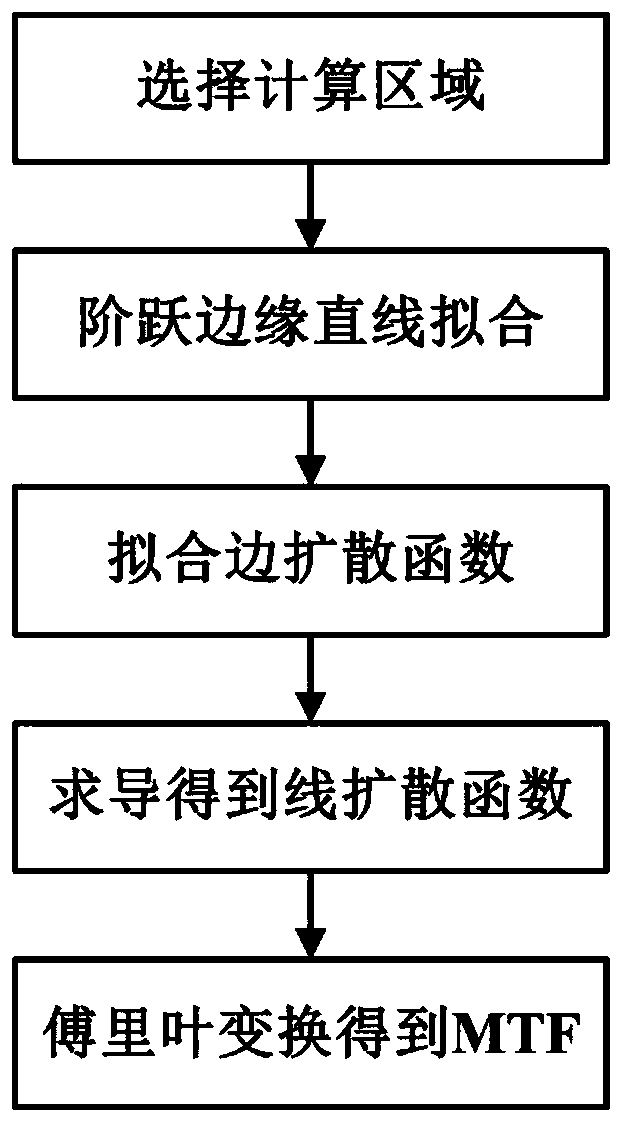
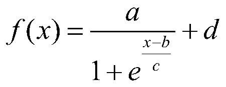
[0038] like figure 1 As shown, a method for evaluating the quality of remote sensing images based on MTF in this embodiment includes the following steps: Step 1: Select a calculation area; Step 2: Fit a straight line to the image step edge; Step 3: Fit the edge spread function ; Step 4: derivation to obtain the line spread function; Step 5: Fourier transform to obtain the MTF.

[0039] Step 1: Select the calculation area

[0040] From the remote sensing images, the ground objects with obvious differences in brightness values ​​and linear step edges are selected as the calculation area, and airports, highways, etc. can be selected as the calculation area.

[0041] Step 2: Fitting a straight line to the step edge of the image

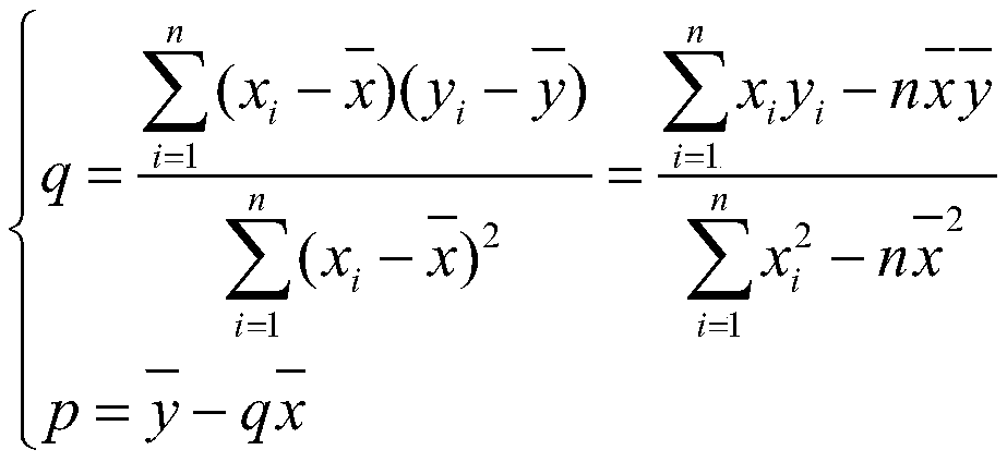
[0042] For each row of data in the selected calculation area, the method of difference is used to record the maximum value of the difference result of each row and the corresponding position, which is used as an alternative edge point. Draw a scatter ...


PUM


Abstract

The invention belongs to the technical field of remote sensing, and particularly relates to an MTF-based remote sensing image quality evaluation method. The method comprises the following steps: step1, selecting a calculation area; step 2, carrying out straight line fitting on the step edge of the image; 3, fitting an edge spread function; 4, performing deriving to obtain a line spread function;and step 5, performing Fourier transform to obtain an MTF. The method solves the problem of objective evaluation of the remote sensing image. According to the method, the remote sensing image can be objectively evaluated, and the problems that a subjective evaluation method depends on testers to manually interpret the remote sensing image, time and labor are wasted, and automatic interpretation ofmassive remote sensing data is not facilitated are solved. In the actual application of remote sensing image processing, a reference image corresponding to a distorted image cannot be obtained, and areference evaluation method is not suitable, so that the reference-free evaluation method based on MTF has greater application advantages and wider application range.

Description

technical field [0001] The invention belongs to the technical field of remote sensing, and in particular relates to an MTF-based remote sensing image quality evaluation method. Background technique [0002] During the long-term operation of the earth observation remote sensor, due to the aging of its own components, changes in the space environment, transmission media and other factors, the image quality will be degraded to varying degrees during the process of data acquisition, transmission, processing, and storage, which greatly It affects subsequent processing and applications such as image registration, fusion, target recognition, and change monitoring. In order to evaluate the quality of remote sensing images with different distortion types, it is very important to study the comprehensive factors for the evaluation indicators of various degradation factors. Through the quality analysis and evaluation of remote sensing images, it can guide the imaging control of on-orbi...

Claims


Application Information

Patent Timeline
Patent Type & Authority Applications(China)
IPC IPC(8): G06T7/00
CPCG06T7/0002G06T2207/10004G06T2207/20056G06T2207/30168
Inventor 陈雪娇潘蔚田青林余长发
Owner BEIJING RES INST OF URANIUM GEOLOGY
Why Eureka
Try Eureka