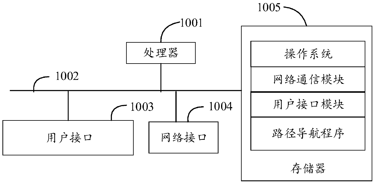
Path navigation method and device and computer readable storage medium
A path navigation and path technology, applied in the fields of devices, computer-readable storage media, and path navigation methods, can solve problems such as low positioning accuracy, and achieve the effect of improving accuracy and efficiency
- Summary
- Abstract
- Description
- Claims
- Application Information
AI Technical Summary
Problems solved by technology
Method used
Image

Examples
no. 1 example
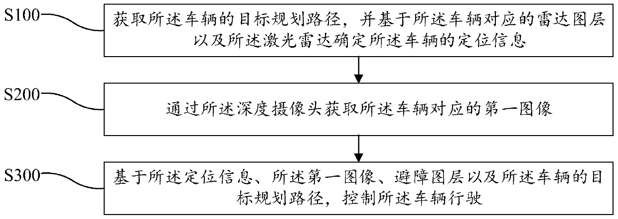
[0103] Based on the first embodiment, the second embodiment of the route navigation method of the present invention is proposed, referring to Figure 4 , in this embodiment, step S300 includes:
[0104] Step S310, determining whether there is an obstacle in the target planning path based on the first image and the obstacle avoidance layer;
[0105] Step S320, if not, control the vehicle to travel based on the positioning information and the planned target route.
[0106] In this embodiment, when the first image is obtained, the obstacle avoidance layer corresponding to the current driving scene is obtained, based on the first image and the obstacle avoidance layer, it is determined whether there is an obstacle in the target planning path, if there is no obstacle, Based on the positioning information and the target planned route, the vehicle is controlled to drive, that is, the vehicle is controlled to continue to drive according to the target planned route, so as to improve t...
PUM
 Abstract
Description
Claims
Application Information
 - R&D
- Intellectual Property
- Life Sciences
- Materials
- Tech Scout
- Unparalleled Data Quality
- Higher Quality Content
- 60% Fewer Hallucinations
Browse by: Latest US Patents, China's latest patents, Technical Efficacy Thesaurus, Application Domain, Technology Topic, Popular Technical Reports.
© 2025 PatSnap. All rights reserved.Legal|Privacy policy|Modern Slavery Act Transparency Statement|Sitemap|About US| Contact US: help@patsnap.com