
Spatial data comparison method and related products

A spatial data and spatial technology, applied in the field of data processing, can solve problems such as complex networking, achieve the effect of reducing cloud data processing time, improving efficiency and real-time performance

Active Publication Date: 2020-01-31
WANYI TECH
View PDF5 Cites 2 Cited by
  • Summary
  • Abstract
  • Description
  • Claims
  • Application Information

AI Technical Summary

Problems solved by technology

However, in this process, there is a problem of complex networking and the need for multi-level transit

Method used


Image

  • Spatial data comparison method and related products
  • Spatial data comparison method and related products
  • Spatial data comparison method and related products

Examples


Embodiment Construction

[0053] In order to enable those skilled in the art to better understand the solution of the present application, the technical solution in the embodiment of the application will be clearly and completely described below in conjunction with the accompanying drawings in the embodiment of the application. Obviously, the described embodiment is only It is a part of the embodiments of this application, not all of them. Based on the embodiments in this application, all other embodiments obtained by persons of ordinary skill in the art without creative efforts fall within the protection scope of this application.

[0054] The following describes the embodiments of the present application in detail.

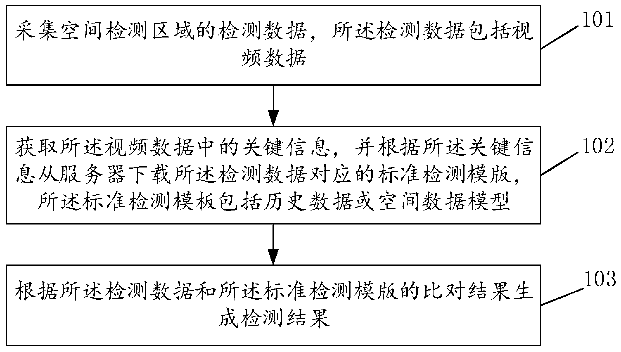
[0055] see Figure 1A , Figure 1A It is a schematic flowchart of a spatial data comparison method provided in the embodiment of this application, which is applied to the cost system, such as Figure 1A As shown, the spatial data comparison method includes the following steps:

[0056]1...


PUM


Abstract

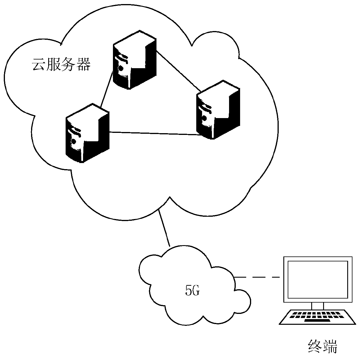
The embodiment of the invention discloses a spatial data comparison method and a related product, and the method comprises the steps: collecting detection data of a spatial detection region, wherein the detection data comprises video data; obtaining key information in the video data, downloading a standard detection template corresponding to the detection data from a server according to the key information, wherein the standard detection template comprises historical data or a spatial data model; and generating a detection result according to a comparison result of the detection data and the standard detection template. According to the embodiment of the invention, the standard detection template is downloaded from the server in combination with the performance advantages of the 5G technology, and spatial data comparison is performed offline at the terminal, so that the data processing complexity is reduced, and the spatial data comparison efficiency is effectively improved.

Description

technical field [0001] This application relates to the technical field of data processing, in particular to spatial data comparison methods and related products. Background technique [0002] In construction engineering, it is necessary to collect spatial data in real time and compare spatial data to find problems in construction engineering or architectural space. Existing spatial data comparison algorithms mostly use edge computing algorithms. On the side close to the object or data source, an open platform integrating network, computing, storage, and application core capabilities is used to provide the nearest end service. However, in this process, there is a problem of complex networking and the need for multi-level transit. [0003] The fifth generation mobile communication technology (5th generation mobile networks or 5th generation wireless systems, 5th-Generation, 5G technology) is the latest generation of cellular mobile communication technology, namely 4G (LTE-A, ...

Claims


Application Information

Patent Timeline
Patent Type & Authority Applications(China)
IPC IPC(8): G06T7/00
CPCG06T7/0006G06T2207/10016G06T2207/30132
Inventor 田岱
Owner WANYI TECH
Learn More