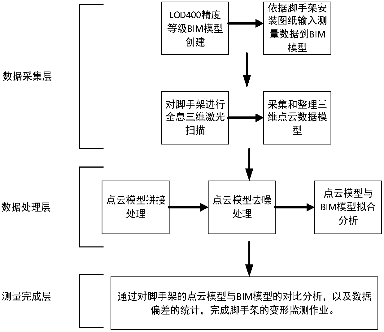
Construction external scaffold deformation monitoring method
A technology of external scaffolding and scaffolding, which is applied in the direction of measuring devices, details involving processing steps, image data processing, etc., and can solve problems such as inability to monitor and heavy field work
- Summary
- Abstract
- Description
- Claims
- Application Information
AI Technical Summary
Problems solved by technology
Method used
Image
Examples
Embodiment 1
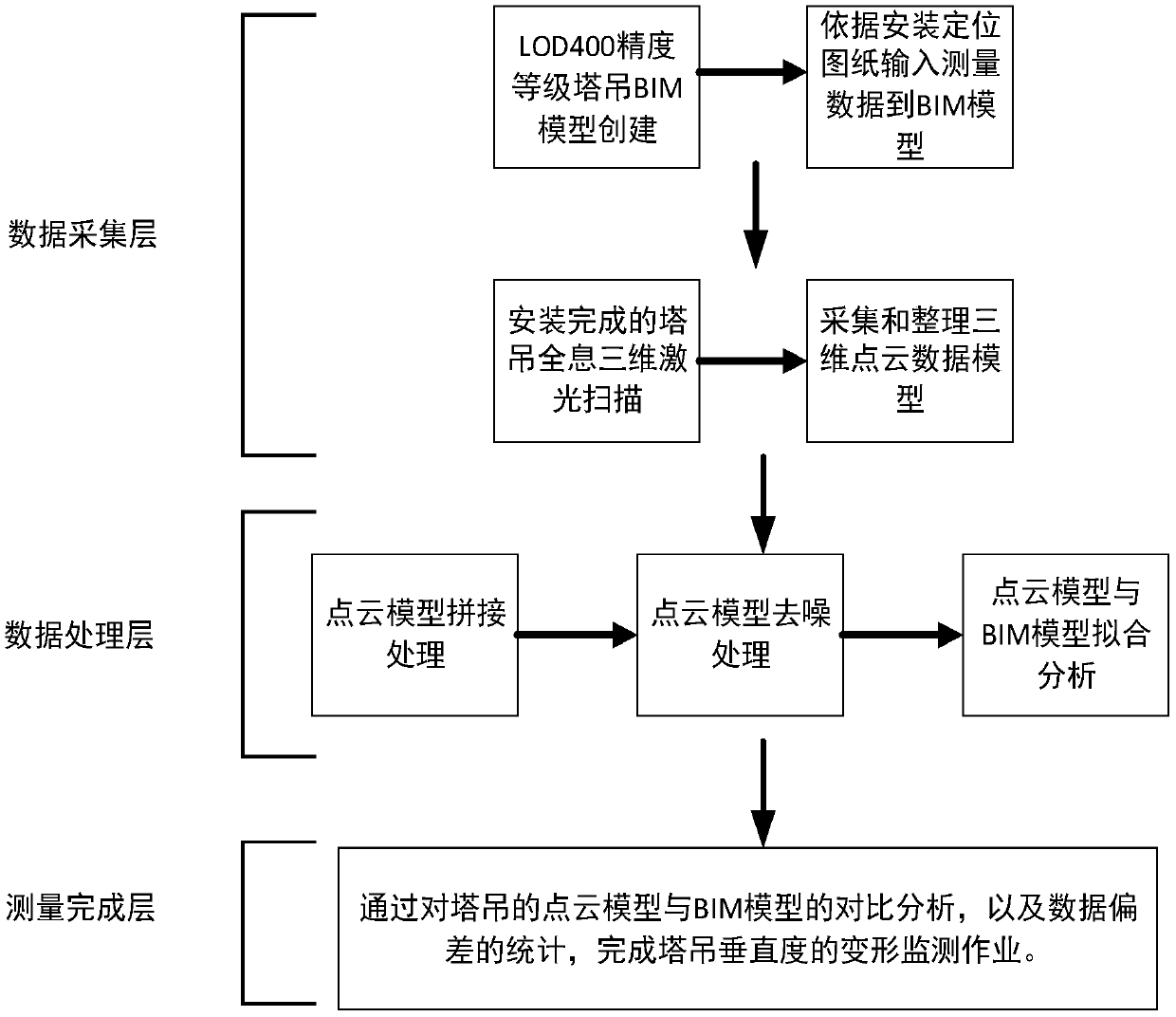
[0039] Such as figure 2 As shown, a method for monitoring the verticality of the tower crane is exemplified. At present, the conventional method for monitoring the verticality of the tower crane requires professional surveyors to use special measuring instruments, such as total stations, theodolites and other instruments for monitoring operations. This method of tower crane verticality monitoring is not flexible, the monitoring operation is inconvenient, the monitoring data cannot be obtained in time, and the monitoring personnel are fixed, which is not conducive to the safety management of the tower crane, and often easily leads to the occurrence of tower crane safety accidents. In this context, a method for monitoring the verticality of the tower crane is a fundamental problem that needs to be solved.
[0040] The method for monitoring verticality of the tower crane specifically includes the following steps:
[0041] (1) After the installation of the tower crane is complet...
Embodiment 2
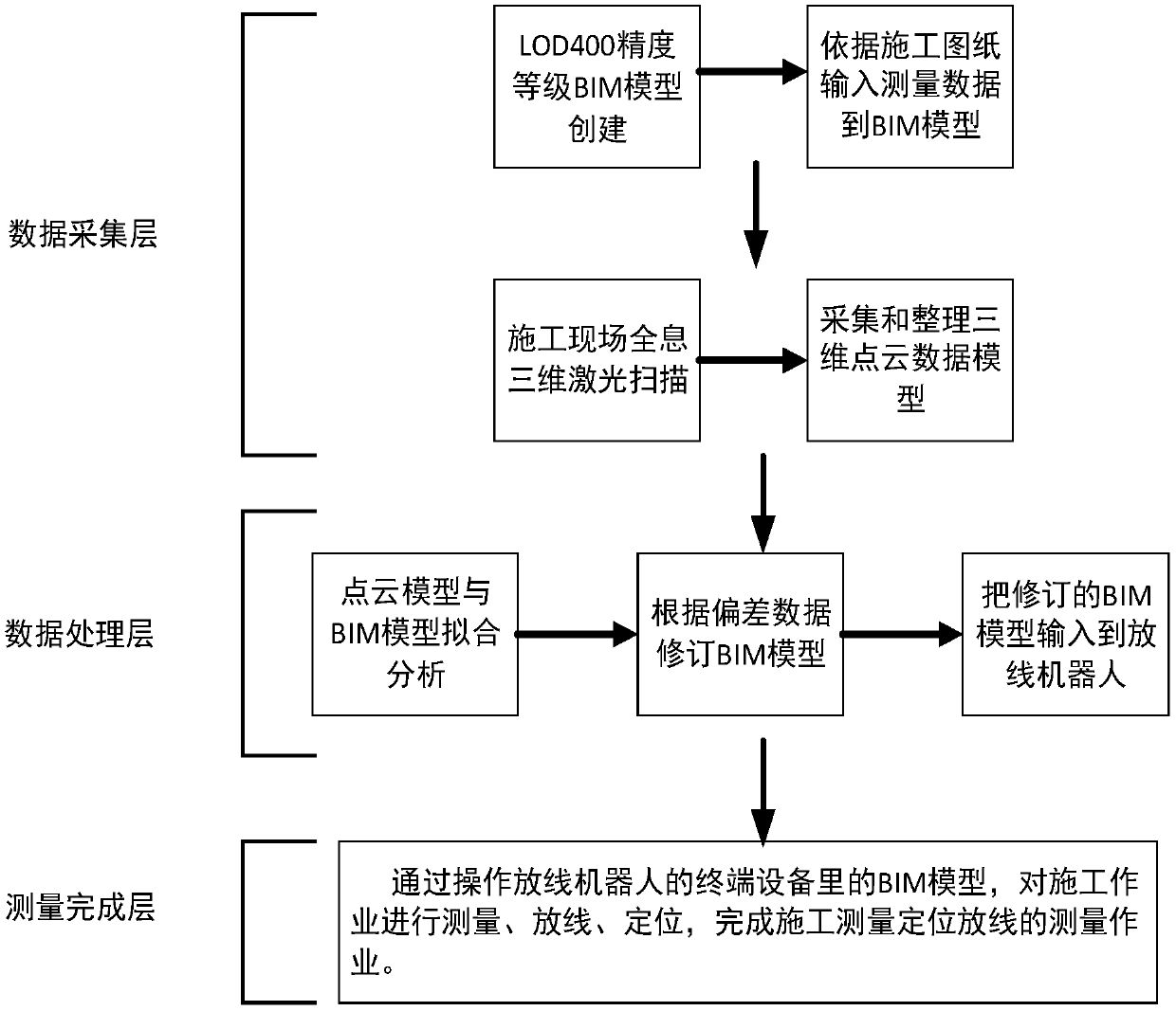
[0050] Such as image 3 As shown, a method for construction survey positioning setting out is provided, which specifically includes the following steps:
[0051] (1) After the construction drawings are completed, create a BIM model with LOD400 precision level according to the general construction plan drawings. The BIM model must meet the requirements of LOD400 precision level and meet and reflect the information of the construction drawings. The software used to create the model is not limited to Autodesk Revit software and its series of auxiliary software products. According to the requirements of modeling convenience and flexibility, various forms of BIM software can be used.
[0052] (2) Before the construction, use the 3D holographic scanning technology, use the UAV 3D laser scanner to scan the construction site, and collect the 3D point cloud information of the construction site. The 3D point cloud data information of the construction site collected by scanning is saved...
Embodiment 3
[0063] Such as Figure 4 As shown, a measurement and positioning method for the installation of special-shaped steel structural members with variable spatial angles is provided, which specifically includes the following steps:
[0064] (1) After the construction drawings are completed, a BIM model of LOD400 precision level is created according to the steel structure drawings. The BIM model must meet the requirements of LOD400 precision level, meet and reflect the model of the construction drawing information. The software used to create the model is not limited to Tekla software and its series of auxiliary software products. According to the requirements of modeling convenience and flexibility, various forms of BIM software can be used.
[0065] (2) Before the installation and construction of the steel structure components, use the 3D holographic scanning technology to scan the construction site with the 3D laser scanner of the UAV, and collect the 3D point cloud information o...
PUM
 Abstract
Description
Claims
Application Information
 - R&D
- Intellectual Property
- Life Sciences
- Materials
- Tech Scout
- Unparalleled Data Quality
- Higher Quality Content
- 60% Fewer Hallucinations
Browse by: Latest US Patents, China's latest patents, Technical Efficacy Thesaurus, Application Domain, Technology Topic, Popular Technical Reports.
© 2025 PatSnap. All rights reserved.Legal|Privacy policy|Modern Slavery Act Transparency Statement|Sitemap|About US| Contact US: help@patsnap.com


