
Full-link optical satellite geometrical imaging model construction method and full-link optical satellite geometrical imaging model construction system

A geometric imaging and optical satellite technology, applied in image analysis, 3D modeling, image data processing, etc., can solve the problem without the refinement and correction of the imaging geometric model, the failure to provide an effective technical solution to the problem, and the failure to realize the optical satellite geometry. Imaging model and other problems, to achieve the effect of high modeling accuracy and high precision

Active Publication Date: 2019-07-19
WUHAN UNIV
View PDF5 Cites 8 Cited by
  • Summary
  • Abstract
  • Description
  • Claims
  • Application Information

AI Technical Summary

Problems solved by technology

Related literature "Greslou, D., Lussy, F.D., Montel, J. LIGHT ABERRATION EFFECT IN HR GEOMETRICMODEL[J]. The International Archives of the Photogrammetry, Remote Sensing and Spatial Information Sciences, 2008." Correction of vector, literature "Yan, M., et al. Atmosphere Refraction Effects in Object Locating for OpticalSatellite Remote Sensing Images [J]. Acta Geodaetica et Cartographica Sinica, 2015, 44(9):995-1002." on atmospheric refraction The geometric positioning deviation caused by the method has been solved, but both have not refined and corrected the imaging geometric model, and only for one of the errors
Therefore, the scope of application of the two documents is limited to error analysis, and the construction of an optical satellite geometric imaging model that takes into account atmospheric refraction and aberration correction has not been realized, and an effective technical solution to the problem has not been provided.

Method used

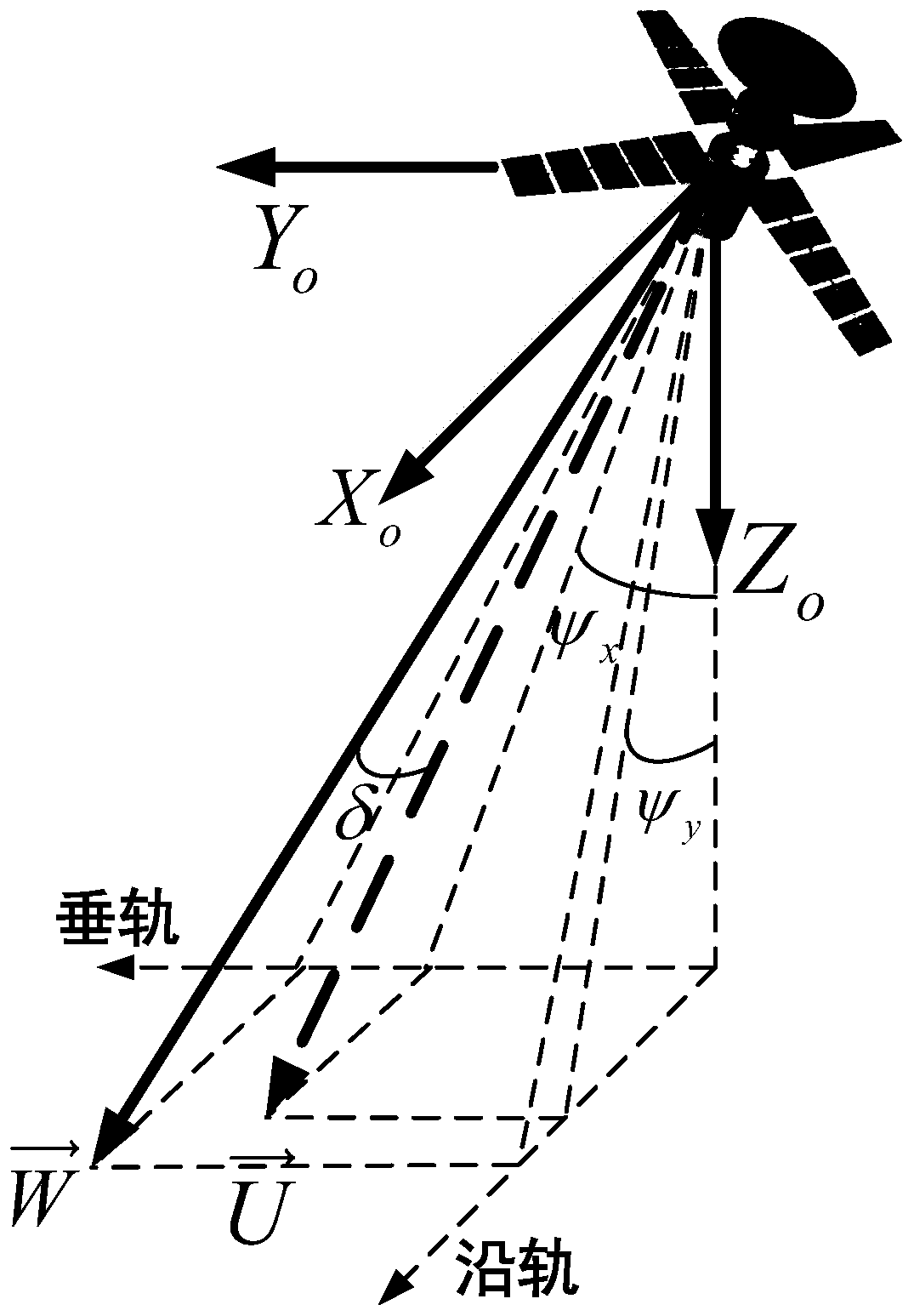
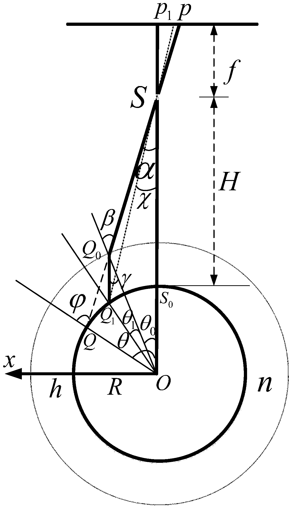
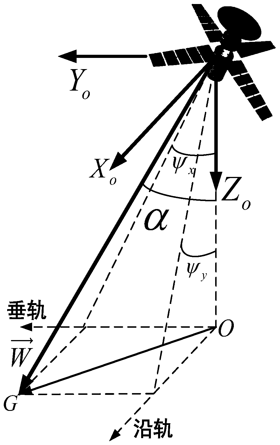

Image

  • Full-link optical satellite geometrical imaging model construction method and full-link optical satellite geometrical imaging model construction system
  • Full-link optical satellite geometrical imaging model construction method and full-link optical satellite geometrical imaging model construction system
  • Full-link optical satellite geometrical imaging model construction method and full-link optical satellite geometrical imaging model construction system

Examples


Embodiment Construction

[0033] The specific implementation of the present invention will be described in detail below in conjunction with the accompanying drawings and examples.

[0034] During specific implementation, the technical scheme of the present invention can be realized by those skilled in the art using computer software technology to automatically run the process. The embodiment of the present invention provides a method for constructing a full-link optical satellite geometric imaging model, which can provide an optical satellite geometric imaging model that takes into account atmospheric refraction and aberration correction with high precision for the full link from the observation camera to the ground target , including the following steps:

[0035] Step 1: Determine the relative motion relationship between the imaging probe and the observed object points, and construct an aberration error correction model for the satellite image light pointing based on the relative motion speed of the i...


PUM


Abstract

The invention provides a full-link optical satellite geometrical imaging model construction method and a full-link optical satellite geometrical imaging model construction system. The method comprisesthe following steps: determining a relative motion relation between an imaging exploration element and an observation site object point, and based on relative motion speed of an imaging image point to an observation earth surface, constructing an aberration error correction model of a satellite image light direction; based on an atmospheric subdivision mode, calculating geometrical positioning error caused by multiple layers of atmospheric refraction, obtaining an actual side-view angle of an exploration element light after the atmospheric refraction error is corrected, and based on a side tilt angle and an angle of pitch of updated imaging light under a satellite orbit coordinate system, constructing the atmospheric refraction error correction model of the satellite image light direction; according to the aberration error correction model and the atmospheric refraction error correction model, performing fine treatment for a conventional geometrical model, and constructing a fine geometrical imaging model in which atmospheric refraction and aberration error correction are considered. The model provided by the invention can reflect a mapping relation between the image point coordinate of a high-resolution optical remote sensing satellite image and a ground point coordinate more precisely.

Description

technical field [0001] The invention belongs to the field of aerospace photographic silhouette measurement, and aims at high-resolution optical remote sensing satellites, and relates to a method and system for constructing a full-link optical satellite geometric imaging model. Background technique [0002] At present, the traditional satellite geometric imaging model and geometric calibration model are constructed based on the ideal collinear equation, that is, the image point, the imaging feature point and the projection center satisfy the three-point collinear principle. With the enhancement of satellite mobile imaging capabilities, more and more satellites have agile imaging capabilities. Agile optical satellite imaging has the characteristics of large angle and multiple angles, that is, it has the ability of large-angle imaging from the sub-satellite point ±40-50 degrees and the ability to perform multi-orbit or same-orbit multi-angle continuous imaging for the same sens...

Claims


Application Information

Patent Timeline
Patent Type & Authority Applications(China)
IPC IPC(8): G01C11/00G06T7/80G06T17/00
CPCG01C11/00G06T7/85G06T17/00
Inventor 王密程宇峰金淑英朱映
Owner WUHAN UNIV
Learn More