
Method for searching similar drainage basins based on space fractal dimension theory

A similar watershed and fractal-dimension technology, applied to instruments, calculations, climate change adaptation, etc., can solve problems such as inaccurate description of watershed terrain features, unfavorable watershed similarity research and development, unreasonable hydrological model construction, etc., to achieve data The source is stable and reliable, which is conducive to rapid automatic classification and identification, and the effect of promoting in-depth development

Active Publication Date: 2019-07-16
HOHAI UNIV
View PDF4 Cites 7 Cited by
  • Summary
  • Abstract
  • Description
  • Claims
  • Application Information

AI Technical Summary

Problems solved by technology

For the watershed in the natural state, due to the joint action of internal and external forces, the topographic features of each area in the watershed, such as slope, aspect and elevation, have been in the process of continuous development and change, so simply adopt an average Numerical values ​​can no longer accurately describe the topographical characteristics of the watershed, which is likely to cause misjudgment when studying the similarity of watersheds, which in turn leads to unreasonable hydrological model construction, resulting in large errors in the final flood forecast results, which are mountainous small and medium-sized watersheds The prevention and control of mountain torrents leaves hidden dangers
[0007] Therefore, ignoring the spatial differentiation of natural features in a watershed is not conducive to the development of watershed similarity research.

Method used


Image

  • Method for searching similar drainage basins based on space fractal dimension theory
  • Method for searching similar drainage basins based on space fractal dimension theory
  • Method for searching similar drainage basins based on space fractal dimension theory

Examples


Embodiment Construction

[0063] Below in conjunction with accompanying drawing, the technical scheme of the present invention is described in further detail by taking Daheba River Basin as an example:

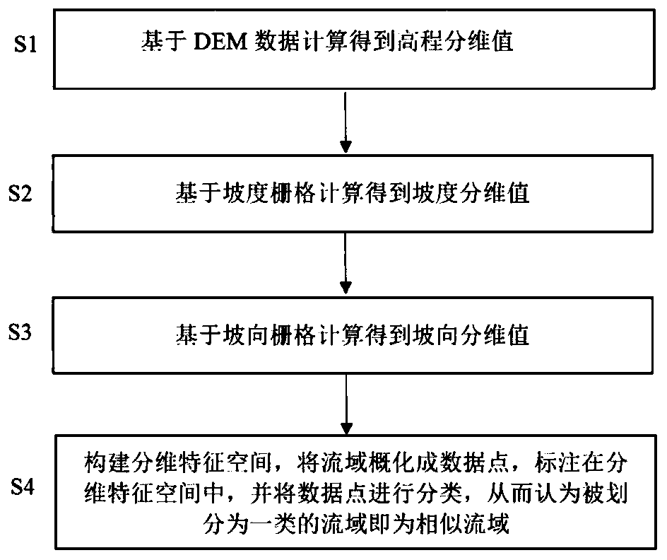
[0064] Such as figure 1 As shown, the present invention discloses a method for finding similar watersheds based on the spatial fractal dimension theory, comprising the following steps:

[0065] Step 1), divide the watershed into several orthogonal grid units based on digital elevation model data, that is, DEM data, and obtain the elevation in each grid unit, thereby obtaining the elevation raster Raster_Fle of the watershed, and calculating the height fractal dimension Value Fra_Ele, as follows:

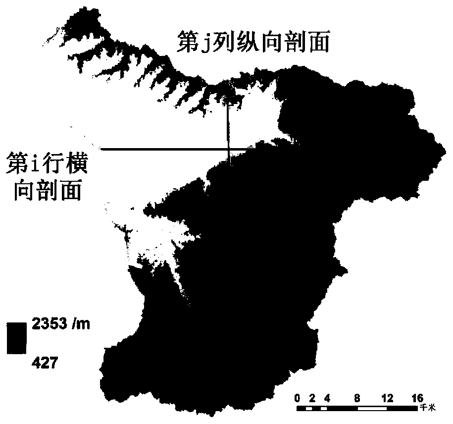
[0066] Step 1.1), based on the DEM data, the watershed is divided into several orthogonal grid units, and the elevation in each grid unit is obtained, so as to obtain the elevation raster Raster_Fle of the watershed, such as figure 2 shown;

[0067] DEM (Digital Elevation Model, Digital Elevation Model) i...


PUM


Abstract

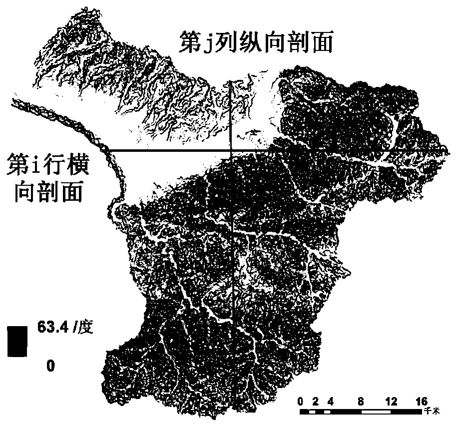
The invention discloses a method for searching a similar watershed based on a spatial dimension division theory. The method comprises the following steps: firstly, dividing a drainage basin into a plurality of orthogonal grid units based on DEM data to obtain an elevation in each grid unit, thereby obtaining an elevation grid Raster_Ele of the drainage basin, and calculating to obtain an elevationfractal dimension value Fra_Ele; secondly, calculating the gradient in each grid unit to obtain a gradient grid Raster_Slope of the drainage basin, and calculating to obtain a gradient fractional dimension value Fra_Slope; next, calculating the slope direction in each grid unit to obtain a slope direction grid Raster_Slope Dir of the drainage basin, and calculating to obtain a slope direction sub-dimension value Fra_Slope Dir; and finally, constructing a multi-dimensional feature space, generalizing a drainage basin into data points, labeling the data points in the multi-dimensional feature space, and classifying the data points, so that the drainage basin divided into one class is regarded as a similar drainage basin.

Description

technical field [0001] The invention relates to the technical field of hydrology, in particular to a method for finding similar watersheds based on the spatial fractal dimension theory. Background technique [0002] There are many rivers in my country, with a drainage area of ​​200 to 3000 km 2 There are nearly 9,000 small and medium watersheds in China. In recent years, affected by climate change, sudden floods of small and medium-sized rivers caused by local heavy rainfall have occurred frequently, and have become the main disasters causing casualties. Because small and medium-sized watersheds are usually located in remote mountainous areas with complex terrain and steep slopes, rapidly rising floods can easily cause flood disasters that endanger the personal safety of local residents and the social economy. Therefore, rapid early warning of sudden floods in small and medium-sized watersheds has become an urgent issue. question. [0003] The hydrological model is an imp...

Claims


Application Information

Patent Timeline
Patent Type & Authority Applications(China)
IPC IPC(8): G06K9/00G06K9/62
CPCG06V20/182G06F18/2323G06F18/22G06F18/24Y02A10/40
Inventor 童冰星李致家刘墨阳
Owner HOHAI UNIV
Learn More