A poverty space classification recognition method and device based on big data and machine learning

A machine learning, classification and recognition technology, applied in the field of geographic information technology and big data analysis, can solve the problems of high efficiency, small amount of data, inability to identify remote sensing data of lights at night, etc., and achieve the effect of strong operational feasibility and accurate identification.

Inactive Publication Date: 2019-06-28
HENAN UNIVERSITY
View PDF0 Cites 8 Cited by
  • Summary
  • Abstract
  • Description
  • Claims
  • Application Information

AI Technical Summary

Problems solved by technology

The current identification method for urban poverty space is to use nighttime light remote sensing data to study urban poverty through the brightness value of nighttime light. This method is to identify urban poverty from a macro perspective, with less data and high efficiency. To identify every spatial location of urban poverty, a single nighttime light remote sensing data cannot be identified

Method used


Image

  • A poverty space classification recognition method and device based on big data and machine learning
  • A poverty space classification recognition method and device based on big data and machine learning
  • A poverty space classification recognition method and device based on big data and machine learning

Examples


Embodiment 1

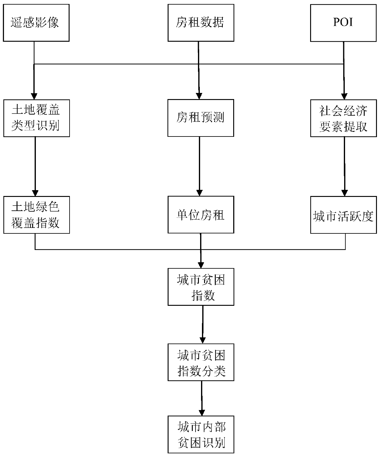
[0053] This embodiment provides a spatial classification and recognition method for urban poverty based on big data and machine learning. For the basic process, please refer to figure 1 , the specific implementation further clarification includes:

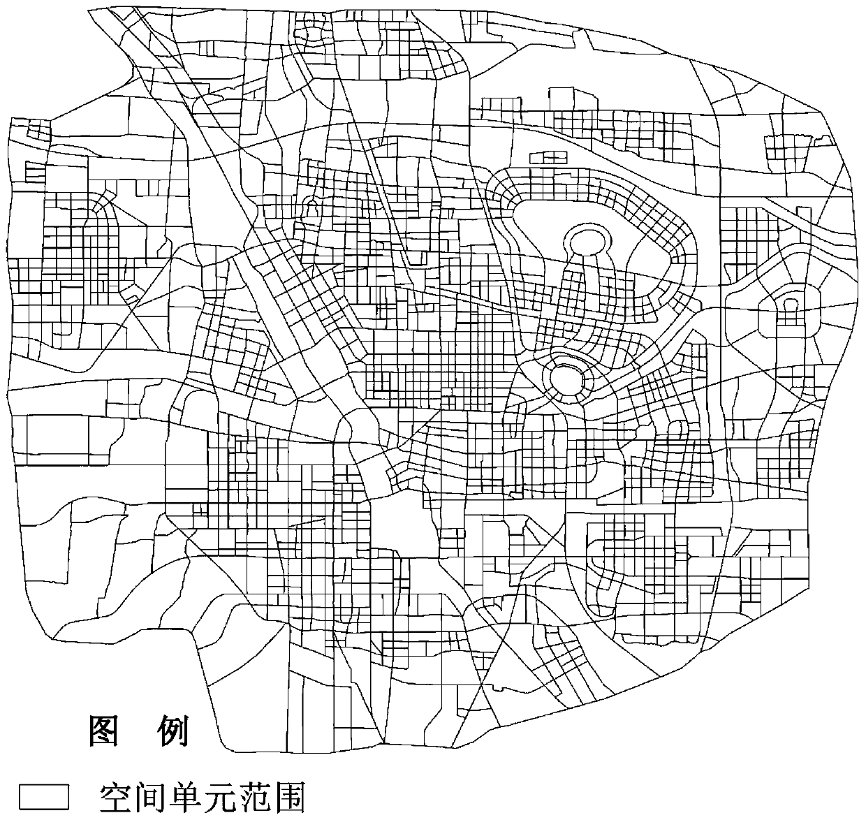
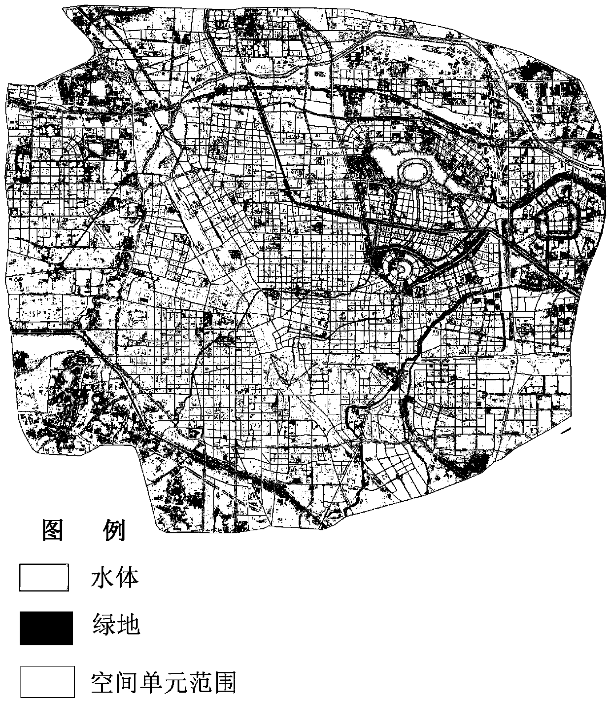
[0054] Step 1: According to the obtained high-precision remote sensing satellite images, divide the city into regions, divide the urban region into the smallest spatial units composed of several grids, and calculate the area Z of each smallest spatial unit;

[0055] Based on high-precision remote sensing satellite images, the range of the smallest space unit is divided. The division of space units should be based on the area enclosed by the smallest residential unit or the last road. The area enclosed by each smallest residential unit or the last road The area is a minimum space unit, figure 2 It is the map of the minimum spatial unit range divided according to the end-level road enclosure and the minimum residential unit, and th...


PUM


Abstract

The invention relates to an urban poverty space classification and recognition method and device based on big data and machine learning, and the method comprises the steps: obtaining the remote sensing data of a target city through various types of remote sensing satellites, and carrying out the regional grid division of the interior of the target city; extracting surface greenbelts and water bodies from the remote sensing data, and establishing a land green coverage model; obtaining POI data of the target city, judging the type and number of city POIs contained in each region, and establishing a city liveness model; obtaining the rent data of the internal area range of the target city; an urban poverty index model is established according to the land green coverage model, the urban activeness model and the rent data, classification is carried out according to the urban poverty index model, the urban poverty area is determined and recognized, and the method has the advantages of beingaccurate in recognition and high in operation feasibility.

Description

technical field [0001] The invention relates to the fields of geographic information technology and big data analysis, in particular to a method and device for classifying and identifying poverty-stricken spaces based on big data and machine learning. Background technique [0002] As my country's urbanization process continues to accelerate, the proportion of agricultural population shifting to non-agricultural population continues to increase, and a large number of agricultural workers continue to flock to cities. If policies such as these are not guaranteed, low-income farmers and business workers will gather in the fringe areas of urban core areas, residential communities and urban villages with weak infrastructure and poor living environment; in addition, due to my country's market economy Continuous improvement, adjustment of industrial structure, and reform of the state-owned enterprise system have left many retired and laid-off professional workers in the old industrial...

Claims


Application Information

Patent Timeline
IPC IPC(8): G06K9/62
Inventor 王坤张丽君秦耀辰
Owner HENAN UNIVERSITY
Why Eureka
Try Eureka